Green Meadows, Indiana
Green Meadows is an unincorporated community in Wabash Township, Tippecanoe County, in the U.S. state of Indiana.[2]
Green Meadows, Indiana | |
|---|---|
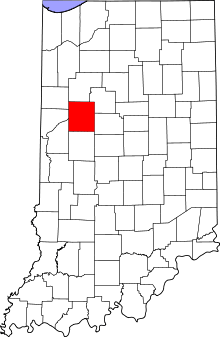
 Tippecanoe County's location in Indiana | |
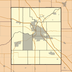
 Green Meadows Location in Tippecanoe County | |
| Coordinates: 40°26′25″N 86°57′57″W | |
| Country | United States |
| State | Indiana |
| County | Tippecanoe |
| Township | Wabash |
| Elevation | 709 ft (216 m) |
| Time zone | UTC-5 (Eastern (EST)) |
| • Summer (DST) | UTC-4 (EDT) |
| ZIP code | 47906 |
| Area code(s) | 765 |
| GNIS feature ID | 435408 |
The community is part of the Lafayette, Indiana Metropolitan Statistical Area.
Geography
Green Meadows is located at 40°26′25″N 86°57′57″W with an elevation of 709 feet.
gollark: Surely you could define the program state easily as "tape + position + accumulator" or something.
gollark: I should implement it in PotatOS as an optional syntax!
gollark: CONTRIBUTE, APIOFORM1
gollark: Idea: don't even have booleans just use `Option<()>`.
gollark: Delete precedence utilize RPN/lisp.
References
- "US Board on Geographic Names". United States Geological Survey. 2007-10-25. Retrieved 2008-01-31.
- "Green Meadows, Tippecanoe County, Indiana". Geographic Names Information System. United States Geological Survey. Retrieved August 4, 2017.
This article is issued from Wikipedia. The text is licensed under Creative Commons - Attribution - Sharealike. Additional terms may apply for the media files.