Niles Township, Cook County, Illinois
Niles Township is one of 29 townships in Cook County, Illinois, USA. As of the 2010 census, its population was 105,882.[2]
Niles Township | |
|---|---|
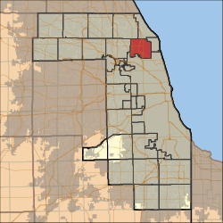
 Location in Cook County | |
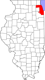
 Cook County's location in Illinois | |
| Coordinates: 42°01′56″N 87°45′30″W | |
| Country | United States |
| State | Illinois |
| County | Cook |
| Area | |
| • Total | 21.25 sq mi (55.05 km2) |
| • Land | 21.25 sq mi (55.05 km2) |
| • Water | 0 sq mi (0 km2) 0% |
| Elevation | 623 ft (190 m) |
| Population (2010) | |
| • Estimate (2016)[1] | 105,285 |
| • Density | 4,982/sq mi (1,923.4/km2) |
| Time zone | UTC-6 (CST) |
| • Summer (DST) | UTC-5 (CDT) |
| ZIP codes | 60025, 60029, 60053, 60076, 60077, 60091, 60201, 60202, 60203, 60645, 60712, 60714 |
| FIPS code | 17-031-53013 |
Geography
According to the United States Census Bureau, Niles Township covers an area of 21.25 square miles (55.0 km2).
Cities, towns, villages
- Glenview (southeast segment)
- Golf
- Lincolnwood
- Morton Grove (east three-quarters)
- Niles (southeast half)
- Skokie
Adjacent townships
- New Trier Township (north)
- Maine Township (west)
- Northfield Township (northwest)
Cemeteries
The township contains these eight cemeteries: Beth Jacob, Dewes, Memorial, New Light, Saint Adelbert, Saint Matthews, Saint Pauls Lutheran and Saint Peters Catholic.
Major highways


Airports and landing strips
- Lincolnwood Town Center Heliport
Education
Political districts
- Illinois' 9th congressional district
- State House District 15
- State House District 16
- State House District 17
- State House District 18
- State House District 20
- State Senate District 08
- State Senate District 09
- State Senate District 10
gollark: It's a combination of all the disadvantages of XML and JSON together.
gollark: ```xml<?xml version="1.0" encoding="UTF-8"?><!DOCTYPE plist PUBLIC "-//Apple Computer//DTD PLIST 1.0//EN" "http://www.apple.com/DTDs/PropertyList-1.0.dtd"><plist version="1.0"><dict> <key>architecture</key> <string>x86_64</string> <key>homepage</key> <string>http://xorg.freedesktop.org</string> <key>installed_size</key> <integer>19425</integer> <key>license</key> <string>MIT</string> <key>maintainer</key> <string>Juan RP <xtraeme@voidlinux.eu></string> <key>pkgname</key> <string>xkill</string> <key>pkgver</key> <string>xkill-1.0.5_1</string> <key>run_depends</key> <array> <string>libXmu>=1.0.4_1</string> <string>libX11>=1.2_1</string> <string>glibc>=2.26_1</string> </array> <key>shlib-requires</key> <array> <string>libXmuu.so.1</string> <string>libX11.so.6</string> <string>libc.so.6</string> </array> <key>short_desc</key> <string>Kill a client by its X resource</string> <key>source-revisions</key> <string>xkill:0d1bbbdf2f</string> <key>version</key> <string>1.0.5_1</string></dict></plist>```The stupidest way to store data ever designed.
gollark: Each ASCII character is 7 bits, but basically everything represents them as UTF-8 which makes them a byte (well, octet) each.
gollark: <@218047149512982531> * bytes
gollark: ?remind 1y "Initiate Protocol 137-Theta"
References
- "Niles Township, Cook County, Illinois". Geographic Names Information System. United States Geological Survey. Retrieved 2010-01-10.
- United States Census Bureau 2007 TIGER/Line Shapefiles
- United States National Atlas
- "Population and Housing Unit Estimates". Retrieved June 9, 2017.
- "Geographic Identifiers: 2010 Demographic Profile Data (DP-1): Niles township, Cook County, Illinois". U.S. Census Bureau, American Factfinder. Archived from the original on February 12, 2020. Retrieved March 21, 2013.
- "Census of Population and Housing". Census.gov. Retrieved June 4, 2016.
External links
This article is issued from Wikipedia. The text is licensed under Creative Commons - Attribution - Sharealike. Additional terms may apply for the media files.