National Register of Historic Places listings in St. Lawrence County, New York
List of the National Register of Historic Places listings in St. Lawrence County, New York
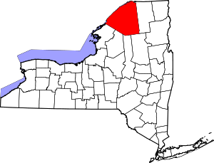
Location of St. Lawrence County in New York
This is intended to be a complete list of historic properties and districts listed on the National Register of Historic Places in St. Lawrence County, New York. The locations of National Register properties and districts (at least for all showing latitude and longitude coordinates below) may be seen in a map by clicking on "Map of all coordinates".[1] Three of the sites are further designated U.S. National Historic Landmarks.
- This National Park Service list is complete through NPS recent listings posted August 14, 2020.[2]
| Albany (Albany) – Allegany – Bronx – Broome – Cattaraugus – Cayuga – Chautauqua – Chemung – Chenango – Clinton – Columbia – Cortland – Delaware – Dutchess (Poughkeepsie, Rhinebeck) – Erie (Buffalo) – Essex – Franklin – Fulton – Genesee – Greene – Hamilton – Herkimer – Jefferson – Kings – Lewis – Livingston – Madison – Monroe (Rochester) – Montgomery – Nassau – New York (Below 14th Street, 14th to 59th Streets, 59th to 110th Streets, Above 110th Street, Islands) – Niagara – Oneida – Onondaga – Ontario – Orange – Orleans – Oswego – Otsego – Putnam – Queens – Rensselaer – Richmond – Rockland – St. Lawrence – Saratoga – Schenectady – Schoharie – Schuyler – Seneca – Steuben – Suffolk – Sullivan – Tioga – Tompkins – Ulster – Warren – Washington – Wayne – Westchester (Northern, Southern, New Rochelle, Peekskill, Yonkers) – Wyoming – Yates |
Listings county-wide
| [3] | Name on the Register | Image | Date listed[4] | Location | City or town | Description |
|---|---|---|---|---|---|---|
| 1 | Acker and Evans Law Office | September 15, 1983 (#83001792) |
315 State St. 44°41′50″N 75°29′33″W |
Ogdensburg | ||
| 2 | Adirondack Forest Preserve | 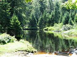 Adirondack Forest Preserve |
October 15, 1966 (#66000891) |
Northeast New York State 43°58′43″N 74°18′42″W |
St. Lawrence County | 623,000 acres (2,520 km2) of the 6-million-acre (24,000 km2) park are in St. Lawrence County |
| 3 | Arab Mountain Fire Observation Station | 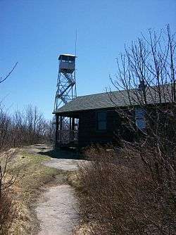 Arab Mountain Fire Observation Station |
September 23, 2001 (#01001039) |
Arab Mountain 44°12′47″N 74°35′48″W |
Piercefield | |
| 4 | Benjamin Gordon Baldwin House | September 15, 2004 (#04000994) |
26 Baldwin Ave. 44°45′14″N 74°59′26″W |
Norwood | ||
| 5 | Bayside Cemetery and Gatehouse Complex | March 26, 2004 (#03000026) |
115 Clarkson Ave. 44°39′17″N 74°59′29″W |
Potsdam | ||
| 6 | Brick Chapel Church and Cemetery | December 22, 2005 (#05001461) |
5501 Cty Rte 27 44°33′36″N 75°06′58″W |
Canton | ||
| 7 | Luke Brown House | June 6, 2003 (#03000030) |
831 NY 72 44°37′45″N 74°54′08″W |
Parishville | ||
| 8 | Buck's Bridge United Methodist Church | September 15, 2004 (#04000985) |
2927 Cty Rte 14 44°42′09″N 75°09′39″W |
Buck's Bridge | ||
| 9 | Chase Mills Inn | November 29, 1978 (#78003122) |
Mein and Townline Rds. 44°50′56″N 75°04′52″W |
Chase Mills | ||
| 10 | Childwold Memorial Presbyterian Church | May 30, 2001 (#01000585) |
Bancroft Rd. 44°17′05″N 74°40′09″W |
Piercefield | ||
| 11 | Clare Town Hall | December 6, 2004 (#04001343) |
3441 CR 27 44°26′06″N 75°03′21″W |
Clare | ||
| 12 | Clarkson Office Building | 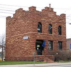 Clarkson Office Building |
March 5, 2004 (#03000031) |
17 Maple St. 44°40′04″N 74°59′20″W |
Potsdam | |
| 13 | Clarkson-Knowles Cottage | 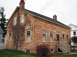 Clarkson-Knowles Cottage |
December 7, 1995 (#95001405) |
37 Main St. 44°40′06″N 74°59′00″W |
Potsdam | |
| 14 | Congregational Church | December 8, 2005 (#05001387) |
218 Rensselaer St. 44°35′33″N 75°19′07″W |
Rensselaer Falls | ||
| 15 | Gardner Cox House | March 20, 1986 (#86000484) |
Main St. 44°36′43″N 74°58′23″W |
Hannawa Falls | ||
| 16 | Crossover Island Light Station | 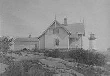 Crossover Island Light Station |
October 3, 2007 (#07001037) |
Crossover Island 44°29′56″N 75°46′42″W |
St. Lawrence River | |
| 17 | Dr. Buck-Stevens House | May 17, 1982 (#82004745) |
W. Main St. 44°48′27″N 74°46′32″W |
Brasher Falls | ||
| 18 | Edwards Town Hall | July 28, 2004 (#04000752) |
161 Main St. 44°19′29″N 75°15′07″W |
Edwards | ||
| 19 | Fine Town Hall | August 1, 1996 (#96000829) |
91 NY 58 44°14′51″N 75°08′21″W |
Fine | ||
| 20 | Judge John Fine House | January 9, 1986 (#86000012) |
422 State St. 44°41′46″N 75°29′29″W |
Ogdensburg | ||
| 21 | First Baptist Church of Ogdensburg Complex | May 18, 2018 (#SG100002466) |
617 State St. 44°41′37″N 75°29′24″W |
Ogdensburg | Stone church built over 50 years in the 19th century is home to city's oldest congregation; also houses exemplary 1930s stained glass by Harry James Horwood. | |
| 22 | First Congregational Church of Madrid | November 10, 2010 (#10000914) |
6 Cross St.; 32 Main St. 44°45′02″N 75°07′53″W |
Madrid | ||
| 23 | First Presbyterian Church Complex | 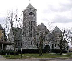 First Presbyterian Church Complex |
September 17, 2015 (#15000607) |
22 Church St. 44°20′05″N 75°28′14″W |
Gouverneur | 1893 Romanesque Revival church made of locally quarried marble |
| 24 | First Presbyterian Church of Dailey Ridge | April 1, 2002 (#02000300) |
411 Elliot Rd. 44°44′48″N 75°03′48″W |
Potsdam | ||
| 25 | Jacob Ford House | 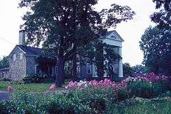 Jacob Ford House |
September 2, 1982 (#82004684) |
Northumberland St. 44°35′09″N 75°39′09″W |
Morristown | |
| 26 | Fort La Presentation Site | November 26, 2010 (#10000944) |
Lighthouse Point 44°41′44″N 75°30′03″W |
Ogdensburg | ||
| 27 | French Family Farm | November 4, 1982 (#82001269) |
Southwest of Potsdam on US 11 44°38′18″N 75°04′18″W |
Potsdam | ||
| 28 | Harrison Grist Mill | September 16, 1982 (#82004683) |
NY 345 44°39′50″N 75°11′47″W |
Morley | ||
| 29 | Hepburn Library | 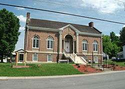 Hepburn Library |
September 24, 2004 (#04001056) |
1 Hepburn St. 44°48′09″N 74°59′29″W |
Norfolk | |
| 30 | Hepburn Library of Colton | May 16, 2012 (#12000287) |
84 Main St. 44°33′11″N 74°56′20″W |
Colton | ||
| 31 | Hepburn Library of Lisbon | August 22, 2016 (#16000556) |
6899 Lisbon Center State Rd. 44°43′30″N 75°19′15″W |
Lisbon | One of seven Hepburn libraries built across the county from 1917–20 by local philanthropist they are named for | |
| 32 | Herring-Cole Hall, St. Lawrence University | 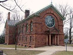 Herring-Cole Hall, St. Lawrence University |
May 1, 1974 (#74002203) |
St. Lawrence University campus 44°35′32″N 75°09′51″W |
Canton | |
| 33 | Hopkinton Green Historic District |  Hopkinton Green Historic District |
September 10, 2014 (#14000583) |
NY 11B, Co. Rd. 49 & Church St 44°41′26″N 74°42′15″W |
Hopkinton | Core of small town that grew up around 1803 mill |
| 34 | Knollwood | January 4, 2012 (#11001006) |
South end of Inlet Rd. at Oswegatchie River 44°07′28″N 74°57′32″W |
Star Lake | ||
| 35 | Land Office |  Land Office |
September 2, 1982 (#82004685) |
Main St. 44°35′20″N 75°39′02″W |
Morristown | |
| 36 | Library Park Historic District |  Library Park Historic District |
November 4, 1982 (#82001270) |
303-323 Washington St., 100-112 Carolina St., and Liberty Park 44°41′58″N 75°29′37″W |
Ogdensburg | |
| 37 | Lisbon Railroad Depot | November 22, 2000 (#00001422) |
6936 Cty Rd. 10 44°43′39″N 75°19′09″W |
Lisbon | ||
| 38 | Lisbon Town Hall | September 4, 1980 (#80004336) |
Church and Main Sts. 44°43′44″N 75°19′16″W |
Lisbon | ||
| 39 | Market Street Historic District |  Market Street Historic District |
November 16, 1979 (#79003171) |
Market and Raymond Sts. 44°40′13″N 74°59′12″W |
Potsdam | |
| 40 | Paschal Miller House |  Paschal Miller House |
September 2, 1982 (#82004686) |
Main and Gouveneur Sts. 44°35′16″N 75°38′57″W |
Morristown | |
| 41 | Morristown Schoolhouse |  Morristown Schoolhouse |
September 2, 1982 (#82004687) |
Columbia St. 44°35′06″N 75°38′47″W |
Morristown | |
| 42 | New York Central Railroad Adirondack Division Historic District |  New York Central Railroad Adirondack Division Historic District |
December 23, 1993 (#93001451) |
NYCRR Right-of-Way 44°08′05″N 74°37′50″W |
Horseshoe | The New York Central passed through Horseshoe, Mt. Arab Station, and Childwold Station. A 1908 bunkhouse in Horseshoe is extant. |
| 43 | New York State Armory | December 12, 1976 (#76002174) |
100 Lafayette St. 44°41′26″N 75°29′36″W |
Ogdensburg | try also New York State Armory | |
| 44 | Ogdensburg Armory |  Ogdensburg Armory |
March 2, 1995 (#95000088) |
225 Elizabeth St. 44°41′57″N 75°29′23″W |
Ogdensburg | |
| 45 | Ogdensburg Harbor Lighthouse | 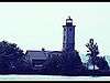 Ogdensburg Harbor Lighthouse |
April 26, 2016 (#16000202) |
2 Jackson St. 44°41′52″N 75°30′12″W |
Ogdensburg | 1871 lighthouse at Oswegatchie River confluence with St. Lawrence was key to establishing safe commerce on river. |
| 46 | Oswegatchie Pumping Station | June 11, 1990 (#90000816) |
Mechanic St. north of Lafayette St. 44°41′29″N 75°29′32″W |
Ogdensburg | ||
| 47 | Nathaniel Parmeter House | June 6, 2003 (#03000027) |
498 NY 59 44°38′33″N 74°59′13″W |
Potsdam | ||
| 48 | Pickens Hall | October 27, 2004 (#04001205) |
83 State St. 44°37′10″N 75°24′22″W |
Heuvelton | ||
| 49 | Pierrepont Town Buildings | November 4, 1982 (#82001271) |
Main St. 44°32′30″N 75°00′39″W |
Pierrepont Center | ||
| 50 | Potsdam Civic Center Complex | May 3, 2016 (#16000226) |
2 Park St 44°40′10″N 74°58′58″W |
Potsdam | Mid-1930s complex built as New Deal relief project of locally quarried stone incorporates 1870s church | |
| 51 | Potsdam State Normal School Campus | February 23, 2015 (#15000032) |
41 Elm & 56-60 Main Sts. 44°40′07″N 74°58′56″W |
Potsdam | One of the two buildings used by Clarkson University; built around 1917 as sixth such school in state | |
| 52 | Raymondville Parabolic Bridge | 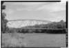 Raymondville Parabolic Bridge |
September 7, 1984 (#84002961) |
Grant Rd. over Raquette River 44°50′23″N 74°58′47″W |
Raymondville | |
| 53 | Richardson Hall, St. Lawrence University |  Richardson Hall, St. Lawrence University |
May 1, 1974 (#74002204) |
St. Lawrence University campus 44°35′31″N 75°09′48″W |
Canton | |
| 54 | Robinson Bay Archeological District |  Robinson Bay Archeological District |
September 13, 1977 (#77001524) |
Address Restricted |
Massena | |
| 55 | Russell Town Hall | January 4, 1996 (#95001492) |
Jct. of Main and Mill Sts., NW corner 44°25′46″N 75°09′02″W |
Russell | ||
| 56 | St. Lawrence University-Old Campus Historic District | 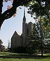 St. Lawrence University-Old Campus Historic District |
September 15, 1983 (#83001793) |
Park St. 44°35′26″N 75°09′50″W |
Canton | |
| 57 | Samuel Stocking House | September 2, 1982 (#82004688) |
83 Gouverneur St. 44°35′18″N 75°38′53″W |
Morristown | ||
| 58 | Sunday Rock | 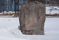 Sunday Rock |
December 7, 2010 (#10000990) |
NY 56 44°30′35″N 74°53′39″W |
South Colton | |
| 59 | Stone Windmill | 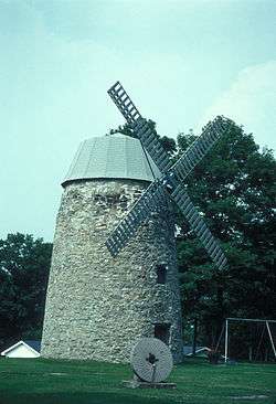 Stone Windmill |
September 2, 1982 (#82004689) |
Morris St. 44°35′24″N 75°38′50″W |
Morristown | |
| 60 | Trinity Episcopal Chapel | February 19, 1990 (#90000003) |
Rt. 65, south of Morley 44°39′44″N 75°12′03″W |
Morley | ||
| 61 | Trinity Episcopal Church | 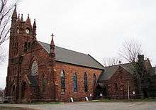 Trinity Episcopal Church |
February 13, 2003 (#03000032) |
38 Maple St. 44°40′02″N 74°59′18″W |
Potsdam | |
| 62 | U.S. Customshouse | 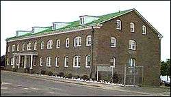 U.S. Customshouse |
October 9, 1974 (#74002205) |
127 N. Water St. 44°41′50″N 75°29′52″W |
Ogdensburg | |
| 63 | U.S. Post Office-Ogdensburg | August 16, 1977 (#77001525) |
431 State St. 44°36′52″N 75°29′28″W |
Ogdensburg | ||
| 64 | United Methodist Church | 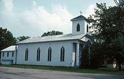 United Methodist Church |
September 2, 1982 (#82004690) |
Gouveneur St. 44°35′10″N 75°38′46″W |
Morristown | |
| 65 | United Presbyterian Church | October 5, 2005 (#05001124) |
26 Church St. 44°43′47″N 75°19′17″W |
Lisbon | ||
| 66 | US Post Office-Canton | 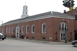 US Post Office-Canton |
November 17, 1988 (#88002469) |
100 Main St.[5] 44°35′43″N 75°10′09″W |
Canton | |
| 67 | US Post Office-Gouverneur | 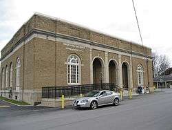 US Post Office-Gouverneur |
May 11, 1989 (#88002516) |
35 Grove St. 44°20′06″N 75°27′58″W |
Gouverneur | |
| 68 | US Post Office-Potsdam | 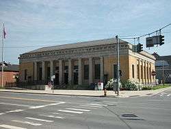 US Post Office-Potsdam |
May 11, 1989 (#88002410) |
21 Elm St. 44°40′10″N 74°59′05″W |
Potsdam | |
| 69 | Village Park Historic District | 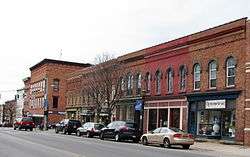 Village Park Historic District |
May 6, 1975 (#75002087) |
Both sides of Main and Park Sts., and Park Pl. 44°35′43″N 75°10′06″W |
Canton | |
| 70 | Waddington Historic District | 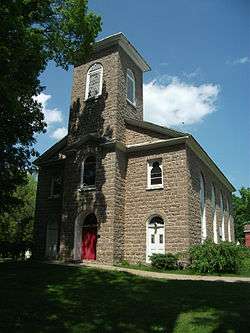 Waddington Historic District |
May 18, 1992 (#92000457) |
Jct. of NY 37 and La Grasse St. 44°51′49″N 75°12′13″W |
Waddington | |
| 71 | Jonathan Wallace House | 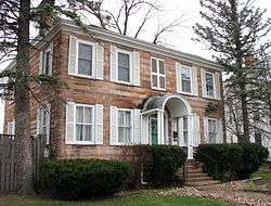 Jonathan Wallace House |
June 6, 2003 (#03000028) |
99 Market St. 44°40′19″N 74°59′15″W |
Potsdam | |
| 72 | Wanakena Presbyterian Church | 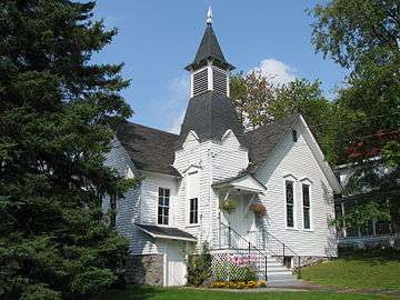 Wanakena Presbyterian Church |
September 28, 2007 (#07001015) |
32 Second St. 44°08′09″N 74°55′18″W |
Wanakena | Called the Western Adirondack Presbyterian Church |
| 73 | Watkins-Sisson House | September 9, 2013 (#13000697) |
14 Leroy Street 44°40′18″N 74°59′01″W |
Potsdam | Mid-1860s brick house given Classical Revival expansion in early 20th century | |
| 74 | West Stockholm Historic District | November 20, 1979 (#79003172) |
W. Stockholm and Livingston Rds. 44°42′44″N 74°54′08″W |
West Stockholm | ||
| 75 | Wright's Stone Store | 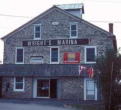 Wright's Stone Store |
September 2, 1982 (#82004691) |
Main St. 44°35′20″N 75°39′04″W |
Morristown | |
| 76 | Young Memorial Church | 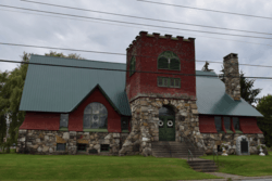 Young Memorial Church |
May 18, 2011 (#11000293) |
Junction of School St. and NY 37 44°31′54″N 75°39′47″W |
Brier Hill | |
| 77 | Zion Episcopal Church and Rectory | June 6, 2003 (#03000029) |
91 and 95 Main St. 44°33′13″N 74°56′22″W |
Colton |
Former listing
| [3] | Name on the Register | Image | Date listed | Date removed | Location | City or town | Summary |
|---|---|---|---|---|---|---|---|
| 1 | Wanakena Footbridge | 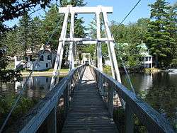 Wanakena Footbridge |
August 19, 1999 (#99001001) | May 3, 2016 | Over Oswegatchie River, between Front St. and South Shore Rd. 44°07′59″N 74°55′18″W |
Wanakena (Fine) | Bridge built to allow workers to reach lumber mills destroyed by ice in 2014 |
gollark: Why would you do the calculation on the *serverside*?
gollark: No it doesn't.
gollark: This is not a very good application.
gollark: ddg! site:pastebin.com "PotatOS"
gollark: ddg! PotatOS Tau, First Edition
References
- The latitude and longitude information provided in this table was derived originally from the National Register Information System, which has been found to be fairly accurate for about 99% of listings. Some locations in this table may have been corrected to current GPS standards.
- "National Register of Historic Places: Weekly List Actions". National Park Service, United States Department of the Interior. Retrieved on August 14, 2020.
- Numbers represent an ordering by significant words. Various colorings, defined here, differentiate National Historic Landmarks and historic districts from other NRHP buildings, structures, sites or objects.
- The eight-digit number below each date is the number assigned to each location in the National Register Information System database, which can be viewed by clicking the number.
- Address based on USPS website. Accessed April 2, 2016.
| Topics | 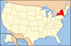 | |
|---|---|---|
| Lists by county |
| |
| Lists by city | ||
| Other lists | ||
| ||
| Wikimedia Commons has media related to National Register of Historic Places in St. Lawrence County, New York. |
This article is issued from Wikipedia. The text is licensed under Creative Commons - Attribution - Sharealike. Additional terms may apply for the media files.