National Register of Historic Places listings in Cortland County, New York
List of the National Register of Historic Places listings in Cortland County, New York:
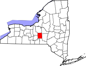
Location of Cortland County in New York
This is intended to be a complete list of properties and districts listed on the National Register of Historic Places in Cortland County, New York. The locations of National Register properties and districts (at least for all showing latitude and longitude coordinates below) may be seen in a map by clicking on "Map of all coordinates".[1]
- This National Park Service list is complete through NPS recent listings posted August 14, 2020.[2]
| Albany (Albany) – Allegany – Bronx – Broome – Cattaraugus – Cayuga – Chautauqua – Chemung – Chenango – Clinton – Columbia – Cortland – Delaware – Dutchess (Poughkeepsie, Rhinebeck) – Erie (Buffalo) – Essex – Franklin – Fulton – Genesee – Greene – Hamilton – Herkimer – Jefferson – Kings – Lewis – Livingston – Madison – Monroe (Rochester) – Montgomery – Nassau – New York (Below 14th Street, 14th to 59th Streets, 59th to 110th Streets, Above 110th Street, Islands) – Niagara – Oneida – Onondaga – Ontario – Orange – Orleans – Oswego – Otsego – Putnam – Queens – Rensselaer – Richmond – Rockland – St. Lawrence – Saratoga – Schenectady – Schoharie – Schuyler – Seneca – Steuben – Suffolk – Sullivan – Tioga – Tompkins – Ulster – Warren – Washington – Wayne – Westchester (Northern, Southern, New Rochelle, Peekskill, Yonkers) – Wyoming – Yates |
Listings county-wide
| [3] | Name on the Register | Image | Date listed[4] | Location | City or town | Description |
|---|---|---|---|---|---|---|
| 1 | Cincinnatus Historic District | 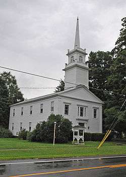 Cincinnatus Historic District |
September 7, 1984 (#84002208) |
Main St. and Taylor Ave. 42°32′31″N 75°54′16″W |
Cincinnatus | Historic district in this very small town |
| 2 | Cortland County Courthouse | %2C_Cortland%2C_New_York.jpg) Cortland County Courthouse |
October 9, 1974 (#74001228) |
Courthouse Park 42°35′56″N 76°10′37″W |
Cortland | |
| 3 | Cortland County Poor Farm | 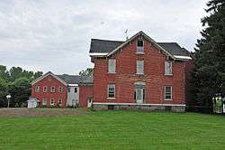 Cortland County Poor Farm |
October 29, 1982 (#82001115) |
Northeast of Cortland off NY 13 42°37′36″N 76°08′14″W |
Cortland | |
| 4 | Cortland Fire Headquarters | 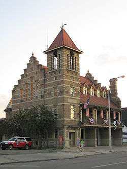 Cortland Fire Headquarters |
July 12, 1974 (#74001229) |
21 Court St. 42°35′57″N 76°10′46″W |
Cortland | |
| 5 | Cortland Free Library | 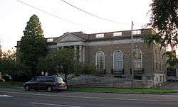 Cortland Free Library |
May 30, 2008 (#08000469) |
32 Church Street 42°35′59″N 76°10′41″W |
Cortland | |
| 6 | Crescent Corset Company | June 21, 2016 (#16000391) |
166-177 Main St. 42°35′39″N 76°10′48″W |
Cortland | 1923 clothing factory employed many of the Italian immigrants to the area | |
| 7 | First Presbyterian Church | 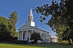 First Presbyterian Church |
January 24, 2002 (#01001502) |
Courtland Cty Rd. 108B 42°44′06″N 76°08′47″W |
Preble | |
| 8 | First Presbyterian Church Complex | 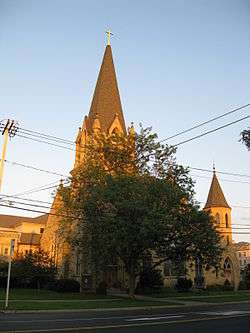 First Presbyterian Church Complex |
March 6, 2002 (#02000142) |
23 Church St. 42°35′57″N 76°10′41″W |
Cortland | |
| 9 | Glen Haven District No. 4 School and Public Library | May 23, 1997 (#97000420) |
7325 Fair Haven Rd. 42°45′39″N 76°16′04″W |
Fair Haven | ||
| 10 | Glenwood Cemetery | January 31, 2019 (#100003395) |
51 S. West St. 42°37′58″N 76°11′32″W |
Homer | ||
| 11 | William J. Greenman House | 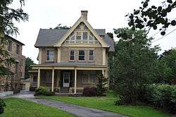 William J. Greenman House |
August 18, 2011 (#11000542) |
27 N. Church St. 42°36′15″N 76°10′40″W |
Cortland | |
| 12 | Hatheway Homestead | %2C_Cortland_(Cortland_County%2C_New_York).jpg) Hatheway Homestead |
January 20, 1978 (#78001848) |
NY 41 42°35′50″N 76°01′10″W |
Solon | |
| 13 | Little York Pavilion | 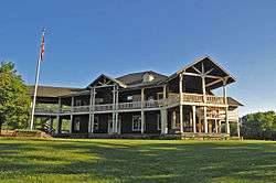 Little York Pavilion |
July 27, 1979 (#79001575) |
South of Preble off NY 281 42°42′37″N 76°09′11″W |
Preble | |
| 14 | Main Street Historic District | 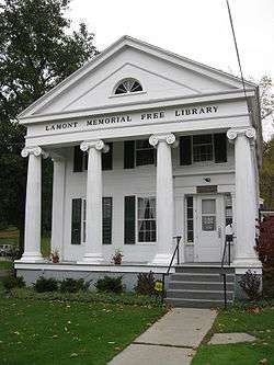 Main Street Historic District |
September 25, 1986 (#86002773) |
Roughly on Main St. between South and Washington Sts. 42°35′46″N 76°05′35″W |
McGraw | |
| 15 | Old Homer Village Historic District | 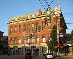 Old Homer Village Historic District |
October 2, 1973 (#73001176) |
N.and S. Main St., Central Park, Clinton, James, Cayuga, and Albany Sts. 42°38′11″N 76°10′50″W |
Homer | |
| 16 | Peck Memorial Library | 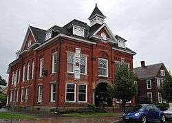 Peck Memorial Library |
May 19, 1992 (#92000557) |
28 E. Main St. 42°26′28″N 76°02′00″W |
Marathon | |
| 17 | Presbyterian Church of McGraw | 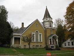 Presbyterian Church of McGraw |
September 11, 1986 (#86002517) |
3 W. Main St. 42°35′44″N 76°05′45″W |
McGraw | |
| 18 | Randall Farm | 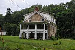 Randall Farm |
June 2, 2000 (#00000573) |
3713 Page Green Rd. 42°35′06″N 76°10′49″W |
Cortland | |
| 19 | Stage Coach Inn | 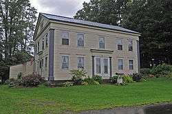 Stage Coach Inn |
December 11, 2009 (#09001080) |
2548 Clarks Corners Rd. 42°26′27″N 76°06′03″W |
Lapeer | |
| 20 | Tarbell Building | 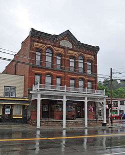 Tarbell Building |
November 22, 2000 (#00001408) |
2 Cortland St. 42°26′31″N 76°01′58″W |
Marathon | |
| 21 | Taylor Center Methodist Episcopal Church and Taylor District #3 School | 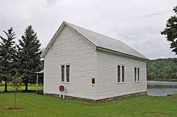 Taylor Center Methodist Episcopal Church and Taylor District #3 School |
July 30, 2010 (#10000513) |
4332-4338 Cheningo-Solon Pond Rd. 42°36′59″N 75°55′32″W |
Taylor Center | |
| 22 | Tompkins Street Historic District | 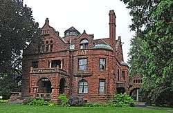 Tompkins Street Historic District |
March 18, 1975 (#75001179) |
Tompkins and intersecting streets from Main St. to Cortland Rural Cemetery 42°35′43″N 76°11′12″W |
Cortland | |
| 23 | Town Line Bridge | 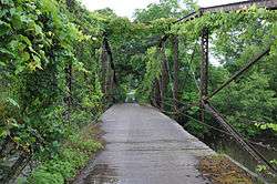 Town Line Bridge |
May 29, 2008 (#08000470) |
Town Line Rd. 42°33′57″N 75°52′57″W |
Taylor | |
| 24 | Truxton Depot | 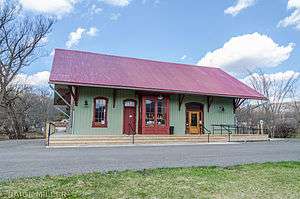 Truxton Depot |
September 25, 2008 (#08000930) |
Railroad St. 42°42′31″N 76°01′49″W |
Truxton | |
| 25 | Union Valley Congregational Church | 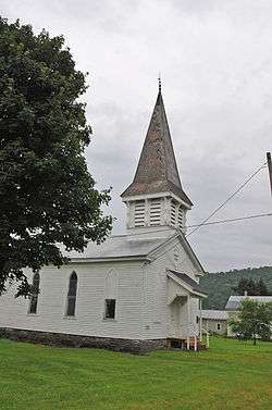 Union Valley Congregational Church |
December 31, 2002 (#02001639) |
Union Valley Cross Rd. 42°38′01″N 75°53′00″W |
Taylor | |
| 26 | Unitarian Universalist Church | .jpg) Unitarian Universalist Church |
July 1, 1993 (#93000592) |
3 Church St. 42°36′05″N 76°10′41″W |
Cortland | Cobblestone church |
| 27 | US Post Office-Cortland |  US Post Office-Cortland |
November 17, 1988 (#88002475) |
88 Main St. 42°35′54″N 76°10′51″W |
Cortland | |
| 28 | US Post Office-Homer |  US Post Office-Homer |
May 11, 1989 (#88002502) |
2 S. Main St. 42°38′44″N 76°10′46″W |
Homer | |
| 29 | Water, Wall, and Pine Streets Lenticular Truss Bridges | 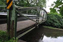 Water, Wall, and Pine Streets Lenticular Truss Bridges |
October 5, 1977 (#77000938) |
Wall, Water and Pine Sts. 42°38′15″N 76°10′36″W |
Homer |
gollark: As far as I'm aware it's more like saturating your internet connection than the computer itself, since most can probably deal with a lot of packets fine.
gollark: Discord won't actually just give your IP to random people, so it's probably fine.
gollark: Maybe you just shouldn't raid people's servers then.
gollark: There is nothing stopping them from revealing personal information if they have it (Discord won't randomly provide it) except maybe being banned afterward.
gollark: It's an Electron app. It's basically glorified Chrome.
See also
| Wikimedia Commons has media related to National Register of Historic Places in Cortland County, New York. |
References
- The latitude and longitude information provided in this table was derived originally from the National Register Information System, which has been found to be fairly accurate for about 99% of listings. Some locations in this table may have been corrected to current GPS standards.
- "National Register of Historic Places: Weekly List Actions". National Park Service, United States Department of the Interior. Retrieved on August 14, 2020.
- Numbers represent an ordering by significant words. Various colorings, defined here, differentiate National Historic Landmarks and historic districts from other NRHP buildings, structures, sites or objects.
- The eight-digit number below each date is the number assigned to each location in the National Register Information System database, which can be viewed by clicking the number.
| Topics | 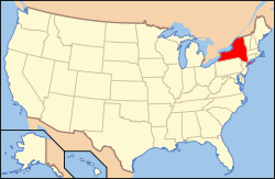 | |
|---|---|---|
| Lists by county |
| |
| Lists by city | ||
| Other lists | ||
| ||
This article is issued from Wikipedia. The text is licensed under Creative Commons - Attribution - Sharealike. Additional terms may apply for the media files.