National Register of Historic Places listings in Dixie County, Florida
This is a list of the National Register of Historic Places listings in Dixie County, Florida.
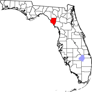
Location of Dixie County in Florida
This is intended to be a complete list of the properties on the National Register of Historic Places in Dixie County, Florida. The locations of National Register properties for which the latitude and longitude coordinates are included below, may be seen in a map.[1]
There are 2 properties listed on the National Register in the county.
- This National Park Service list is complete through NPS recent listings posted August 14, 2020.[2]
| Alachua - Baker - Bay - Bradford - Brevard - Broward - Calhoun - Charlotte - Citrus - Clay - Collier - Columbia - DeSoto - Dixie - Duval - Escambia - Flagler - Franklin - Gadsden - Gilchrist - Glades - Gulf - Hamilton - Hardee - Hendry - Hernando - Highlands - Hillsborough (Tampa) - Holmes - Indian River - Jackson - Jefferson - Lafayette - Lake - Lee - Leon - Levy - Liberty - Madison - Manatee - Marion - Martin - Miami-Dade (Miami) - Monroe - Nassau - Okaloosa - Okeechobee - Orange - Osceola - Palm Beach - Pasco - Pinellas - Polk - Putnam - St. Johns - St. Lucie - Santa Rosa - Sarasota - Seminole - Sumter - Suwannee - Taylor - Union - Volusia - Wakulla - Walton - Washington |
Current listings
| [3] | Name on the Register[4] | Image | Date listed[5] | Location | City or town | Description |
|---|---|---|---|---|---|---|
| 1 | CITY OF HAWKINSVILLE (shipwreck) | 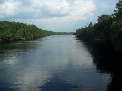 CITY OF HAWKINSVILLE (shipwreck) |
May 31, 2001 (#01000533) |
Suwannee River, 100 yards south of the Old Town railroad trestle 29°36′26″N 82°58′15″W |
Old Town | |
| 2 | Garden Patch Archeological Site (8Di4) | April 25, 1991 (#91000454) |
Address Restricted |
Horseshoe Beach |
gollark: æ™, sponsored by bees.
gollark: MODERATOR ABUSE!
gollark: No.
gollark: What codepoint is andrew?
gollark: It is glorious æ. It stands alone.
See also
| Wikimedia Commons has media related to National Register of Historic Places in Dixie County, Florida. |
References
- The latitude and longitude information provided in this table was derived originally from the National Register Information System, which has been found to be fairly accurate for about 99% of listings. Some locations in this table may have been corrected to current GPS standards.
- "National Register of Historic Places: Weekly List Actions". National Park Service, United States Department of the Interior. Retrieved on August 14, 2020.
- Numbers represent an ordering by significant words. Various colorings, defined here, differentiate National Historic Landmarks and historic districts from other NRHP buildings, structures, sites or objects.
- "National Register Information System". National Register of Historic Places. National Park Service. March 13, 2009.
- The eight-digit number below each date is the number assigned to each location in the National Register Information System database, which can be viewed by clicking the number.

Municipalities and communities of Dixie County, Florida, United States | ||
|---|---|---|
| Towns | | |
| Unincorporated communities | ||
This article is issued from Wikipedia. The text is licensed under Creative Commons - Attribution - Sharealike. Additional terms may apply for the media files.