National Register of Historic Places listings in Citrus County, Florida
This is a list of the National Register of Historic Places listings in Citrus County, Florida.
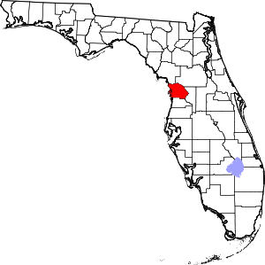
Location of Citrus County in Florida
This is intended to be a complete list of the properties and districts on the National Register of Historic Places in Citrus County, Florida, United States. The locations of National Register properties and districts for which the latitude and longitude coordinates are included below, may be seen in a map.[1]
There are 10 properties and districts listed on the National Register in the county, including 1 National Historic Landmark.
- This National Park Service list is complete through NPS recent listings posted August 14, 2020.[2]
| Alachua - Baker - Bay - Bradford - Brevard - Broward - Calhoun - Charlotte - Citrus - Clay - Collier - Columbia - DeSoto - Dixie - Duval - Escambia - Flagler - Franklin - Gadsden - Gilchrist - Glades - Gulf - Hamilton - Hardee - Hendry - Hernando - Highlands - Hillsborough (Tampa) - Holmes - Indian River - Jackson - Jefferson - Lafayette - Lake - Lee - Leon - Levy - Liberty - Madison - Manatee - Marion - Martin - Miami-Dade (Miami) - Monroe - Nassau - Okaloosa - Okeechobee - Orange - Osceola - Palm Beach - Pasco - Pinellas - Polk - Putnam - St. Johns - St. Lucie - Santa Rosa - Sarasota - Seminole - Sumter - Suwannee - Taylor - Union - Volusia - Wakulla - Walton - Washington |
Current listings
| [3] | Name on the Register[4] | Image | Date listed[5] | Location | City or town | Description |
|---|---|---|---|---|---|---|
| 1 | Crystal River Indian Mounds | 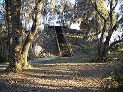 Crystal River Indian Mounds |
September 29, 1970 (#70000178) |
2 miles northwest of Crystal River on U.S. Routes 19/98 28°55′01″N 82°36′33″W |
Crystal River | |
| 2 | Crystal River Old City Hall | 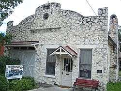 Crystal River Old City Hall |
May 29, 1998 (#98000588) |
532 North Citrus Avenue 28°53′55″N 82°35′36″W |
Crystal River | |
| 3 | Etna Turpentine Camp Archeological Site | December 10, 2009 (#09001055) |
Address Restricted |
Inverness vicinity | ||
| 4 | Floral City Historic District | 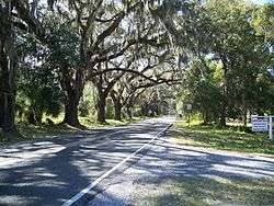 Floral City Historic District |
December 1, 1993 (#93001357) |
Roughly Orange Avenue from South Old Floral City Road to South Annie Terrace and South Aroostook Way from Orange to Lake Tsala Apopka 28°45′02″N 82°17′27″W |
Floral City | |
| 5 | Fort Cooper | 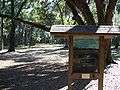 Fort Cooper |
June 13, 1972 (#72000304) |
Address Restricted 28°48′36″N 82°18′19″W |
Inverness | |
| 6 | Masonic Temple of Citrus Lodge No. 18, F. and A.M. |  Masonic Temple of Citrus Lodge No. 18, F. and A.M. |
June 23, 2010 (#10000387) |
111 West Main St 28°50′09″N 82°19′53″W |
Inverness | NRHP No. 10000387 |
| 7 | Mullet Key | 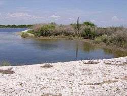 Mullet Key |
July 3, 1986 (#86001409) |
In Crystal Bay, within Crystal River Preserve State Park[6] 28°52′52″N 82°41′32″W |
Crystal River | |
| 8 | Old Citrus County Courthouse | 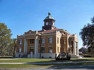 Old Citrus County Courthouse |
April 17, 1992 (#92000340) |
1 Courthouse Square 28°50′08″N 82°19′49″W |
Inverness | |
| 9 | Old Hernando Elementary School | 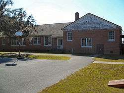 Old Hernando Elementary School |
May 4, 2001 (#00001129) |
2435 North Florida Avenue 28°53′53″N 82°22′22″W |
Hernando | |
| 10 | Yulee Sugar Mill Ruins | 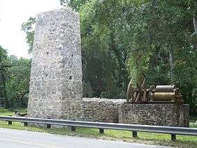 Yulee Sugar Mill Ruins |
August 12, 1970 (#70000179) |
State Road 490 west of U.S. Route 19 28°47′01″N 82°36′28″W |
Homosassa |
gollark: WHAT DID I MEAN?
gollark: What?
gollark: <@319753218592866315> make minoteaur.
gollark: ?tag create "sallen-key filter" A Sallen–Key filter is a variation on a VCVS filter that uses a unity-voltage-gain amplifier (i.e., a pure buffer amplifier).
gollark: ++remind 32h CODE GUE§
See also
| Wikimedia Commons has media related to National Register of Historic Places in Citrus County, Florida. |
References
- The latitude and longitude information provided in this table was derived originally from the National Register Information System, which has been found to be fairly accurate for about 99% of listings. Some locations in this table may have been corrected to current GPS standards.
- "National Register of Historic Places: Weekly List Actions". National Park Service, United States Department of the Interior. Retrieved on August 14, 2020.
- Numbers represent an ordering by significant words. Various colorings, defined here, differentiate National Historic Landmarks and historic districts from other NRHP buildings, structures, sites or objects.
- "National Register Information System". National Register of Historic Places. National Park Service. March 13, 2009.
- The eight-digit number below each date is the number assigned to each location in the National Register Information System database, which can be viewed by clicking the number.
- Location derived from its GNIS feature record; the NRIS lists the site as "Address restricted"

Municipalities and communities of Citrus County, Florida, United States | ||
|---|---|---|
| Cities | | |
| CDPs | ||
| Unincorporated communities |
| |
| Ghost town | ||
This article is issued from Wikipedia. The text is licensed under Creative Commons - Attribution - Sharealike. Additional terms may apply for the media files.