Na-hpan
Na-hpan[1] is a village in Mongyai Township, Shan State.[2]
Na-hpan | |
|---|---|
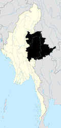
 Na-hpan Location in Burma | |
| Coordinates: 22°39′6″N 97°52′30″E | |
| Country | |
| Division | Shan State |
| District | Lashio District |
| Township | Mongyai Township |
| Elevation | 1,991 ft (607 m) |
| Population | |
| • Ethnicities | Shan |
| Time zone | UTC+6.30 (MST) |
Geography
Na-hpan is located west of the Salween, 20 km to the west of Loi Leng mountain.[3]
gollark: Quite a lot of the time I don't care a massive amount about performance, as long as my thing isn't horrendously slow, because it's serving not very much traffic on a server with quite a lot of free resources.
gollark: Well, it is harder to have to semi-manually manage memory than to have it garbage collected, and it has issues like being stuck in the middle of moving to asynchronous code right now.
gollark: (praise Rust™, although I still find it somewhat harder to write stuff in than JS or whatever so I only use it for my more perf-sensitive projects)
gollark: Like Rust's `Option`, which is optimized to use null pointers or something, meaning it's basically only a compile-time performance cost.
gollark: There are *low-cost* ones.
References
- "Na-hpan". Mapcarta. Retrieved 20 May 2016.
- Shan State
- GoogleEarth
Capital: | |
|

This article is issued from Wikipedia. The text is licensed under Creative Commons - Attribution - Sharealike. Additional terms may apply for the media files.