Laukkaing District
Laogai District (Burmese: လောက်ကိုင်ခရိုင်) is a district of the Shan State in Myanmar. It consists 2 towns and 333 villages.
Laukkaing | |
|---|---|
District | |
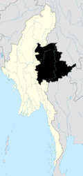
 Laukkaing Location in Burma | |
| Coordinates: 23°41′00″N 98°45′00″E | |
| Country | |
| State | Shan State |
| Elevation | 991 m (3,251 ft) |
| Time zone | UTC+6.30 (MST) |
It is located in Kokang Self-Administered Zone according to the Constitution of Myanmar (2008).[2]
Townships
The district contains the following townships:
- Laukkaing Township, or Laukkai Township[3]
- Kongyan Township, or Konkyan Township
gollark: Isn't there going to be significant bias from looking at *people who go to hospital*?
gollark: The government here seems to be actively refusing to say what they're planning to do.
gollark: It seems like we should have been using the time to try and come up with more permanently sustainable solutions, but this... doesn't really seem to have been happening *here*, at least.
gollark: Thoughts?
gollark: be able to last a bit without work.
See also
- Constitution of Burma
- Kokang incident
References
- GoogleEarth
- Myanmar Constitution Archived 2011-02-18 at the Wayback Machine
- M-G Archived 2011-10-02 at the Wayback Machine

This article is issued from Wikipedia. The text is licensed under Creative Commons - Attribution - Sharealike. Additional terms may apply for the media files.