Mong Ping
Mong Ping (Burmese: မိုင်းပြင်းမြို့) is a town and seat of Mong Ping Township in Mongsat District, Shan State in eastern Myanmar.[2] The town was not the capital of Mongping State in the Lawksawk area.
Mong Ping မိူင်းပဵင်း | |
|---|---|
Town | |
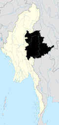
 Mong Ping Location in Burma | |
| Coordinates: 21°21′00″N 99°1′00″E | |
| Country | |
| State | Shan State |
| District | Mongsat District |
| Township | Mong Ping Township |
| Elevation | 468 m (1,535 ft) |
| Time zone | UTC+6.30 (MST) |
Geography
Mong Ping lies in a narrow valley about 60 km west of Kengtung. The entirety of the Mong Ping area is mountainous with high ranges running roughly in a north/south direction. The 1,831 m high Loi Wengwo mountain overlooks the narrow Mong Ping valley from the western side.[3]
gollark: You get time *differences* in real life since the clocks aren't synced.
gollark: It's harder than that.
gollark: CC does this using the distance thing on modems.
gollark: Anyway, CC (and *kind of* real world) GPS works by computing distances to various things in known places and then determining position based on that.
gollark: Too slow and costly.
References
- GoogleEarth
- Picture
- "Loi Wengwo". Mapcarta. Retrieved 28 May 2016.
Capital: Mong Ping | |
|

This article is issued from Wikipedia. The text is licensed under Creative Commons - Attribution - Sharealike. Additional terms may apply for the media files.