Moffat Beach, Queensland
Moffat Beach is a coastal suburb in the Sunshine Coast Region, Queensland, Australia.[2] In the 2016 census, Moffat Beach had a population of 2,553 people.[1]
| Moffat Beach Caloundra, Queensland | |||||||||||||||
|---|---|---|---|---|---|---|---|---|---|---|---|---|---|---|---|
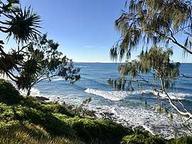 Views from Moffat Head, 2018 | |||||||||||||||
 Moffat Beach | |||||||||||||||
| Coordinates | 26.7933°S 153.1386°E | ||||||||||||||
| Population | 2,553 (2016 census)[1] | ||||||||||||||
| • Density | 1,820/km2 (4,720/sq mi) | ||||||||||||||
| Postcode(s) | 4551 | ||||||||||||||
| Area | 1.4 km2 (0.5 sq mi) | ||||||||||||||
| Time zone | AEST (UTC+10:00) | ||||||||||||||
| Location | |||||||||||||||
| LGA(s) | Sunshine Coast Region | ||||||||||||||
| County | Canning | ||||||||||||||
| Parish | Bribie | ||||||||||||||
| State electorate(s) | Caloundra | ||||||||||||||
| Federal Division(s) | Fisher | ||||||||||||||
| |||||||||||||||
Geography
Moffat Beach is within the Caloundra urban centre directly north-east of Caloundra CBD.
History
The suburb and beach were named after James C. Moffat, a chemist from Brisbane, who established a holiday house on Moffat Head in 1883.[3][2]
In the 2016 census, Moffat Beach had a population of 2,553 people.[1]
Education
There are no schools in Moffat Beach. The nearest primary school is Caloundra State School in neighbouring Caloundra. The nearest secondary school is Caloundra State High School also in Caloundra.[4]
gollark: !hwdyk msg
gollark: Sinthorion
gollark: !hwdyk msg
gollark: hd!histohist -1
gollark: Why are you reading the cognitohazardous version?
References
- Australian Bureau of Statistics (27 June 2017). "Moffat Beach (SSC)". 2016 Census QuickStats. Retrieved 20 October 2018.

- "Moffat Beach - suburb in Sunshine Coast Region (entry 48764)". Queensland Place Names. Queensland Government. Retrieved 27 January 2020.
- "Caloundra". Sydney Morning Herald. 8 February 2004. Archived from the original on 27 February 2007. Retrieved 8 February 2004.
- "Queensland Globe". State of Queensland. Retrieved 4 April 2020.
External links
| Wikimedia Commons has media related to Moffat Beach, Queensland. |
- "Moffat Beach". Queensland Places. Centre for the Government of Queensland, University of Queensland.
This article is issued from Wikipedia. The text is licensed under Creative Commons - Attribution - Sharealike. Additional terms may apply for the media files.