Minnesota Territory
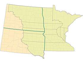
The Territory of Minnesota was an organized incorporated territory of the United States that existed from March 3, 1849, until May 11, 1858, when the eastern portion of the territory was admitted to the Union as the State of Minnesota.
| Territory of Minnesota | |||||||||||||
|---|---|---|---|---|---|---|---|---|---|---|---|---|---|
| Organized incorporated territory of the United States | |||||||||||||
| 1849–1858 | |||||||||||||
| Capital | St. Paul | ||||||||||||
| Government | |||||||||||||
| • Type | Organized incorporated territory | ||||||||||||
| Governor | |||||||||||||
• 1849–1853 | Alexander Ramsey | ||||||||||||
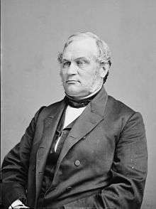
• 1853–1857 | Willis A. Gorman | ||||||||||||
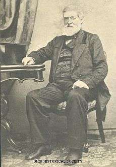
• 1857–1858 | Samuel Medary | ||||||||||||
| Legislature | Minnesota Territorial Legislature | ||||||||||||
| History | |||||||||||||
| March 3 1849 | |||||||||||||
| May 11 1858 | |||||||||||||
| |||||||||||||
History
| Year | Pop. | ±% |
|---|---|---|
| 1850 | 6,077 | — |
| Source: 1850;[1] | ||

The boundaries of the Minnesota Territory, as carved out of Iowa Territory, included the current Minnesota region and most of what later became Dakota Territory east of the Missouri River. Minnesota Territory also included portions of Wisconsin Territory that did not become part of Wisconsin, located between the Mississippi River and Wisconsin, including the Arrowhead Region.[2]
At the time of its formation, the territory which is now Minnesota contained three significant "white" settlements: St. Paul, St. Anthony (now part of Minneapolis), and Stillwater. The major territorial institutions were divided among the three: St. Paul was made the capital; Minneapolis was selected as the site of the University of Minnesota; and Stillwater was chosen as the site of the Minnesota Territorial Prison.[3]
Territorial Governors
| # | Governor | Took office | Left office | Party | |
|---|---|---|---|---|---|
| 1 | Alexander Ramsey |  |
June 1, 1849 | May 15, 1853 | Whig |
| 2 | Willis Arnold Gorman |  |
May 15, 1853 | April 23, 1857 | Democratic |
| 3 | Samuel Medary |  |
April 23, 1857 | May 24, 1858 | Democratic |
Territorial Secretaries
- Charles K. Smith, 1849–1851
- Alexander Wilkin, 1851–1853
- Joseph Rosser, 1853–1857
- Charles L. Chase, 1857–1858
Territorial Attorneys General
- Lorenzo A. Babcock, 1849–1853
- Lafayette Emmett, 1853–1858
Congressional Delegates
- Henry Hastings Sibley, 31st Congress, 32nd Congress, 1849–1853
- Henry Mower Rice, 33rd Congress, 34th Congress, 1853–1857
- William W. Kingsbury, 35th Congress, 1857–1858
See also
References
- Forstall, Richard L. (ed.). Population of the States and Counties of the United States: 1790–1990 (PDF) (Report). United States Census Bureau. p. 4. Retrieved May 18, 2020.
- See The Student Page of the Minnesota Secretary of State Archived July 1, 2007, at the Wayback Machine for an overview of how Minnesota's state boundaries were determined.
- "History of the Minnesota Territory". Minnesota Territorial Pioneers. Archived from the original on July 24, 2016. Retrieved August 25, 2019.
External links
![]()