Malaysia Federal Route 1
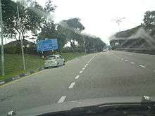
The Federal Route 1 is the first federal road in Malaysia, and also the oldest federal road in Malaysia, as well as among the nation's earliest public roadways ever constructed.[1] The Federal Route 1 was the backbone of the road system in the western states of Peninsular Malaysia before being supplanted by the North–South Expressway (E1 and E2).

Route background

The Federal Route 1 is one of the three north–south backbone federal highways in Peninsular Malaysia; the other two are the Federal Routes 3 and 5.[4]
The Kilometre Zero of the Federal Route 1 is located at the former site of the now-demolished Tanjung Puteri CIQ Complex in Johor Bahru, where it connected to the Johor–Singapore Causeway at the Malaysia–Singapore border. Since 2008, it is no longer possible to access the Causeway by the Federal Route 1, when the new Sultan Iskandar CIQ Complex was opened with access to the border checkpoint provided by the Johor Bahru Eastern Dispersal Link Expressway.
At the first kilometre at the city of Johor Bahru, it is connected with the Federal Route 3, the main trunk road of the east coast of Peninsular Malaysia. Next, at Kilometre 19 which is at Skudai, the route is connected with the Federal Route 5 which is the main trunk road of the west coast of Peninsular Malaysia.[5]
The Federal Route 1 is the main trunk road at the interior part of Peninsular Malaysia but passes the western states. From Tampin to Sungai Siput, the FT1 highway runs along the western foothills of the Titiwangsa Range. The FT1 highway intersects with the Federal Route 2 at Kuala Lumpur before intersecting with another end of the Federal Route 5 at Ipoh. At Sungai Siput, Perak, the route changes its direction westbound and later become the main west coastal route, starting from Changkat Jering, Perak to Alor Setar, Kedah.[5] The route meets with the North–South Expressway Northern Route E1 at Jitra, Kedah and the section of the North–South Expressway from Jitra to Bukit Kayu Hitam is a part of the Federal Route 1.[3][4][6]
There are 92 street names being associated with the Federal Route 1 along its entire length.[7] In addition, it is estimated that over a million of Malaysians rely on the Federal Route 1 users as their main economic source.[3]
History
The Federal Route 1 is believed to be the nation's earliest public roadway constructed. Construction began in 1880 under the orders on the Sultan of Kedah at that time, Sultan Ahmad Tajuddin Mukarram Shah, connecting Alor Setar, Kedah to Songkhla, Thailand.[1] Today, the road is also a part of the Phetkasem Road (Thailand Route 4), Routes 407 and 414 in Thailand.[3]
The road grew in importance as it connected most of the state capitals on the west coast (except Perlis and Malacca), and as a result, numerous towns grew along its path. The next phases were mostly constructed by the British colonial government as a means to provide an efficient transportation network to exploit the economic resources in Malaya.[3] The second section being completed was Perai–Ipoh section, opened to traffic in 1897. In 1915, the Kuala Lumpur–Ipoh and Johor Bahru–Kulai sections were completed.[2] In 1924, the Johor–Singapore Causeway was completed, connecting Johor Bahru to the island of Singapore.[8][9][10][11][12][13][14] The next sections being completed were Butterworth–Alor Setar and Kulai–Yong Peng sections, both were opened to traffic in 1928. The entire roadway was finally concluded in 1939 after the completion of the final section connecting Yong Peng to Tampin in 1939.[2][3]
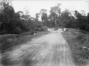
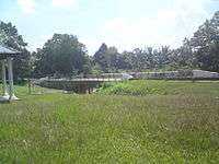
During the Second World War, the Federal Route 1 sustained heavy damages being resulted from the Malayan Campaign between the British army and the Imperial Japanese Army. During the campaign, it was estimated that more than 100 bridges were blown by the Royal Engineers in order to stop the Japanese advances southwards. Among the most famous bridges being blown were the Sungai Kelamah Bridge (also known as the Gemencheh Bridge), Gemas Bridge and Buloh Kasap Bridge – all of them were located at the Federal Route 1 – as a result of the Battle of Gemas which had claimed the lives of more than 1,000 Imperial Japanese soldiers.[15] After the Second World War ended, the FT1 road was restored and damaged bridges were rebuilt.[3]
A lot of improvements were implemented towards the Federal Route 1 after the independence of Malaya in 1957 and the formation of Malaysia in 1963. Among the earliest improvements during the post-independent Malaya was the construction of the Merdeka Bridge at the Penang–Kedah state border. It was constructed to replace the old bridge that was destroyed in 1942 during the Second World War. The bridge assumed its name for being opened to motorists during the year of Malayan independence.[6]
In 1966, the Tanjung Malim–Slim River Highway FT1 was opened to motorists, becoming the earliest toll road in Malaysia.[16] The two-lane highway bypassed the former section between Slim River to Tanjung Malim, which would later being downgraded to Perak State Route A121 and Federal Route 193[5][17]
The improvements of the FT1 route was also being implemented within the Federal Territory of Kuala Lumpur as well, in order to improve the highway network within the city. Lack of proper highway planning was blamed for the severe congestion in the city. At that time, the FT1 route within Kuala Lumpur consisted of Jalan Cheras, Jalan Pudu, Jalan Tun Perak (formerly known as Java Street and then Mountbatten Road), Jalan Tuanku Abdul Rahman and Jalan Ipoh (both previously known as Batu Road).[18] Under the recommendation from the 1979 Klang Valley Review Report, the FT1 route in Kuala Lumpur was rerouted to a new road system consisting Jalan Loke Yew, Jalan Maharajalela, Jalan Kinabalu and Jalan Kuching as a traffic dispersal means as well as providing the constant continuity of the FT1 route in Kuala Lumpur.[19] One of the components of the new road system was the Jalan Kinabalu viaduct, which was opened on 15 March 1963.[20]
The most controversial development of the FT1 highway in Kuala Lumpur was the toll collection at Jalan Kuching FT1. The nine-year concession of Jalan Kuching FT1 was awarded to Kamunting Corporation Berhad, signed on 15 April 1985. In the original concessionaire agreement, Kamunting Corporation Berhad was required to build an interchange at Kepong Roundabout and to upgrade the Jalan Kepong FT54, in return for the nine-year toll collection rights starting from 1987 until 1996. However, in 1987, the concessionaire agreement was amended, and Kamunting Corporation Berhad was required to add two more lanes from the existing four lanes along Jalan Kuching FT1, resulting another 7-year extension of toll concession which was ended in 2003.[21] The toll collection at Jalan Kuching FT1 had sparked fury among Kuala Lumpurian motorists, and numerous protests were held to urge the government to end the toll collection there.[21][22] The toll collection at Jalan Kuching FT1 was finally abolished on 8 January 2003.[23]
In 1977, the government proposed to build a new north–south divided highway as an alternative to the Federal Route 1, which would be later known as the North–South Expressway E1 and E2.[24] The proposal to build the new highway was mooted as a result of the severe congestion along the Federal Route 1.[25] Because of the financially massive scale of the project, the highway was planned to be privatised and tolled, but none of the constructors being invited by the government were willing to do the job due to economic uncertainties at that time and the plan could not be materialised.[24][25] It was only after Tun Dr. Mahathir Mohamad became the Prime Minister that the North–South Expressway project was revived. The North–South Expressway was launched in 1981,[24] where the Jitra–Bukit Kayu Hitam section was constructed as an upgrade of the existing Federal Route 1 section into a divided highway with partial access control and at-grade intersections.[25] At that time, the construction of the Kuala Lumpur–Seremban Expressway E2 was still ongoing, and therefore the expressway would later form the pioneer route for the southern route. Unlike the other sections of the North–South Expressway, the Jitra–Bukit Kayu Hitam section did not comply with the expressway standards defined by the Arahan Teknik 8/86: A Guide on Geometric Design of Roads which was only published by the Malaysian Public Works Department (JKR) later in 1986, resulting the section to be grandfathered as a part of the North–South Expressway E1.[25] After the North–South Expressway was completed in 1994, the expressway took the role of the Federal Route 1 as the main backbone route in Peninsular Malaysia.[26]
Apart from the Jitra–Bukit Kayu Hitam section that was being upgraded to be a part of the North–South Expressway E1, there are some other sections of the FT1 highway that have been upgraded to toll roads and controlled-access expressways. For example, the Skudai Highway FT1 was completed in November 1985 as a tolled divided highway until 1 March 2004.[27] Meanwhile, Jalan Cheras–Kajang FT1 was upgraded from the former 2-lane road into an 8-lane controlled-access expressway known as the Cheras–Kajang Expressway E7/FT1. The expressway was opened to traffic on 15 January 1999.[28]
Much of the road remains in use, although in September 2009, portions of the road to north of Ipoh were temporarily closed to facilitate double tracking and electrification along the Ipoh–Padang Besar railway line.
List of junctions and towns (south–north)
| Km | Exit | Interchange/Junctions | To | Remarks | |
|---|---|---|---|---|---|
| Johor Bahru–Senai | see also Skudai Highway | ||||
| Saleng | |||||
| Hospital Temenggong Seri Maharaja | |||||
| Indahpura | Southwest Persiaran Indahpura Utama Indahpura Northeast Lebuh Putra Utama Bandar Putra Kulai IOI Mall Kulai | Diamond interchange | |||
| Kulai | Majlis Perbandaran Kulai (MPKulai) main headquarters | ||||
| Kulai Jalan Kota Tinggi | East | T-junctions | |||
| Kulai | |||||
| Kulai Jalan Sengkang | Northeast Jalan Sengkang Sengkang | T-junctions | |||
| Kulaijaya-NSE Highway | West (Jalan Alor Bukit) Taman Puteri Kulai Gunung Pulai Kuala Lumpur Johor Bahru | T-junctions | |||
| Kelapa Sawit | |||||
| Kampung Rahmat | |||||
| Sedenak | East Sedenak | T-junctions | |||
| Ayer Bemban | |||||
| Kampung Ayer Manis | |||||
| Jalan Parit Panjang | Southwest FELDA Bukit Batu Ayer Baloi Kuala Lumpur Johor Bahru | T-junctions | |||
| Bukit Batu | |||||
| Jalan Layang-Layang | Northeast Layang-Layang Renggam Kluang | T-junctions | |||
| Kulai–Kluang district border Simpang Renggam sub-district border | |||||
| Jalan FELDA Layang-Layang | East 1423 Jalan FELDA Layang-Layang FELDA Layang-Layang | T-junctions | |||
| Johore Safari World (Closed on 1984) | Abandoned T-junctions | ||||
| Jalan Benut | Southwest Kuala Lumpur Johor Bahru | T-junctions | |||
| Simpang Renggam Jalan Simpang Renggam–Layang Layang | Northeast Renggam Layang-Layang Kluang | T-junctions | |||
| Sungai Machap bridge | |||||
| Machap | |||||
| Machap-NSE | North Kuala Lumpur Melaka Ayer Hitam South Johor Bahru Kulai Simpang Renggam | T-junctions | |||
| Tropical Village | T-junctions | ||||
| Kluang–Batu Pahat district border Simpang Renggam–Yong Peng sub-district border | |||||
| Ayer Hitam, Bandar Persinggahan (The Rest Town of Johor) | |||||
| Ayer Hitam | Southwest Northeast Kuala Lumpur Johor Bahru | Junctions | |||
| Masjid Sultan Ibrahim, Ayer Hitam | |||||
| Ayer Hitam, Bandar Persinggahan (The Rest Town of Johor) | |||||
| Sungai Semberong Bridge | |||||
| Jalan Olak Batu | Southwest Olak Batu, Parit Raja | T-junctions | |||
| Kampung Haji Abdul Ghaffar | |||||
| Yong Peng South-NSE | South Only Johor Bahru Simpang Renggam Ayer Hitam | T-junctions | |||
| Yong Peng | West Kuala Lumpur Johor Bahru | T-junctions | |||
| Jalan Paloh | East Paloh Kluang | T-junctions | |||
| TNB Yong Peng intake | Largest power intake in Johor state | ||||
| Batu Pahat–Segamat district border Yong Peng–Labis sub-district border | |||||
| Sungai Simpang Kiri bridge | |||||
| Chaah | |||||
| Jalan Bekok | East Bekok Jagoh | T-junctions | |||
| Kampung Sungai Karas | |||||
| Sungai Gatom bridge | |||||
| Sungai Labis bridge | |||||
| Jalan Muar–Labis | North Jalan Stesen Keretapi Labis Labis railway station Southwest Bukit Kepong Pagoh Muar Kuala Lumpur Johor Bahru | T-junctions | |||
| Railway crossing bridge | |||||
| Labis | East Jalan Bandar Labis Town Centre Hospital Labis | T-junctions | |||
| Labis | |||||
| Jalan Ayer Panas | North Pekan Air Panas | T-junctions | |||
| Labis–Segamat sub-district border | |||||
| Hutan Rizab Bukit Mambai | |||||
| Tenang | |||||
| Genuang | T-junction | ||||
| Segamat Industrial Area | Segamat Industrial Area Hospital Segamat Bandar Putra Segamat | Junctions | |||
| Segamat Kampung Abdullah | South Bukit Kepong Lenga Muar North Segamat Inner Ring Road 1384 FELDA Medoi | Junctions | |||
| Sungai Segamat Bridge | |||||
| Segamat | South Kuala Lumpur Johor Bahru | Junctions | |||
| Segamat Taman Pemuda | North Segamat Inner Ring Road 1384 FELDA Medoi | Junctions | |||
| Tun Razak Highway | North | Junctions | |||
| Buloh Kasap | Southwest Kuala Lumpur Johor Bahru | T-junctions | |||
| Sungai Muar Bridge Jambatan Buloh Kasap | Historical site | ||||
| Railway crossing bridge | |||||
| Jalan Batu Enam | South Kuala Lumpur Johor Bahru | T-junctions | |||
| Batu Enam | |||||
| Railway crossing bridge | |||||
| Gemas Baharu | |||||
| Johor Darul Takzim Segamat district border Segamat sub-district border | |||||
| Sungai Gemas Bridge Johor-Negeri Sembilan Border | |||||
| Negeri Sembilan Darul Khusus Tampin district border | |||||
| GEMAS | |||||
| Railway crossing | |||||
| Taman Desa Permai | North Kampung Ladang Bangka Hulu Pasir Besar | T-junctions | |||
| Gemas Army Camp (Kor Armor Diraja) | |||||
| Jalan Jempol | North | T-junctions | |||
| Battle of Gemencheh Bridge historical site Sungai Gemencheh Bridge | Historical site | ||||
| FELDA Sungai Kelamah | |||||
| Kampung Sungai Dua | South Ayer Kuning Nyalas Jasin | T-junctions | |||
| Kampung Baharu Gedok | |||||
| Gemencheh | North Dangi Bahau South Batang Melaka Selandar Jasin | Junctions | |||
| Negeri Sembilan Darul Khusus Tampin district border | |||||
| Negeri Sembilan–Melaka Border | |||||
| Melaka Alor Gajah district border | |||||
| Kampung Ibus | |||||
| Sempang Kampung Sungga | South Machap Umboo Durian Tunggal Melaka | T-junctions | |||
| Melaka Alor Gajah district border | |||||
| Melaka–Negeri Sembilan Border | |||||
| Negeri Sembilan Darul Khusus Tampin district border | |||||
| Kampung Pondoi | |||||
| Jalan Kuala Pilah | North | T-junctions | |||
| Tampin | Tampin Museum Tampin District and Land Office Majlis Daerah Tampin main headquarters Masjid Tampin | ||||
| Tampin | South Melaka Cheng Peringgit Alor Gajah Kuala Lumpur Johor Bahru West Tampin Railway Station | Roundabout Upgrades to an intersection Under construction | |||
| Layby | |||||
| Tampin-Rembau district border | |||||
| Kampung Ulu Kendong | South Kuala Lumpur Johor Bahru | T-junctions | |||
| Railway crossing bridge | |||||
| Kampung Padang Lebar | |||||
| Jalan Semerbok | Southwest Semerbok | T-junctions | |||
| Kampung Kota Lama | |||||
| Kampung Perah | |||||
| Jalan Gadong | Northeast Gadong Chengkau | T-junctions | |||
| Jalan Kota | West Kota | T-junctions | |||
| Kampung Kota | |||||
| Tanjung Berangan | |||||
| Jalan Penajis | South Penajis | T-junctions | |||
| Jalan Paya Lebar | Southwest Paya Lebar | T-junctions | |||
| Railway crossing bridge | |||||
| Jalan Gadong | Northeast Gadong Chengkau | T-junctions | |||
| Jalan Inas | East Inas Johol Kuala Pilah | T-junctions | |||
| Jalan Chembong | North Chembong Ulu Sepri | T-junctions | |||
| Rembau | |||||
| Railway crossing bridge | |||||
| P&R Rembau railway station | |||||
| Rembau | Rembau District and Land Office | T-junctions | |||
| Kampung Tebing Tinggi | |||||
| Jalan Batu Hampar | North Batu Hampar | T-junctions | |||
| Jalan Rantau–Pedas | North Rantau Pedas | T-junctions | |||
| Rembau Industrial Area | |||||
| Wet World Resort Pedas | |||||
| Pedas | South Linggi Port Dickson Kuala Lumpur Johor Bahru | T-junctions | |||
| Pedas Jalan Chembong | East Chembong Ulu Sepri | T-junctions | |||
| Railway crossing bridge Rembau–Seremban district border | |||||
| Sungai Gadut bridge | |||||
| P&R Sungai Gadut Komuter station | Sungai Gadut Komuter station KTM Komuter | ||||
| Jalan Sungai Gadut | South Sungai Gadut Rantau | T-junctions | |||
| Senawang | North Ulu Bendol Recreation Area South Taman Seremban Jaya Kuala Lumpur Johor Bahru | Diamond interchange | |||
| Kampung Baru Rahang | |||||
| Taman Ideal | Taman Ideal | Junctions | |||
| Railway crossing bridge | |||||
| Rahang-SIRR | Seremban Inner Ring Road Southwest Kuala Lumpur Johor Bahru North | Diamond interchange | |||
| Sungai Linggi bridge | |||||
| Start/End of separated carriageway | |||||
| Seremban Jalan Dato' Muda Linggi | North Ulu Bendol Recreation Area | T-junctions | |||
| Seremban Jalan Rasah | South Port Dickson Kuala Lumpur Johor Bahru | Junctions | |||
| Seremban Seremban Station Roundabout | Southwest Seremban Komuter station Southeast Senawang Seremban Lake Gardens Seremban State Mosque | Roundabout | |||
| Seremban Jalan Sungai Ujong | Southwest Jalan Sungai Ujong Labu Nilai Kuala Lumpur Johor Bahru | Junctions | |||
| Seremban Seremban Old Mosque | Southeast Seremban Lake Gardens Seremban State Mosque | ||||
| Start/End of separated carriageway | |||||
| Taman Suria | |||||
| Taman Bukit Markisa | |||||
| Jalan Mantin-SIRR | East Seremban Inner Ring Road Sikamat Kuala Klawang (Jelebu) Kuala Pilah Senawang | Interchange | |||
| Taman Dawn | |||||
| Bukit Mika | |||||
| Taman Kota Emas | |||||
| Setul-LEKAS | North Kuala Lumpur Kajang Pajam South Kuala Pilah Paroi Ampangan | T-junctions | |||
| Kawasan Industri Ringan Jalan Tun Dr Ismail | |||||
| Kampung Raya | |||||
| Kampung Belihoi | |||||
| Jalan Lenggeng | East Lenggeng | T-junctions | |||
| Mantin-LEKAS | North Kuala Lumpur Kajang Pajam South Seremban Ampangan Setul | T-junctions | |||
| Mantin | Southwest | T-junctions | |||
| Mantin | Northeast Lenggeng | T-junctions | |||
| Mantin | Southeast | T-junctions | |||
| Jalan Nilai–Pajam | West Pajam Nilai Kuala Lumpur International Airport (KLIA) Sepang Kuala Lumpur Johor Bahru | T-junctions | |||
| Ulu Beranang | |||||
| Negeri Sembilan Darul Khusus Seremban district border | |||||
| Negeri Sembilan–Selangor Border | |||||
| Selangor Darul Ehsan Hulu Langat district border | |||||
| Beranang | West Bangi Dengkil | T-junctions | |||
| Semenyih | East Broga | T-junctions | |||
| Sungai Semenyih Bridge | |||||
| Semenyih | West Bangi Dengkil Kuala Lumpur Seremban | T-junctions | |||
| Kajang South-LEKAS | North Kuala Lumpur Cheras Saujana Impian South Seremban Pajam | Full cloverleaf interchange | |||
| Kajang Prima-SILK | West Only Puchong Putrajaya Cyberjaya Kuala Lumpur International Airport (KLIA) Kuala Lumpur Johor Bahru | Half diamond interchange | |||
| Taman Zamrud | South Jalan Taman Zamrud Taman Zamrud | T-junctions | |||
| Jalan Sungai Jelok | Northeast Jalan Sungai Jelok Kajang Prison | T-junctions | |||
| Kajang Jelok | |||||
| Kajang | Kajang Hospital | ||||
| Kajang Jalan Bukit | South Jalan Bukit Taman Bukit Taman Kajang Jaya | T-junctions | |||
| Kajang | West Sungai Chua Puchong Putrajaya Cyberjaya Kuala Lumpur International Airport (KLIA) Kuala Lumpur Johor Bahru South Town Centre Bandar Baru Bangi Bangi Dengkil Universiti Kebangsaan Malaysia (UKM) Kajang railway station | Junctions | |||
| Kajang Masjid Bandar Kajang | Northeast Jalan Sungai Kantan Kampung Sungai Kantan | T-junctions | |||
| Sungai Jernih bridge | |||||
| Kajang | KPJ Kajang Specialist Hospital | ||||
| P&R Sungai Jernih MRT station | P&R Sungai Jernih MRT station 9 | ||||
| Kajang-CKE | North Kuala Lumpur Cheras Balakong East Kajang Bypass Seremban Semenyih Saujana Impian | Diamond interchange | |||
| Kampung Bukit Dukung | |||||
| Kajang–Cheras | see also | ||||
| Cheras–Kuala Lumpur | see also Cheras Highway | ||||
| Kuala Lumpur | |||||
| Kuala Lumpur–Rawang | see also Kuala Lumpur–Rawang Highway | ||||
| Rawang | |||||
| Gombak–Hulu Selangor district border | |||||
| Sungai Choh | West Bukit Beruntung Serendah Industrial Area Kuala Lumpur Ipoh | T-junctions | |||
| Rawang Bypass | South Bandar Baru Selayang Batu Caves Kuala Lumpur | Trumpet interchange | |||
| Serendah | |||||
| Serendah Golf Resort | |||||
| Railway crossing bridge | |||||
| Ulu Yam | East Ulu Yam Sungai Sendat waterfalls | T-junctions | |||
| Batang Kali | West East Ulu Yam hotsprings | T-junctions | |||
| Rasa | |||||
| Jalan Ampang Pechah | Northeast Ampang Pechah Kuala Kubu Bharu Darul Quran Jakim | T-junctions | |||
| Sungai Selangor Bridge | |||||
| Rasa Industrial Area | |||||
| Kuala Kubu Bharu Kuala Kubu Road | West Jalan Stesen Keretapi East | T-junctions | |||
| Kampung Kuala Paya | |||||
| Kampung Kuala Kubu Road | |||||
| Railway crossing bridge | |||||
| Sungai Kerling bridge | |||||
| Kerling | |||||
| Railway crossing bridge | |||||
| Kampung Air Panas | |||||
| Kampung Gumut | |||||
| Taman Tempua Bestari | |||||
| Sungai Keliang bridge | |||||
| Kalumpang | |||||
| Sungai Keliang bridge | |||||
| Kampung Keliang | |||||
| Tanjung Malim-NSE Interchange–Slim River | see also Tanjung Malim–Slim River Highway | ||||
| Slim River-NSE | North Alor Setar Penang Ipoh South Kuala Lumpur Tanjung Malim | T-junctions | |||
| Kampung Batu Ampat | |||||
| Jalan FELDA Besout | West 1154 Jalan FELDA Besout FELDA Besout | T-junctions | |||
| Terolak | |||||
| Kampung Terolak | |||||
| FELDA Terolak | |||||
| Muallim–Batang Padang district border | |||||
| Sungkai Deer Farm | |||||
| Jalan Sungai Klah | East 1149 Jalan Sungai Klah FELDA Sungai Klah Sungai Klah Hotsprings | T-junctions | |||
| Kampung Gajah | |||||
| Kampung Pekan Lama | |||||
| Jalan Pekan Sungkai | West Sungkai town | T-junctions | |||
| Sungkai-NSE | North Alor Setar Penang Ipoh South Kuala Lumpur Tanjung Malim | T-junctions | |||
| Sungai Sungkai Bridge | |||||
| Kampung Buloh Telor | |||||
| Sungkai | East Kampung Ulu Sungkai | T-junctions | |||
| Sungkai | West Sungkai town Changkat Sulaiman FELDA Besout | T-junctions | |||
| Taman Permai Jaya | Taman Permai Jaya | T-junctions | |||
| Kampung Bikam | |||||
| Kampung Baharu Pekan Pasir | |||||
| Bidor Bypass | West | Junctions | |||
| Sungai Bidor Bridge | |||||
| Bidor | West East Kampung Poh Kuala Lumpur Ipoh | Junctions | |||
| Kampung Bukit Pagar | |||||
| Tapah | West Tapah Road Chikus Pasir Salak Teluk Intan Pasir Salak Historical Complex | Junctions | |||
| Sungai Batang Padang bridge | |||||
| Tapah | East Kuala Lumpur Ipoh | Junctions | |||
| Sungai Cherok bridge | |||||
| Jalan Chenderiang | North Chenderiang | T-junctions | |||
| Kampung Baharu Ladang Banir | |||||
| Jalan Sungai Chenderiang | North Chenderiang | T-junctions | |||
| Kampung Pasir | |||||
| Temoh | West Temoh Road Tanjung Tualang | T-junctions | |||
| Batang Padang–Kampar district border Tapah sub-district border | |||||
| Kampar | |||||
| Kampar | South | T-junctions | |||
| Kampar | |||||
| Jalan Chenderiang | South Chenderiang | T-junctions | |||
| Kampung Kuala Dipang | West Malim Nawar Tanjung Tualang | T-junctions | |||
| Jeram | |||||
| Gopeng-NSE | North Alor Setar Penang Ipoh South Kuala Lumpur Tanjung Malim | T-junctions | |||
| Gopeng | |||||
| Gopeng | West Kota Baharu | T-junctions | |||
| Historical Gopeng Pipeline | Historical site | ||||
| Masjid Jamek Baru Gopeng | |||||
| Gopeng Fire Station | |||||
| Gopeng | |||||
| Kampar–Kinta district border | |||||
| Batu Gajah Highway | West | T-junctions | |||
| Simpang Pulai-NSE | North Alor Setar Penang Ipoh South Kuala Lumpur Tanjung Malim | T-junctions | |||
| Simpang Pulai | West East Cameron Highlands Gua Musang Kuala Lipis Kota Bharu Kuala Terengganu | T-junctions | |||
| Kek Lok Tong temple | |||||
| Sam Poh Tong temple | |||||
| Pomelo stalls | |||||
| Jalan Lapangan Terbang Sultan Azlan Shah | West Sultan Azlan Shah Airport | T-junctions | |||
| Ipoh Taman Gopeng | West Jalan Sultan Azlan Shah Selatan (Jalan President Kennedy) Taman Cerilex Pasir Puteh Northeast Jalan Sultan Azlan Shah Tambun Sungai Siput Tanjung Rambutan Kuala Lumpur Alor Setar | Diamond interchange | |||
| Istana Kinta | |||||
| The Royal Casuarina Hotel | |||||
| Ipoh Bulatan Sultan Yussuf | East Tambun Sungai Siput Tanjung Rambutan Kuala Lumpur Alor Setar | Roundabout | |||
| Ipoh Ipoh railway station | Ipoh railway station Cenotaph Ipoh | ||||
| Ipoh Jalan Kelab | South Menglembu Lumut Sitiawan | T-junctions | |||
| Ipoh Railway flyover bridge | East Jalan Raja Musa Aziz Taman Dr Seenivasagam (Formerly Coronation Park) Ipoh General Hospital | ||||
| Bukit Cheroh | Bukit Cheroh Bukit Lang | T-junctions | |||
| Pottery Centre | |||||
| Meh Prasit Siamese Temple | |||||
| Ipoh North-NSE | Alor Setar Penang Kuala Lumpur Tanjung Malim | Cloverleaf interchange | |||
| Jalan Tasek | South Jalan Tasek Bercham | T-junctions | |||
| Chemor | Southwest Jelapang East Tambun Tanjung Rambutan Hospital Bahagia Tanjung Rambutan waterfall | Junctions | |||
| Kanthan | |||||
| Kinta–Kuala Kangsar district border | |||||
| Sungai Siput (South) | |||||
| Sungai Siput (North) | |||||
| Jalan Lintang Timur | North Sungai Nyamuk Lintang | T-junctions | |||
| Jalan Lintang Barat | North Lintang | T-junctions | |||
| Railway crossing bridge | |||||
| Kampung Kangsar Road | |||||
| Salak Baharu | |||||
| Karai | North Karai Historical Victoria Bridge | T-junctions | |||
| Jalan Sayong | South Sayong Manong Parit Labu Sayong craft centre | T-junctions | |||
| Sungai Perak Bridge Jambatan Iskandariah | |||||
| Kuala Kangsar, Bandar Diraja (The Royal Town of Perak) | |||||
| Jalan Sungai Temong | Northwest | T-junctions | |||
| Kampung Kledang | |||||
| Kampung Kota Lama Kiri | Kampung Kota Lama Kiri Kampung Bendang Susur | T-junctions | |||
| Kampung Masjid | |||||
| Kampung Parit | |||||
| Kampung Banjir | |||||
| Kuala Kangsar Jambatan Sultan Abdul Jalil Shah | West Jalan Tun Razak Kuala Kangsar railway station East Jalan Jambatan Sultan Abdul Jalil Shah Jambatan Sultan Abdul Jalil Shah Sayong Manong Parit Labu Sayong craft centre | Junctions | |||
| Kuala Kangsar | Medan Selera Kuala Kangsar Tepian Sungai Perak | T-junctions | |||
| Kuala Kangsar Kuala Kangsar clock tower | Southwest Jerlun Manong Parit Beruas Southeast Istana Iskandariah Istana Kenangan Galeri Sultan Azlan Shah Masjid Ubudiah (Ubudiah Mosque) Makam Al-Ghufran (Perak Royal Mausoleum) | Roundabout | |||
| Malay College Kuala Kangsar (MCKK) | |||||
| Jalan Tun Razak | North Jalan Tun Razak Kuala Kangsar railway station | T-junctions | |||
| Kuala Kangsar, Bandar Diraja (The Royal Town of Perak) Kuala Kangsar Royal Welcome Arch | |||||
| Kuala Kangsar (West) | North South Kuala Lumpur Alor Setar | Diamond interchange | |||
| Kampung Kuala Dal | |||||
| Kampung Dendang Kering | |||||
| Kampung Binjai | |||||
| Kampung Padang Asam | |||||
| Padang Rengas | North Padang Lintar Labu Kubong | T-junctions | |||
| Kuala Kangsar–Larut, Matang and Selama district border | |||||
| Sungai Bukit Gantang | |||||
| Bukit Berapit | |||||
| Kampung Pasir Besar | |||||
| Kampung Pauh | |||||
| Kampung Sungai Serai | |||||
| Jalan Bukit Gantang | South Bukit Gantang Bukit Chempedak | T-junctions | |||
| Jalan Sungai Bukit Gantang | South Sungai Bukit Gantang | T-junctions | |||
| Kampung Paya | |||||
| Changkat Jering | Northeast Taiping Southwest Kuala Lumpur Alor Setar | Junctions | |||
| Taiping Simpang | West Kota Ngah Ibrahim East | Junctions | |||
| Taman Bukit Jaya | |||||
| Sungai Bukit Teguh bridge | |||||
| Sungai Jebong bridge | |||||
| Kampung Air Putih | |||||
| Taiping (North) | West Kuala Lumpur Alor Setar East Kamunting Taiping Bukit Larut | Junctions | |||
| Kampung Dew | |||||
| Sungai Sepetang bridge Larut,Matang and Selama-Kerian district border | |||||
| Jalan Gula–Jalan Semanggol | West Kuala Gula Kuala Kurau Kuala Gula Bird Sanctuary East Simpang Ampat Semanggol Bukit Merah Bukit Merah Laketown Resort Kuala Lumpur Alor Setar | Junctions | |||
| Sungai Gedong | |||||
| Sungai Kurau bridge | |||||
| Kampung Teluk Medan | |||||
| Kampung Masjid Tinggi | |||||
| Kampung Alor Senggut | |||||
| Bagan Serai | West East | Junctions | |||
| Bagan Serai | |||||
| Kampung Sungai Bongak | |||||
| Simpang Lima | West Titi Serong Kampung Sungai Kota East Kampung Tali Air Southwest Kuala Kurau | Junctions | |||
| Parit Buntar | Southwest Tanjung Piandang Northeast Town Centre Kuala Lumpur Alor Setar | Junctions | |||
| Parit Buntar | West Sungai Bakau East Hospital Parit Buntar Kuala Lumpur Alor Setar | Junctions | |||
| Perak Darul Ridzuan Kerian district border | |||||
| Parit Sempadan Parit Buntar bridge Perak–Penang Border | |||||
| Penang Seberang Perai Selatan district border | |||||
| Teluk Ipil | |||||
| Jalan Transkrian | Southeast Transkrian Parit Buntar Universiti Sains Malaysia (USM) Engineering Campus | T-junctions | |||
| Sungai Kerian Bridge | |||||
| Nibong Tebal | |||||
| Nibong Tebal Iron Bridge Railway crossing bridge | |||||
| Jawi-NSE | North Alor Setar Butterworth Penang South Kuala Lumpur Ipoh Bandar Baharu | T-junctions | |||
| Jawi | |||||
| Sungai Bakap | |||||
| Kampung Gurun | |||||
| Val D'or | |||||
| Seberang Perai Selatan–Seberang Perai Tengah district border | |||||
| Railway crossing bridge | |||||
| Kampung Paaboi | North Bukit Tambun Ipoh Penang Queensbay Bayan Lepas Industrial Zone (Phases) Universiti Sains Malaysia | T-junctions | |||
| Taman Simpang Ampat & Bukit Tambun | Northbound Bukit Tambun Batu Kawan | T-junctions | |||
| Simpang Empat | West Bukit Tambun Bayan Lepas Industrial Zone (Phases) Queensbay Penang F.I.Z. / USM Gerik Alor Setar East Tasek Junjong Kulim | T-junctions | |||
| Permatang Tinggi | Alma Machang Bubok Kulim Bukit Mertajam (North bound) | T-junctions | |||
| Bukit Minyak Industrial Area | Bukit Tambun Batu Kawan (South Bound) | T-junctions | |||
| Juru–Butterworth | see also Butterworth–Juru Highway | ||||
| Perai | Taman Perai Jaya | ||||
| Butterworth Outer Ring Road | South Perai Industrial Area West Butterworth Ferry Terminal | ||||
| Sungai Perai bridge | |||||
| Jalan Bagan 1 | Telaga Air Jalan Mak Mandin | ||||
| Butterworth | East Raja Uda West | Interchange | |||
| Jalan Heng Choon Tian | East Kulim Seberang Jaya West North Butterworth Container Terminal NBCT Alor Setar | ||||
| Bagan Ajam | Bagan Lalang Sungai Puyu | ||||
| Bagan Tambang | |||||
| Titi Mukim | North Kota Kuala Muda Kuala Muda Pantai Merdeka | T-junctions | |||
| Simpang Empat Permatang Sintok | Northwest Kota Kuala Muda Kuala Muda Pantai Merdeka South Bertam Padang Menora Bukit Mertajam | Junctions | |||
| Kepala Batas | East Bertam Kubang Menerung Tasek Gelugor Kuala Lumpur Alor Setar | T-junctions | |||
| Lahar Ikan Mati | |||||
| Permatang Tiga Ringgit | |||||
| Kampung Bumbung | |||||
| Penang Seberang Perai Utara district border | |||||
| Sungai Muda Bridge Jambatan Merdeka Penang–Kedah Border | |||||
| Kedah Darul Aman Kuala Muda district border | |||||
| Tikam Batu | West Kota Kuala Muda Kuala Muda Pantai Merdeka | T-junctions | |||
| Jalan Lencongan Timur | East Bandar Aman Jaya Kuala Ketil | T-junctions | |||
| Sungai Petani South-NSE | West Sungai Layar East Alor Setar Kuala Lumpur Butterworth Kulim | T-junctions | |||
| Sungai Petani bridge | |||||
| Sungai Petani | East | T-junctions | |||
| Railway crossing bridge | |||||
| Taman Lagenda Indah | |||||
| Jalan Lencongan Timur | East Bandar Aman Jaya Kuala Ketil | T-junctions | |||
| Sungai Petani North-NSE | West Sungai Layar East Alor Setar Kuala Lumpur Butterworth Kulim | T-junctions | |||
| Sungai Lalang | |||||
| Bedong | West Merbok Yan Bujang Valley Archaeological Museum | T-junctions | |||
| Railway crossing bridge | |||||
| Gurun | |||||
| Gurun | East Alor Setar Kuala Lumpur | T-junctions | |||
| Gurun | |||||
| Kuala Muda–Yan district border | |||||
| Jalan Gunung Jerai | Southwest Kampung Titi Teras Gunung Jerai | T-junctions | |||
| Guar Chempedak | |||||
| Guar Chempedak | West Yan East Banggul Sanai Sungai Rotan | Junctions | |||
| Guar Chempedak | |||||
| Sungai Padang Terap bridge | |||||
| Madrasah Taufiqiah Khairiah Al-Halimiah (Pondok Pak Ya) | |||||
| Padang Lumat | |||||
| Yan–Kota Setar district border | |||||
| Kota Sarang Semut | West Sala East Pendang Alor Setar Kuala Lumpur | Junctions | |||
| Simpang Empat | West Kampung Kuala Kangkong Permatang Ibus East Tokai Tanah Merah | Junctions | |||
| Alor Setar Selatan | Northwest East Bukit Kayu Hitam Kuala Lumpur | Junctions | |||
| Alor Setar Selatan–Alor Setar | see also Sultan Abdul Halim Highway | ||||
| Alor Setar | |||||
| Alor Setar–Jitra | see also Darul Aman Highway | ||||
| Jitra | Northwest Arau Kangar Padang Besar | T-junctions | |||
| Jitra–Bukit Kayu Hitam | see also | ||||
References
- Roads in Malaysia. Kuala Lumpur: Malaysian Ministry of Works. 2011. p. 15. ISBN 978-967-5399-17-6.
- Roads in Malaysia. Kuala Lumpur: Malaysian Ministry of Works. 2011. p. 16. ISBN 978-967-5399-17-6.
- "Sejarah lengkap Jalan Persekutuan 1". Blog Jalan Raya Malaysia (in Malay). 2015-05-31. Retrieved 2015-05-31.
- "Kenali rangkaian laluan tulang belakang negara kita". Blog Jalan Raya Malaysia (in Malay). 2014-11-01. Retrieved 2015-11-18.
- Inventori Rangkaian Jalan Utama Persekutuan Semenanjung Malaysia. Kuala Lumpur: Malaysian Ministry of Works. 2009. pp. 58–64. ISBN 978-983-44278-2-5.
- "Istimewa Hari Merdeka - Sejarah Jambatan Merdeka FT1". Blog Jalan Raya Malaysia (in Malay). 2014-08-31. Retrieved 2015-05-31.
- "Jalan 1Malaysia kembali dengan semangat baru". Blog Jalan Raya Malaysia (in Malay). 2013-10-22. Retrieved 2015-05-31.
- Johore Annual Report 1920
- Johore Annual Report 1921
- Johore Annual Report 1922
- Johore Annual Report 1923
- Johore Annual Report 1924
- Johore Annual Report 1925
- Page 21. A Souvernir Commemorating The Diamond Jubilee of His Highness the Sultan of Johore (1885-1955), 1955.
- Coulthard-Clark 2001, p.197.
- "Menyingkap sejarah lebuh raya" (in Malay). Utusan Malaysia. 2012-03-10. Retrieved 2015-05-31.
- "Lebuhraya Slim River-Tanjung Malim FT1 - Lebuh raya tol terawal negara". Blog Jalan Raya Malaysia (in Malay). 2012-03-13. Retrieved 2015-05-31.
- "Sejarah lengkap Jalan Lingkaran Tengah 1 (JLT1) Kuala Lumpur". Blog Jalan Raya Malaysia (in Malay). 2015-01-14. Retrieved 2015-05-31.
- 1979 Klang Valley Review Report - Accessed on 2015-05-31.
- "Perasmian Viaduct di antara Jalan Birch dengan Jalan Sultan Hishamuddin". Hari Ini Dalam Sejarah (in Malay). National Archives of Malaysia. 1963-03-15. Archived from the original on 2016-03-11. Retrieved 2015-05-31.
- Lim Kit Siang (1999-02-07). "Media Conference Statement - second nation-wide toll plazas protest at the Jalan Kuching Toll Plaza". Retrieved 2015-05-31.
- Quek, Lawrence (1999-02-10). "Kerajaan diminta telus mengenai konsesi tol" (in Malay). Utusan Malaysia. Retrieved 2015-05-31.
- "Kutipan tol di lebuhraya Metramac dimansuhkan" (in Malay). Malaysiakini. 2011-05-16. Retrieved 2015-05-31.
- Roads in Malaysia. Kuala Lumpur: Malaysian Ministry of Works. 2011. p. 204. ISBN 978-967-5399-17-6.
- "Sejarah lengkap Lebuhraya Utara-Selatan E1 dan E2". Blog Jalan Raya Malaysia (in Malay). 2015-04-20. Retrieved 2015-05-31.
- "Perasmian Penyempurnaan Lebuhraya Utara-Selatan". Hari Ini Dalam Sejarah. National Archives of Malaysia. 1994-10-08. Archived from the original on 2016-01-19. Retrieved 2015-05-31.
- "Perasmian Penutupan Plaza Tol Senai, Lebuh Raya Senai-Tampoi". Hari Ini Dalam Sejarah. National Archives of Malaysia. 2004-03-01. Archived from the original on 2016-01-19. Retrieved 2015-05-31.
- "The Cheras-Kajang Highway". Grand Saga Sdn. Bhd. Retrieved 2015-05-31.
See also
- Malaysia Federal Route 3 – the east coastal counterpart of the Federal Route 1
- Malaysia Federal Route 5 – the west coastal counterpart of the Federal Route 1
- North–South Expressway – the nation's longest controlled-access expressway that runs in parallel with the Federal Route 1