Macks Creek, Missouri
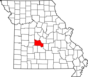
Macks Creek is an unincorporated community and census-designated place in southwest Camden County, Missouri, United States. The population was 244 at the 2010 census.[8]
Macks Creek, Missouri | |
|---|---|
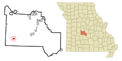
 Location of Macks Creek, Missouri | |
| Coordinates: 37°57′59″N 92°58′10″W[1] | |
| Country | United States |
| State | Missouri |
| County | Camden |
| Incorporation | 1923[2] |
| Disincorporation | September 27, 2012[3] |
| Area | |
| • Total | 1.18 sq mi (3.06 km2) |
| • Land | 1.17 sq mi (3.03 km2) |
| • Water | 0.01 sq mi (0.03 km2) |
| Elevation | 879 ft (268 m) |
| Population | |
| • Total | 244 |
| • Estimate (2012[6]) | 243 |
| • Density | 208.5/sq mi (80.5/km2) |
| Time zone | UTC-6 (Central (CST)) |
| • Summer (DST) | UTC-5 (CDT) |
| ZIP code | 65786 |
| Area code(s) | 573 |
| FIPS code | 29-45218[7] |
History
A post office called Macks Creek has been in operation since 1872.[9] The community takes its name from a nearby creek of the same name, which most likely was named after the local Mack or Hack family.[10]
For years, Macks Creek had one of the most infamous speed traps in the nation, with a strictly enforced 45-MPH speed limit along US 54, which currently has a 65-MPH speed limit on either side of town. However, in 1995, this practice ended when the state of Missouri passed a law prohibiting cities and towns from collecting more than 45% of their total revenue from speeding tickets. Macks Creek reportedly had been collecting approximately 85% of its revenue from speeding tickets. The police department later resigned as well along with the mayor.[11]
In 1997, a state audit of Macks Creek's treasury uncovered major financial woes. Shortly afterward, virtually every town official resigned from office and the city itself declared bankruptcy.[12]
In 2012, voters approved dissolving the town with 69% in favor of the motion; above the required amount of 60%.[13]
Geography
Macks Creek is located on Macks Creek and U.S. Route 54, twelve miles west of Camdenton and twelve miles east of Preston.[14]
According to the United States Census Bureau, the city has a total area of 1.18 square miles (3.06 km2), of which 1.17 square miles (3.03 km2) is land and 0.01 square miles (0.03 km2) is water.[4]
Demographics
2010 census
As of the census[5] of 2010, there were 244 people, 102 households, and 63 families living in the city. The population density was 208.5 inhabitants per square mile (80.5/km2). There were 132 housing units at an average density of 112.8 per square mile (43.6/km2). The racial makeup of the city was 97.1% White, 0.4% from other races, and 2.5% from two or more races. Hispanic or Latino of any race were 2.5% of the population.
There were 102 households, of which 30.4% had children under the age of 18 living with them, 40.2% were married couples living together, 13.7% had a female householder with no husband present, 7.8% had a male householder with no wife present, and 38.2% were non-families. 32.4% of all households were made up of individuals, and 14.7% had someone living alone who was 65 years of age or older. The average household size was 2.39 and the average family size was 3.03.
The median age in the city was 37.5 years. 24.6% of residents were under the age of 18; 8.5% were between the ages of 18 and 24; 22.9% were from 25 to 44; 27.8% were from 45 to 64; and 16% were 65 years of age or older. The gender makeup of the city was 46.7% male and 53.3% female.
2000 census
As of the census[7] of 2000, there were 267 people, 109 households, and 68 families living in the city. The population density was 285.2 people per square mile (109.7/km2). There were 129 housing units at an average density of 137.8 per square mile (53.0/km2). The racial makeup of the city was 97.38% White, and 2.62% from two or more races. Hispanic or Latino of any race were 0.37% of the population.
There were 109 households, out of which 36.7% had children under the age of 18 living with them, 52.3% were married couples living together, 9.2% had a female householder with no husband present, and 36.7% were non-families. 33.9% of all households were made up of individuals, and 22.0% had someone living alone who was 65 years of age or older. The average household size was 2.45 and the average family size was 3.17.
In the city the population was spread out, with 31.8% under the age of 18, 7.9% from 18 to 24, 29.2% from 25 to 44, 16.9% from 45 to 64, and 14.2% who were 65 years of age or older. The median age was 31 years. For every 100 females there were 84.1 males. For every 100 females age 18 and over, there were 75.0 males.
The median income for a household in the city was $21,875, and the median income for a family was $24,643. Males had a median income of $25,893 versus $13,125 for females. The per capita income for the city was $9,053. About 13.6% of families and 22.3% of the population were below the poverty line, including 20.2% of those under the age of eighteen and 24.1% of those 65 or over.
Education
Macks Creek R-V School District operates one elementary school and Macks Creek High School.[15]
Macks Creek has a public library, a branch of the Camden County Library District.[16]
References
- U.S. Geological Survey Geographic Names Information System: Macks Creek, Missouri
- "Archived copy". Archived from the original on 2017-08-18. Retrieved 2017-10-20.CS1 maint: archived copy as title (link)
- "US Gazetteer files 2010". United States Census Bureau. Archived from the original on 2012-01-25. Retrieved 2012-07-08.
- "U.S. Census website". United States Census Bureau. Retrieved 2012-07-08.
- "Population Estimates". United States Census Bureau. Archived from the original on 2013-06-02. Retrieved 2013-05-30.
- "U.S. Census website". United States Census Bureau. Retrieved 2008-01-31.
- "Voters dissolve Macks Creek after 86 years". Archived from the original on 2012-08-13.
- "Post Offices". Jim Forte Postal History. Retrieved 8 September 2016.
- "Camden County Place Names, 1928–1945 (archived)". The State Historical Society of Missouri. Archived from the original on 24 June 2016. Retrieved 8 September 2016.CS1 maint: BOT: original-url status unknown (link)
- Macks Creek rises from bankruptcy, bad reputation | KY3 | Related Content Archived 2008-02-09 at the Wayback Machine
- Frankel, Todd C. "Why Missouri's Speed Trap Law Doesn't Work." St. Louis Post-Dispatch. May 17, 2009. Archived May 21, 2009, at the Wayback Machine Retrieved 2009-9-03.
- "Macks Creek votes to dissolve". Lake News Online. 9 August 2012. Retrieved 2 February 2017.
- Missouri Atlas & Gazetteer, DeLorme, 1998, First edition, p. 44, ISBN 0-89933-224-2
- "Macks Creek R-V School District". Greatschools. Retrieved 18 March 2018.
- "Hours/Location". Camden County Library District. Retrieved 18 March 2018.

