Ménétréols-sous-Vatan
Ménétréols-sous-Vatan is a commune in the Indre department in central France.
Ménétréols-sous-Vatan | |
|---|---|
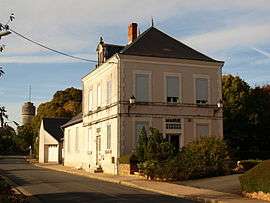
 Town hall | |
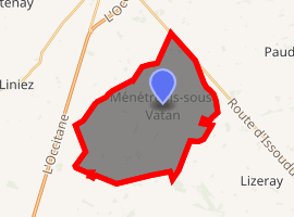
Location of Ménétréols-sous-Vatan 
| |
 Ménétréols-sous-Vatan  Ménétréols-sous-Vatan | |
| Coordinates: 47°00′58″N 1°50′39″E | |
| Country | France |
| Region | Centre-Val de Loire |
| Department | Indre |
| Arrondissement | Issoudun |
| Canton | Levroux |
| Intercommunality | Vatan |
| Government | |
| • Mayor (2008–2014) | Gérard Pion |
| Area 1 | 27.83 km2 (10.75 sq mi) |
| Population (2017-01-01)[1] | 118 |
| • Density | 4.2/km2 (11/sq mi) |
| Time zone | UTC+01:00 (CET) |
| • Summer (DST) | UTC+02:00 (CEST) |
| INSEE/Postal code | 36116 /36150 |
| Elevation | 164–221 m (538–725 ft) (avg. 211 m or 692 ft) |
| 1 French Land Register data, which excludes lakes, ponds, glaciers > 1 km2 (0.386 sq mi or 247 acres) and river estuaries. | |
Population
| Year | Pop. | ±% |
|---|---|---|
| 1793 | 263 | — |
| 1800 | 388 | +47.5% |
| 1806 | 361 | −7.0% |
| 1821 | 408 | +13.0% |
| 1831 | 384 | −5.9% |
| 1836 | 376 | −2.1% |
| 1841 | 380 | +1.1% |
| 1846 | 352 | −7.4% |
| 1851 | 350 | −0.6% |
| 1856 | 350 | +0.0% |
| 1861 | 345 | −1.4% |
| 1866 | 359 | +4.1% |
| 1872 | 352 | −1.9% |
| 1876 | 363 | +3.1% |
| 1881 | 355 | −2.2% |
| 1886 | 390 | +9.9% |
| 1891 | 372 | −4.6% |
| 1896 | 343 | −7.8% |
| 1901 | 339 | −1.2% |
| 1906 | 347 | +2.4% |
| 1911 | 362 | +4.3% |
| 1921 | 331 | −8.6% |
| 1926 | 363 | +9.7% |
| 1931 | 347 | −4.4% |
| 1936 | 355 | +2.3% |
| 1946 | 320 | −9.9% |
| 1954 | 297 | −7.2% |
| 1962 | 277 | −6.7% |
| 1968 | 236 | −14.8% |
| 1975 | 170 | −28.0% |
| 1982 | 160 | −5.9% |
| 1990 | 149 | −6.9% |
| 1999 | 124 | −16.8% |
| 2009 | 121 | −2.4% |
gollark: Wait, you have projects involvng web terminal thingies?
gollark: I was mostly looking at the API for image drawing itself.
gollark: Hmm, I feel stupider now.
gollark: https://developer.mozilla.org/en-US/docs/Web/API/CanvasRenderingContext2D/drawImage
gollark: There's a function to "blit" images onto canvases (canves?) which can also upscale them a bit, but there doesn't *seem* to be a way to make it uses pixelated upscaling instead of some weird antialiasing algorithm.
See also
References
- "Populations légales 2017". INSEE. Retrieved 6 January 2020.
| Wikimedia Commons has media related to Ménétréols-sous-Vatan. |
This article is issued from Wikipedia. The text is licensed under Creative Commons - Attribution - Sharealike. Additional terms may apply for the media files.