List of waterfalls of Canada
This is a list of waterfalls in Canada, by province.
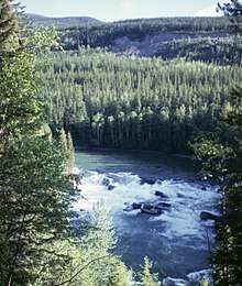
Overview
Waterfalls with the greatest drop
As of 2020, these ten waterfalls have the greatest total drop according to The Canadian Encyclopedia website.[1]
| Waterfall | Drop | Province |
|---|---|---|
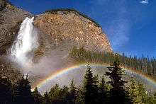
| James Bruce Falls | 840 m (2,760 ft) | British Columbia[2] |
| Della Falls | 440 m (1,440 ft) | British Columbia |
| Takakkaw Falls | 254 m (833 ft) | British Columbia |
| Hunlen Falls | 253 m (830 ft) | British Columbia |
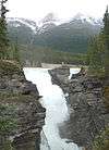
| Panther Falls | 183 m (600 ft) | Alberta |
| Helmcken Falls | 137 m (449 ft) | British Columbia |
| Bridal Veil Falls | 122 m (400 ft) | British Columbia |
| Virginia Falls (Northwest Territories) | 90 m (300 ft) | Northwest Territories |
| Montmorency Falls | 84 m (276 ft) | Quebec |
| Twin Falls | 80 m (260 ft) | British Columbia |
Waterfalls by Height and Province
Highest Waterfalls In Canada
| Image | Waterfall | Watercourse | Drop | Width | Class | Type | Reference | Coordinates |
|---|---|---|---|---|---|---|---|---|
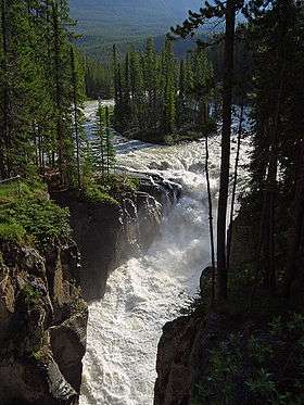
 | Athabasca Falls | Athabasca River | 24 m (79 ft) | 18 m (59 ft) | 6 | Segmented Horsetail | [3] | 52°39′51″N 117°53′01″W |
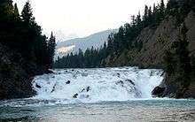 | Bow Falls | Bow River | 9 m (30 ft) | 37 m (121 ft) | 7 | Cascade | [4] | 51°9′56.59″N 115°33′35.24″W |
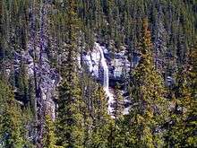
 | Bow Glacier Falls | Bow River | 120 m (390 ft) | 57 m (187 ft) | Horsetail | [5] | 51°39′11.35″N 116°29′57.18″W | |
 | Bridal Veil Falls (Banff) | An unnamed stream | 86 m (282 ft) | 5 m (16 ft) | 2 | Tiered Plunges | [6] | 52°11′0.92″N 117°3′6.55″W |
 | Crescent Falls | Bighorn River | Tiered | [7] | 52°23′14″N 116°21′15″W | |||
 | Crypt Falls | Hellroaring Creek | 175 m (574 ft) | 15 m (49 ft) | Horsetail | [8] | 49°0′18.04″N 113°50′34.52″W | |
 | Elbow Falls | Elbow River | Cascade | [9] | 50°51′31″N 114°47′32″W | |||
| Fossil Falls | Foch Creek | 150 m (490 ft) | 23 m (75 ft) | 5 | Tiered Horsetails | [10] | 50°35′28.06″N 115°11′55.8″W | |
| Geraldine Falls | Geraldine Creek | 152 m (499 ft) | 15 m (49 ft) | 4 | Tiered Horsetails | [11] | 52°36′1.13″N 117°56′20.27″W | |
| Kerkeslin Falls | An unnamed stream | Tiered Horsetails | [12] | disputed[nb 1] | ||||
| Kitchener Creek Falls | Kitchener Creek | 122 m (400 ft) | 122 m (400 ft) | 5 m (16 ft) | 3 | [14] | 52°15′31.3″N 117°18′10.79″W | |
| Lineham Falls | Lineham Creek | 125 m (410 ft) | [15] | 49°4′40.23″N 114°3′20.65″W | ||||
| Murchison Falls | An unnamed stream | 180 m (590 ft) | 30 m (98 ft) | Segmented Plunges | [16] | 51°55′9.45″N 116°41′15.27″W | ||
 | Panther Falls | Nigel Creek | 66 m (217 ft) | 12 m (39 ft) | 3 | Plunge | [17] | 52°10′53.61″N 117°3′29.36″W |
| Sideways Falls (Big Bend Falls) | An unnamed stream | 106 m (348 ft) | 15 m (49 ft) | 5 | Tiered Horsetails | [18] | 52°9′46.17″N 117°4′0.84″W | |
 | Siffleur Falls | Siffleur River | [19] | 52°1′13.5″N 116°21′58.4″W | ||||
 | Sunwapta Falls, Lower Sunwapta Falls | Sunwapta River | 17 m (56 ft), 26 m (85 ft) | 8 m (26 ft), 8 m (26 ft) | 5, 6 | Tiered Horsetails, Tiered Plunges | [20], [21] | 52°31′56.53″N 117°38′41.98″W |
| Maligne Canyon Falls | Maligne Canyon | [22] | ||||||
| O'Shaughnessy Falls | [22] | |||||||
| Snake Indian Falls | Snake Indian River | [22] | ||||||
| Tangle Falls | [22] |
British Columbia
| Image | Waterfall | Watercourse | Drop | Width | Class | Type | Reference | Coordinates |
|---|---|---|---|---|---|---|---|---|
 | Alexander Falls | Madeley Creek | 141 m (463 ft) | 40 m (130 ft) | 4 | Tiered | [23] | 52°08′N 123°08′W |
| Alfred Creek Falls | Alfred Creek | 700 m (2,300 ft) | 3 | Cascade | [24] | |||
| Angel's Staircase Falls | An unnamed stream | 100 m (330 ft) | 20 m (66 ft) | 3 | Cascade | [25] | 51°31′N 116°30′W | |
| Arctomys Falls | Arctomys Creek | [26] | 53°03′57″N 118°53′50″W | |||||
 | Ashlu Falls | Ashlu Creek | 10 m (33 ft) | 33 m (108 ft) | 3 | Tiered | [27] | 49°56′01″N 123°21′31″W |
| Basalt Falls | Dean River | 3.7 m (12 ft) | [28] | 52°48′N 125°33′W | ||||
| Blaeberry Falls (Thompson Falls) | Lower Blaeberry River | [29] | 51°31′N 116°57′W | |||||
 | Brandywine Falls | Brandywine Creek | 70 m (230 ft) | plunge | [30] | 50°02′07″N 123°07′07″W | ||
 | Bridal Veil Falls | Bridal Creek | 122 m (400 ft) | 23 m (75 ft) | [31][32] | 49°11′N 121°44′W | ||
 | Canim Falls | Canim River | 18 m (59 ft) | [33] | 51°52′00″N 120°35′35″W | |||
 | Chatterbox Falls | Loquilts Creek | 37 m (121 ft) | Fan | [34] | 50°12′20.00″N 123°46′14.00″W | ||
| Cliff Lake Falls | Van Creek | 215 m (705 ft) | 23 m (75 ft) | Horsetail | [35] | |||
| Crooked Falls | Sigurd Creek | 198 m (650 ft) | 15 m (49 ft) | Tiered | [36] | |||
 | Dawson Falls | Murtle River | 15.2 m (50 ft) | 91.4 m (300 ft) | [37] | 51°58′N 120°07′W | ||
 | Della Falls | Drinkwater Creek | 440 m (1,440 ft) | 37 m (121 ft) | Segmented, Tiered | [38][39] | 49°27′16″N 125°32′03″W | |
| Deserted River Falls | Deserted River | 670 m (2,200 ft) | [40] | |||||
| Fairy Creek Falls | Fairy Creek | 305 m (1,001 ft) | 3 | Tiered | [41] | |||
| Flood Falls | Fairy Creek | 380 m (1,250 ft) | 8 m (26 ft) | Tiered | [42] | |||
 | Englishman River Falls | Englishman River | [43] | 49°14′51″N 124°21′7″W | ||||
| Francis Falls | Fairy Creek | 650 m (2,130 ft) | Horsetail | [44] | ||||
| Gold Creek Falls | Gold Creek | 610 m (2,000 ft) | Horsetail | [45] | ||||
| Helmet Falls | Helmet Creek | 352 m (1,155 ft) | 30 m (98 ft) | 4 | Tiered | [46] | ||
| Harmony Falls Freil Lake Falls Friel Falls | Friel Creek | 444 m (1,457 ft) | 38 m (125 ft) | 4 | Tiered | [47] | ||
| High Falls | High Falls Creek | 91 m (299 ft) | [48] | |||||
| High Falls | High Falls Creek | 91 m (299 ft) | 26 m (85 ft) | [49] | ||||
 | Hunlen Falls | Hunlen Creek | 374 m (1,227 ft) | 26 m (85 ft) | 4 | Plunge | [50] | |
| Icecap Falls | 457 m (1,499 ft) | 4 | Segmented | [51] | ||||
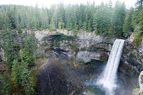
 | Helmcken Falls | Murtle River | 141 m (463 ft) | 23 m (75 ft) | 7 | Plunge | [52] | 52.38693°N 116.35427°W |
 | Keyhole Falls | Lillooet River | 23 m (75 ft) | Punchbowl | [53] | 52.38693°N 116.35427°W | ||
| Kingcome Valley Falls | 520 m (1,710 ft) | 9 m (30 ft) | 3 | Horsetail | [54] | |||
| Kinueso Falls | Murray River | 60m
197ft |
||||||
 | Nairn Falls | Green River | 40 m (130 ft) | 9.1 m (30 ft) | Tiered | [55] | ||
 | Nymph Falls | Puntledge River | 15 m (49 ft) | 46 m (151 ft) | 6 | Cascade | [56] | 49°40′14″N 125°4′38″W |
 | Overlander Falls | Fraser River | 9.1 m (30 ft) | 30 m (98 ft) | 4 | Block | [57][58] | 53°02′N 119°12′W |
 | Upper Little Qualicum Falls | Little Qualicum River | [59] | 49.316667°N 124.55°W | ||||
 | Rearguard Falls | Fraser River | 6 m (20 ft) | [60] | 52°58′25″N 119°21′45″W | |||
 | Shannon Falls | Shannon Creek | 337 m (1,106 ft) | 3 | Horsetail | [61] | 49°40′10″N 123°09′21″W | |
 | Spahats Creek Falls | Spahats Creek | 73 m (240 ft) | 7.5 m (25 ft) | Plunge | [62][63] | 51.733333°N 120.016667°W | |
 | Takakkaw Falls | 384 m (1,260 ft) | 30 m (98 ft) | 5 | Horsetail | [64] | 51°29′59″N 116°28′22″W | |
 | Wapta Falls | Kicking Horse River | 30 m (98 ft) | 91 m (299 ft) | 6 | Block | [65] | 51.187°N 116.576°W |
| Hunlen Falls | Atnarko River | 70 m (230 ft) | [38] | |||||
| Twin Falls | 80 m (260 ft) | [38] | ||||||
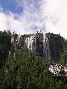
 | James Bruce Falls | Loquilts Creek | 840 m (2,760 ft) | 3 | Horsetail | [66] | ||
| Alfred Creek Falls | Alfred Creek | 700 m (2,300 ft) | 30 m (98 ft) | 3 | Horsetail | [67] | ||
| Bergeron Falls | 99 m (325 ft) | 9 m (30 ft) | Horsetail | [68] | ||||
| Cascade Falls | Cascade Creek | 300 m (980 ft) | 3 m (9.8 ft) | 3 | Horsetail | [68] | ||
| Cummins Falls | Cummins River | 63 m (207 ft) | 15 m (49 ft) | Tiered | [69] | |||
| Kiwi Falls | Nisnak Creek | 480 m (1,570 ft) | [70] | |||||
| Michael Falls | 380 m (1,250 ft) | 12 m (39 ft) | 5 | Tiered | [71] | |||
| Middle Cummins Falls | Cummins River | 220 m (720 ft) | 12 m (39 ft) | Horsetail | [72] | |||
| Moresby Falls | 420 m (1,380 ft) | 12 m (39 ft) | Tiered | [73] | ||||
| Odegaard Falls | Nusatsum River | 280 m (920 ft) | 12 m (39 ft) | 6 | Horsetail | [74] | ||
| Petain Creek Falls Petain Falls | Petain Creek | 375 m (1,230 ft) | tiered | [75] | ||||
| Peach Creek Falls | Peach Creek | 183 m (600 ft) | tiered | [76] | ||||
| Place Creek Falls | Place Creek | 419 m (1,375 ft) | 14 m (46 ft) | 4 | tiered | [77] | ||
 | Pyramid Falls | Pyramid Creek | 91 m (299 ft) | tiered | [78] | |||
| Silvertip Falls | Coursier Creek | 198 m (650 ft) | Tiered | [79] | ||||
| Snowshoe Creek Falls | Snowshoe Creek | 240 m (790 ft) | Horsetail | [80] | ||||
| Swiftcurrent Falls | Swiftcurrent Creek | 520 m (1,710 ft) | [80] | |||||
| Thunder Falls Rockingham Falls Rainbow Falls | 183 m (600 ft) | Cascade | [81] | |||||
| Twin Falls | 183 m (600 ft) | Segmented | [82] | |||||
| Wapta Falls | Kicking Horse River | 30 m (98 ft) | 152 m (499 ft) | 7 | Block | [83] | ||
| Wapta Falls | Kicking Horse River | 30 m (98 ft) | 91 m (299 ft) | 6 | Block | [65] | 51.187°N 116.576°W |
| Wedgemount Creek Falls | Wedgemount Creek | 300 m (980 ft) | 5 | [84] | Lunbreck falls | |||
| Whispering Falls | Landsborough Creek | 152 m (499 ft) | 15 m (49 ft) | Tiered | [85] |
Manitoba
| Image | Waterfall | Watercourse | Drop | Width | Class | Type | Reference | Coordinates |
|---|---|---|---|---|---|---|---|---|
| Muhigan Falls | Muhigan River | 19 m (62 ft) | [38] | |||||
 | Pisew Falls | [86] | 55°11′50″N 98°23′51″W | |||||
| Taskinigup Falls | Burntwood River | 15 m (49 ft) | [38] | |||||
New Brunswick
| Image | Waterfall | Watercourse | Drop | Width | Class | Type | Reference | Coordinates |
|---|---|---|---|---|---|---|---|---|
| "Grand Falls, Nepisiguit River, before 1874" | Nepisiguit Grand Falls | Nepisiguit River | 75 m (246 ft) | segmented Block | 53°36′00″N 64°18′57″W | |||
Newfoundland & Labrador
| Image | Waterfall | Watercourse | Drop | Width | Class | Type | Reference | Coordinates |
|---|---|---|---|---|---|---|---|---|
 | Churchill Falls | Churchill River | 75 m (246 ft) | segmented Block | [87][88] | 53°36′00″N 64°18′57″W | ||
| Muskrat Falls | Churchill River | 15 m (49 ft) | 53°14′44″N 60°46′17″W | |||||
 | Pissing Mare Falls | Burnt Woods Brook | 350 m (1,150 ft) | Plunge, Cascade | [89][90][91] | |||
| Twin Falls | Unknown River | 53 m (174 ft) | [92] | |||||
| Grand Falls | Exploits River | 43 m (141 ft) | [38] | |||||
| Grand Falls | Hamilton River | 92 m (302 ft) | 46 m (151 ft) | 1 | Slide, Plunge | [93] | ||
| Thomas Falls | Unknown River | 31 m (102 ft) | [38] | |||||
| Scott Falls | Unknown River | 27 m (89 ft) | [38] | |||||
| Aviron Bay Falls | 213 m (699 ft) | 12 m (39 ft) | 3 | Tiered | [94] | |||
 | Rattling Brook Falls | Rattling Brook | 140 m (460 ft) | 4 | tiered | [95] | ||
| Sandy Pond Falls | 220 m (720 ft) | 4 | Plunge, Cascades | [96] | ||||
| Grand Falls | Exploits River | 43 m (141 ft) | [38] | |||||
| Grand Falls | Hamilton River | 92 m (302 ft) | 46 m (151 ft) | 1 | Slide, Plunge | [93] | ||
| Scott Falls | Unknown River | 27 m (89 ft) | [38] | |||||
| Thomas Falls | Unknown River | 31 m (102 ft) | [38] |
Northwest Territories
| Image | Waterfall | Watercourse | Drop | Width | Class | Type | Reference | Coordinates |
|---|---|---|---|---|---|---|---|---|
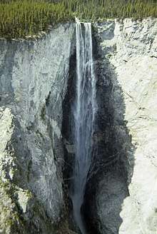
 | Virginia Falls | South Nahanni River | 96 m (315 ft) | 259 m (850 ft) | Segmented | [97] | 50°02′07″N 123°07′07″W | |
| Parry Falls | Lockhart River | 40 m (130 ft) | [38] | |||||
 | Alexandra Falls | Hay River | 32 m (105 ft) | 117 m (384 ft) | [98] | 60°30′02″N 116°16′48″W | ||
| Marengo Falls | Marengo Creek | 30 m (98 ft) | [38] | |||||
| Tyrrell Falls | Lockhart River | 26 m (85 ft) | [38] | |||||
| Louise Falls | Hay River | 20 m (66 ft) | [38] | |||||
| Lady Evelyn Falls | Kakisa River | 17 m (56 ft) | [38] |
Nova Scotia
Ontario
| Image | Waterfall | Watercourse | Drop | Width | Class | Type | Reference | Coordinates |
|---|---|---|---|---|---|---|---|---|
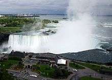 | Niagara Falls | Niagara River | 53 m (174 ft) | 671 m (2,201 ft) | Segmented Block | [99][100] | 43.077305°N 79.07562°W | |
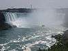 | Horseshoe Falls | Niagara River | 52 m (171 ft) | Segmented Block | [99] | 43.080°N 79.071°W | ||
| Big Beaver Falls | Kapuskasing River | 18 m (59 ft) | [38] | |||||
 | Bridal Veil Falls | Kagawong River | 11 m (36 ft) | Plunge | [101] | 45.90048°N 82.25651°W | ||
| Bridal Veil Falls | Agawa River | 69 m (226 ft) | [102] | |||||
 | Chats Falls | Ottawa River | 16 m (52 ft) | 45°28′35″N 76°14′55″W | ||||
 | Chaudière Falls | Ottawa River | 15 m (49 ft) | 60 m (200 ft) | [103][104] | 45°25′14″N 75°43′20″W | ||
 |
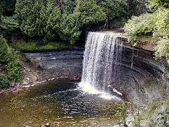
Fenelon Falls, Ontario | Trent-Severn Waterway | 15 m (49 ft) | 7 m (23 ft) 30 m (98 ft) | Plunge | [105] | ||
 | Fourth Falls | Larder River | [106] | 47.885°N 79.7772222°W | ||||
| Helen Falls | Lady Evelyn River | 25 m (82 ft) | Cascade | [107][108] | 47°17′31″N 80°20′02″W | |||
 | Hog's Back Falls | Rideau River | 18 m (59 ft) | artificially created | [109] | 45.371021°N 75.697024°W | ||
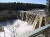
 | Inglis Falls | Sydenham River | 18 m (59 ft) | cascade | [110] | 44.525701°N 80.93482°W | ||
 | Kakabeka Falls | Kaministiquia River | 40 m (130 ft) | Plunge | [111] | 48.4029°N 89.6256°W | ||
 | Onaping Falls | Onaping River | Cascade | |||||
 | Rideau Falls | Rideau River | [112] | 45.441405°N 75.69623°W | ||||
| Rideau Chutes | Rideau River | [113] | 47°27′N 75°42′W | |||||
 | Albion Falls | Red Hill Creek | 19 m (62 ft) | 18 m (59 ft) | classical/cascade | [114] | 43.200472°N 79.819676°W | |
| Ancaster Heights Falls | Tiffany tributary | 13.4 m (44 ft) | 1.8 m (5.9 ft) | high terraced ribbon cascade | [114] | |||
| Betzner Falls | Spring tributary | 6.3 m (21 ft) | 9 m (30 ft) | Twin Classic Cascade | [115] | |||
| Billy Green Falls | Battlefield Creek | 17 m (56 ft) | 6 m (20 ft) | Ribbon | [114] | 43.207160°N 79.766355°W | ||
 | Borer's Falls | Borer's Creek | 15 m (49 ft) | high ribbon-style | [116] | 43°16′52.33″N 79°55′51.71″W | ||
| Dog Falls | Kaministiquia River | 47 m (154 ft) | [38] | |||||
| Wawaitin Falls | Mattagami River | 38 m (125 ft) | [38] | |||||
| White's Falls | 3 Mile Lake | 38 m (125 ft) | [38] | |||||
| Aubrey Falls | Mississagi River | 33 m (108 ft) | [38] | |||||
| Pigeon Falls | Pigeon River | 27 m (89 ft) | [38] | |||||
| High Falls | Onaping River | 24 m (79 ft) | [38] | |||||
| Schist Falls | Pukaskwa River | 24 m (79 ft) | [38] | |||||
| Smoky Falls | Mattagami River | 24 m (79 ft) | [38] | |||||
| Christopher Falls | Opasatika River | 23 m (75 ft) | [38] | |||||
| Partridge Falls | Pigeon River | 21 m (69 ft) | [38] | |||||
| Steephill Falls | Magpie River | 21 m (69 ft) | [38] | |||||
| Boundary Falls | Grindstone Tributaries | 6 m (20 ft) | 2 m (6.6 ft) | high ribbon-style | [117] | |||
| Webster's Falls | Spencer Creek | 22 m (72 ft) | 30 m (98 ft) | Curtain/Plunge | [118] | 43.276241°N 79.980898°W |
Quebec
| Image | Waterfall | Watercourse | Drop | Width | Class | Type | Reference | Coordinates |
|---|---|---|---|---|---|---|---|---|
| Chats Falls | Ottawa River | 16 m (52 ft) | 45°28′35″N 76°14′55″W | ||||
| Chaudière Falls | Ottawa River | 15 m (49 ft) | 60 m (200 ft) | [103][104] | 45°25′14″N 75°43′20″W | ||
 | Chutes de la Chaudière | Chaudière River | 35 m (115 ft) | Cataract | [119] | 46°42′47″N 71°17′10″W | ||
| Chutes de la Chaudière | [120] | 48°59′N 73°04′W | ||||||
| Chute Kabir Kouba | Saint-Charles River | 28 m (92 ft) | cascade/plunge | [121][122] | 46°51′19″N 71°21′20″W | |||
 | Montmorency Falls | Montmorency River | 84 m (276 ft) | [123] | 46°53′27″N 71°8′51″W | |||
 | St. Anne Falls | 70 m (230 ft) | [124] | 46°53′27″N 71°8′51″W | ||||
| Chute Ouiatchouan | 79 m (259 ft) | [38] | ||||||
| Chute de Shawinigan | Rivière Saint-Maurice | 46 m (151 ft) | [38] | |||||
| Chute du Calcaire | Rivière Caniapiscau | 22 m (72 ft) | [38] | |||||
| Chute au Granite | Rivière Caniapiscau | 21 m (69 ft) | [38] | |||||
| Chutes aux Schistes | Rivière Caniapiscau | 18 m (59 ft) | [38] | |||||
| Les Sept Chutes Cascades de Saint Ferreol | Rivière Sainte-Anne-du-Nord | 130 m (430 ft) | Tiered | [125] | ||||
| Chutes Kempt/Normand Falls | Rivière Kempt | [126] | 48°1′41.80″N 66°47′16.31″W | |||||
Saskatchewan
| Image | Waterfall | Watercourse | Drop | Width | Class | Type | Reference | Coordinates |
|---|---|---|---|---|---|---|---|---|
 | Nistowiak Falls | Rapid River | 10 m (33 ft) | segmented | [127] | 55°23′46″N 104°21′59″W | ||
| Spruce Falls | Swan River | [128] | 55°37′N 102°27′W | |||||
| Elizabeth Falls | Fond du Lac River | 34 m (112 ft) | [38] |
gollark: If they run that whole cycle fast enough it'll average out as a reasonable situation!
gollark: Outside of high-level stuff (GCSE *maybe*, probably A-level) I think it's *mostly* irrelevant if you take a few weeks off.
gollark: I mean, you can socialize at school, which is important, but you can do that anyway.
gollark: It annoys me that the government goes on about how amazingly important it is and how it would be unethical to make people not go to school for a bit.
gollark: Probably people with compromised immune systems or something should avoid school.
See also
Notes
References
- Campbell, P. I.; Reid, I. A. "Waterfall". The Canadian Encyclopedia. Retrieved 2020-03-15.
- https://www.worldwaterfalldatabase.com/tallest-waterfalls/total-height
- "Athabasca Falls, Alberta, Canada". World Waterfall Database. Retrieved 2017-06-17.
- "Bow Falls, Alberta, Canada". World Waterfall Database. Retrieved 2017-06-17.
- "Bow Glacier Falls, Alberta, Canada". World Waterfall Database. Retrieved 2017-06-17.
- "Bridal Veil Falls, Alberta, Canada". World Waterfall Database. Retrieved 2017-06-17.
- "Upper Crescent Falls, Alberta, Canada". World Waterfall Database. Retrieved 2017-06-17.
- "Crypt Falls, Alberta, Canada". World Waterfall Database. Retrieved 2017-06-17.
- "Elbow Falls, Alberta, Canada". World Waterfall Database. Retrieved 2017-06-17.
- "Fossil Falls, Alberta, Canada". World Waterfall Database. Retrieved 2017-06-18.
- "Geraldine Falls, Alberta, Canada". World Waterfall Database. Retrieved 2017-06-18.
- "Kerkeslin Falls, Alberta, Canada". World Waterfall Database. Retrieved 2017-06-18.
- "Kerkeslin Falls, II, WI 3 : Climbing, Hiking & Mountaineering". www.summitpost.org. Retrieved 2017-06-18.
- "Kitchener Creek Falls, Alberta, Canada". World Waterfall Database. Retrieved 2017-06-18.
- "Lineham Falls, Alberta, Canada". World Waterfall Database. Retrieved 2017-06-18.
- "Murchison Falls, Alberta, Canada". World Waterfall Database. Retrieved 2017-06-18.
- "Panther Falls, Alberta, Canada". World Waterfall Database. Retrieved 2017-06-17.
- "Sideways Falls, Alberta, Canada". World Waterfall Database. Retrieved 2017-06-18.
- "Siffleur Falls, Alberta, Canada". World Waterfall Database. Retrieved 2017-06-17.
- "Sunwapta Falls, Alberta, Canada". World Waterfall Database. Retrieved 2017-06-17.
- "Lower Sunwapta Falls, Alberta, Canada". World Waterfall Database. Retrieved 2017-06-17.
- "Waterfalls Alberta". Mat Quigley. Retrieved 2013-02-06.
- Waterfalls of the Pacific Northwest: Alexander Falls
- Waterfalls of the Pacific Northwest: Alfred Creek Falls
- Waterfalls of the Pacific Northwest: Angel’s Staircase Falls
- Waterfalls of the Pacific Northwest: Arctomys Falls
- Waterfalls of the Pacific Northwest: Ashlu Falls
- "Basalt Falls Natural Resources Canada ULKATCHO Quad, British Columbia, Topographic Map". TopoZone. Demand Media, Inc. Archived from the original on 2012-10-13. Retrieved 2008-11-07.
- "BCGNIS Geographical Name Details—BCGNIS Query Results". Geographic Data BC. 1999–2008. Retrieved 2008-11-07.
- "Brandywine Falls BC". World Waterfalls. Bryan Swan & Dean Goss. 1985–2008. Retrieved 2008-11-07.
- Turnbull, Leon. "Waterfalls of British Columbia—Bridal Veil Falls; Bridal Falls ..." Retrieved 2008-11-07.
- "Bridal Veil Falls BC – British Columbia – Canada". World Waterfalls. Bryan Swan & Dean Goss. 1985–2008. Retrieved 2008-11-07.
- "Canim Falls". Waterfalls of the Pacific Northwest. Retrieved 2008-11-07.
- Swan, Bryan (2005). "Chatterbox Falls". Waterfalls of the Pacific Northwest. Retrieved 2008-11-07.
- "Cliff Lake Falls – British Columbia – Canada". World Waterfalls. Bryan Swan & Dean Goss. 1985–2008. Retrieved 2008-11-07.
- "Crooked Falls – British Columbia – Canada". World Waterfalls. Bryan Swan & Dean Goss. 1985–2008. Retrieved 2008-11-07.
- "BCGNIS Query Results—BCGNIS Geographical Name Details". 2005. Retrieved 2008-11-07.
- "The Atlas of Canada - Waterfalls". Natural Resources Canada. Government of Canada. 2007-10-19. Archived from the original on 2008-10-24. Retrieved 2008-11-07.
- "Della Falls". World Waterfalls. Bryan Swan & Dean Goss. 1985–2008. Retrieved 2008-11-07.
- "Deserted River Falls – British Columbia – Canada". World Waterfalls. Bryan Swan & Dean Goss. 1985–2008. Retrieved 2008-11-07.Maybe the tallest in North America
- "Fairy Creek Falls – British Columbia – Canada". World Waterfalls. Bryan Swan & Dean Goss. 1985–2008. Retrieved 2008-11-07.
- "Flood Falls – British Columbia – Canada". World Waterfalls. Bryan Swan & Dean Goss. 1985–2008. Retrieved 2008-11-07.
- "Englishman River Falls". World Waterfalls. Bryan Swan & Dean Goss. 1985–2008. Retrieved 2008-11-07.
- "Francis Falls – British Columbia – Canada". World Waterfalls. Bryan Swan & Dean Goss. 1985–2008. Retrieved 2008-11-07.Largest waterfall of British Columbia's Headwall Canyon valley
- "Gold Creek Falls – British Columbia – Canada". World Waterfalls. Bryan Swan & Dean Goss. 1985–2008. Retrieved 2008-11-07.
- "Helmet Falls – British Columbia – Canada". World Waterfalls. Bryan Swan & Dean Goss. 1985–2008. Retrieved 2008-11-07.
- "Harmony Falls – British Columbia – Canada". World Waterfalls. Bryan Swan & Dean Goss. 1985–2008. Retrieved 2008-11-07.
- "Harmony Falls – British Columbia – Canada". World Waterfalls. Bryan Swan & Dean Goss. 1985–2008. Retrieved 2008-11-07.
- "High Falls – British Columbia – Canada". World Waterfalls. Bryan Swan & Dean Goss. 1985–2008. Retrieved 2008-11-07.
- "Hunlen Falls – British Columbia – Canada". World Waterfalls. Bryan Swan & Dean Goss. 1985–2008. Retrieved 2008-11-07.
- "Icecap Falls – British Columbia – Canada". World Waterfalls. Bryan Swan & Dean Goss. 1985–2008. Retrieved 2008-11-07.
- "Helmcken Falls". World Waterfalls. Bryan Swan & Dean Goss. 1985–2008. Retrieved 2008-11-07.
- Swan, Bryan (2005). "Keyhole Falls". Waterfalls of the Pacific Northwest. Retrieved 2007-11-08.
- "Kingcome Valley Falls – British Columbia – Canada". World Waterfalls. Bryan Swan & Dean Goss. 1985–2008. Retrieved 2008-11-07.
- Swan, Bryan (2005). "Nairn Falls". Waterfalls of the Pacific Northwest. Retrieved 2007-11-08.
- Swan, Bryan (2005). "Nymph Falls". Waterfalls of the Pacific Northwest. Retrieved 2007-11-08.
- Swan, Bryan (2005). "Overlander Falls". Waterfalls of the Pacific Northwest. Retrieved 2007-11-08.
- "GeoNames Query—Overlander Falls: Query Record Details". Natural Resources Canada. Government of Canada. 2008-11-09. Archived from the original on 2011-06-08. Retrieved 2008-11-09.
- "Upper Little Qualicum Falls". World Waterfalls. Bryan Swan & Dean Goss. 1985–2008. Retrieved 2008-11-07.
- "Rearguard Falls". World Waterfalls. Bryan Swan & Dean Goss. 2004. Retrieved 2008-11-07.
- "Shannon falls". World Waterfalls. Bryan Swan & Dean Goss. 2004. Archived from the original on 2004-06-27. Retrieved 2008-11-07.Shannon Falls is the third highest waterfall in British Columbia
- "Spahats Creek Falls". World Waterfalls. Bryan Swan & Dean Goss. 2004. Retrieved 2008-11-07.
- "Spahats Creek Falls". Waterfalls of the Pacific Northwest.
- "Takakkaw Falls". Waterfalls of the Pacific Northwest. Retrieved 2007-06-27.
- "Wapta Falls". Waterfalls of the Pacific Northwest. Retrieved 2008-11-08.
- "James Bruce Falls". World Waterfalls. Bryan Swan & Dean Goss. 2004. Archived from the original on 2010-12-01. Retrieved 2008-11-07.19th tallest waterfall in the World
- "James Bruce Falls". World Waterfalls. Bryan Swan & Dean Goss. 2004. Archived from the original on 2017-10-10. Retrieved 2008-11-07.29th tallest waterfall in the World
- "British Columbia – Canada". World Waterfalls. Bryan Swan & Dean Goss. 1985–2008. Retrieved 2008-11-07.
- "Cummins Falls – British Columbia – Canada". World Waterfalls. Bryan Swan & Dean Goss. 1985–2008. Retrieved 2008-11-07.
- "Kiwi Falls – British Columbia – Canada". World Waterfalls. Bryan Swan & Dean Goss. 1985–2008. Retrieved 2008-11-07.
- "Michael Falls – British Columbia – Canada". World Waterfalls. Bryan Swan & Dean Goss. 1985–2008. Retrieved 2008-11-07.
- "Middle Cummins Falls – British Columbia – Canada". World Waterfalls. Bryan Swan & Dean Goss. 1985–2008. Retrieved 2008-11-07.
- "Moresby Falls – British Columbia – Canada". World Waterfalls. Bryan Swan & Dean Goss. 1985–2008. Retrieved 2008-11-07.
- "Odegaard Falls – British Columbia – Canada". World Waterfalls. Bryan Swan & Dean Goss. 1985–2008. Retrieved 2008-11-07.
- "Petain Creek Falls". World Waterfalls. Bryan Swan & Dean Goss. 1985–2008. Retrieved 2008-11-07.
- "Peach Creek Falls – British Columbia – Canada". World Waterfalls. Bryan Swan & Dean Goss. 1985–2008. Retrieved 2008-11-07.
- "Place Creek Falls – British Columbia – Canada". World Waterfalls. Bryan Swan & Dean Goss. 1985–2008. Retrieved 2008-11-07.
- "Pyramid Falls – British Columbia – Canada". World Waterfalls. Bryan Swan & Dean Goss. 1985–2008. Retrieved 2008-11-07.
- "Silvertip Falls". World Waterfalls. Bryan Swan & Dean Goss. 2004. Retrieved 2008-11-07.
- "Snowshoe Creek Falls". World Waterfalls. Bryan Swan & Dean Goss. 2004. Retrieved 2008-11-07.
- "Thunder Falls". World Waterfalls. Bryan Swan & Dean Goss. 2004. Retrieved 2008-11-07.
- "Twin Falls". World Waterfalls. Bryan Swan & Dean Goss. 2004. Retrieved 2008-11-07.
- "Wapta Falls". World Waterfalls. Bryan Swan & Dean Goss. 2004. Retrieved 2008-11-07.
- "Wedgemount Creek Falls". World Waterfalls. Bryan Swan & Dean Goss. 2004. Retrieved 2008-11-07.
- "Whispering Falls". World Waterfalls. Bryan Swan & Dean Goss. 2004. Retrieved 2008-11-07.
- "GeoNames Query - Pisew Falls : Query Record Details". Natural Resources Canada. Government of Canada. 2008-11-09. Archived from the original on 2011-06-08. Retrieved 2008-11-09.
- "Churchill Falls - History". Reprinted Courtesy of Churchill Falls (Labrador) Corporation Compiled by Peter Green - IEEE. Retrieved 2008-11-09.
- "Query Record Details: Churchill Falls". Natural Resources Canada. Government of Canada. Archived from the original on 2011-08-17. Retrieved 2008-11-09.
- Encyclopedia of Newfoundland and Labrador, ISBN 0-9693422-1-7.
- "Newfoundland Gros Morne National Park". 2008-11-09. Archived from the original on 2008-12-07. Retrieved 2008-11-09.Photo of the Pissing Mare Falls
- "Pissing Mare Falls – British Columbia – Canada". World Waterfalls. Bryan Swan & Dean Goss. 1985–2008. Retrieved 2008-11-07.
- "Twin Falls NL - Satellite photo". Google Maps. Retrieved 2008-11-09.
- "Niagara Falls". World Waterfalls. Bryan Swan & Dean Goss. 1985–2008. Archived from the original on 2008-12-18. Retrieved 2008-11-07.Rated as 15th tallest waterfall in the world
- "British Columbia – Canada". World Waterfalls. Bryan Swan & Dean Goss. 1985–2008. Retrieved 2008-11-07.
- "Rattling Brook Falls – Newfoundland – Canada". World Waterfalls. Bryan Swan & Dean Goss. 1985–2008. Retrieved 2008-11-07.
- "Sandy Pond Falls – Newfoundland – Canada". World Waterfalls. Bryan Swan & Dean Goss. 1985–2008. Retrieved 2008-11-07.
- "Virginia Falls". World Waterfalls. Bryan Swan & Dean Goss. 1985–2008. Archived from the original on 2008-12-23. Retrieved 2008-11-07.Rated as 14th largest in the world
- "Alexandra Falls – Northwest Territories, Canada". World Waterfall Database. Retrieved 2020-03-17.
- "City Profile for Niagara Falls, Ontario". Retrieved 2008-10-06.
- "Niagara Falls". World Waterfalls. Bryan Swan & Dean Goss. 1985–2008. Archived from the original on 2008-12-18. Retrieved 2008-11-07.Rated as 10th largest in the world
- Harris, Mark (September 2, 2003). "Waterfalls of Ontario—Bridal Veil Falls (Kagawong)". Waterfalls of Ontario.ca/. Archived from the original on 2009-03-10. Retrieved 2008-11-07.
- "Bridal Veil Falls". Great Lakes Waterfalls and Beyond. 25 Mar 2008. Retrieved 2008-11-07.
- Harris, Mark (September 2, 2003). "Waterfalls of Ontario—Ottawa Valley Index". Archived from the original on 2008-07-23. Retrieved 2008-11-07.
- Corbet, Ron (July 30, 2005). "Chaudiere Falls at the heart of Ottawa's history". The Ottawa Citizen. Canwest Digital Media, Canwest Publishing Inc. Archived from the original on 2012-11-05. Retrieved 2008-11-07.
- Harris, Mark (September 2, 2003). "Waterfalls of Ontario—Fenelon Falls". Archived from the original on 2009-03-22. Retrieved 2008-11-07.
- "Fourth Falls". Natural Resources Canada. October 6, 2016.
- Harris, Mark (September 2, 2003). "Waterfalls of Ontario—Northeast Waterfall Region". Archived from the original on 2009-03-10. Retrieved 2008-11-07.
- "GeoNames Query—Helen Falls : Query Record Details". Natural Resources Canada. Government of Canada. 2008-11-09. Archived from the original on 2011-06-08. Retrieved 2008-11-09.
- "Nomination of the Rideau Canal for Inscription in the World Heritage List". Parks Canada. Government of Canada. 2008-11-09. Archived from the original on 2013-01-01. Retrieved 2008-11-09.Also called Hogs Back Falls
- "Inglis Falls". day trips canada. 4 June 2008. Retrieved 2008-11-09.
- "Waterfalls of Ontario—Kakabeka Falls". Archived from the original on 2007-07-04. Retrieved 2007-09-21.
- "GeoNames Query—Rideau Falls : Query Record Details". Natural Resources Canada. Government of Canada. 2008-11-09. Archived from the original on 2011-06-08. Retrieved 2008-11-09.
- "GeoNames Query—Rideau Chutes] : Query Record Details". Natural Resources Canada. Government of Canada. 2008-11-09. Archived from the original on 2011-06-08. Retrieved 2008-11-09.
- "Hamilton- Waterfall Capital of the World". (www.cityofwaterfalls.ca). Retrieved 2008-07-09.
- "Hamilton Naturalist's Club: Protecting Nature since 1919". (www.hamiltonnature.org/). Retrieved 2008-08-06.
- "Borer's Falls Ontario, Canada". EXPLORE Magazine. Archived from the original on 2008-10-12. Retrieved 2008-07-25.
- "Hamilton Waterfalls: Boundary Falls". (www.hamiltonnature.org). Archived from the original on 2008-10-14. Retrieved 2008-07-29.
- https://www.cityofwaterfalls.ca/websters-falls/
- "GeoNames Query—Chutes-de-la-Chaudière in the Lèvis region: Query Record Details". Natural Resources Canada. Government of Canada. 2008-11-09. Archived from the original on 2011-06-08. Retrieved 2008-11-09.
- "GeoNames Query—Chutes-de-la-Chaudière in the Rivière-Mistassini, Maria-Chapdelaine region: Query Record Details". Natural Resources Canada. Government of Canada. 2008-11-09. Retrieved 2008-11-09.
- "GeoNames Query—Chute Kabir Kouba in the Lèvis region: Query Record Details". Natural Resources Canada. Government of Canada. 2008-11-09. Archived from the original on 2011-06-08. Retrieved 2008-11-09.
- "Kabir Kouba". Conception et réalisation: Bleu Outremer en collaboration avec le CLD de Québec. Archived from the original on 2008-08-25. Retrieved 2008-11-09.
- Steven Dutch (19 January 2007). "Montmorency Falls, Quebec". Virtual Field Trips. Archived from the original on 28 May 2009. Retrieved 2008-11-09. highest in the province of Quebec
- Behrens, David. "Canyon Sainte Anne Falls". Canadian Waterfalls. Retrieved 2008-11-09.
- "Les Sept Chutes - Quebec, Canada". World Waterfalls. Bryan Swan & Dean Goss. 1985–2008. Retrieved 2008-11-07.
- "TRAILS". Restigouche South-East Municipality. Archived from the original on 2011-08-28. Retrieved 15 August 2011.
- Lac La Ronge Provincial Park website Archived 2006-08-27 at the Wayback Machine the highest in the province of Saskatchewan
- Davis, R.W. and Huffaker, M.F. Island Falls Power Development on the Churchill River, a paper presented at the annual general meeting of the Canadian Institute of Mining and Metallurgy, Winnipeg, MB, March, 1935.
| Wikimedia Commons has media related to Waterfalls of Canada. |
This article is issued from Wikipedia. The text is licensed under Creative Commons - Attribution - Sharealike. Additional terms may apply for the media files.