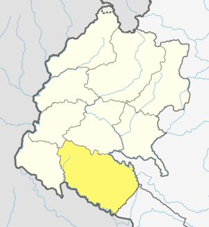
Kailali District
Kailali District (Nepali: कैलाली जिल्ला![]()
Kailali District | |
|---|---|
District | |
Ghodaghodi lake, Kailali | |
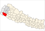
 Location of Kailali District | |
| Coordinates: 28°41′N 80°52′E | |
| Country | |
| Province | Sudurpashchim Pradesh |
| Admin HQ. | Dhangadhi |
| Government | |
| • Type | Coordination committee |
| • Body | DCC, Kailali |
| Area | |
| • Total | 3,235 km2 (1,249 sq mi) |
| Population (2011) | |
| • Total | 775,709 |
| • Density | 240/km2 (620/sq mi) |
| Time zone | UTC+05:45 (NPT) |
| Main Language(s) | Tharu, Nepali language, Doteli |
| Website | ddckailali |
Geography and climate
| Climate zone[1] | Elevation range | % of area |
|---|---|---|
| Lower Tropical | below 300 meters (1,000 ft) | 59.3% |
| Upper Tropical | 300 to 1,000 meters 1,000 to 3,300 ft. |
25.9% |
| Subtropical | 1,000 to 2,000 meters 3,300 to 6,600 ft. |
13.8% |
Demographics
At the time of the 2011 Nepal census, Kailali District had a population of 775,709. Of these, 41.1% spoke Tharu, 27.8% Nepali, 18.7% Doteli, 6.2% Achhami, 1.4% Magar, 0.9% Maithili, 0.8% Hindi and 0.5% Bajureli as their first language.[2]
Administration
The district consists of 13 Local Levels, of which one is a sub-metropolitan city, six are urban municipalities and six are rural municipalities. These are as follows:[3]
- Dhangadhi Sub-Metropolitan City
- Lamki Chuha Municipality
- Tikapur Municipality
- Ghodaghodi Municipality
- Bhajani Municipality
- Godawari Municipality
- Gauriganga Municipality
- Janaki Rural Municipality
- Bardagoriya Rural Municipality
- Mohanyal Rural Municipality
- Kailari Rural Municipality
- Joshipur Rural Municipality
- Chure Rural Municipality
gollark: Did you know? Eigendecomposition is a way to represent a matrix in terms of eigenvectors and eigenvalues.
gollark: Since the entire thing is horrible discrete approximations anyway.
gollark: I basically just have to divide the force by γ³ as long as the box is ticked.
gollark: It turns out that implementing special relativity is very easy (since it's rendered from the reference frame of the ground or something).
gollark: Well, I remember some sort of "lunar lander" game I made several years ago, presumably very loosely based on the "lunar lander" game on ??? platform, so it's based on that.
References
- The Map of Potential Vegetation of Nepal - a forestry/agroecological/biodiversity classification system (PDF), . Forest & Landscape Development and Environment Series 2-2005 and CFC-TIS Document Series No.110., 2005, ISBN 87-7903-210-9, retrieved Nov 22, 2013
- 2011 Nepal Census, Social Characteristics Tables
- "स्थानिय तह" (in Nepali). Ministry of Federal Affairs and General Administration. Archived from the original on 31 August 2018. Retrieved 1 September 2018.
External links
- "Districts of Nepal". Statoids.
| Wikimedia Commons has media related to Kailali District. |
This article is issued from Wikipedia. The text is licensed under Creative Commons - Attribution - Sharealike. Additional terms may apply for the media files.
