Joshipur
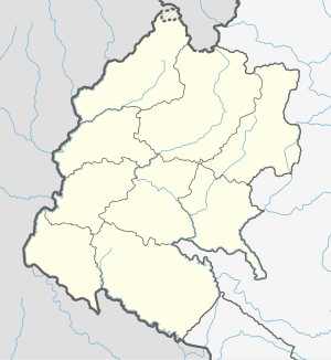
Joshipur is Rural Municipality in Kailali District of Sudurpashchim Pradesh established by merging Bauniya and Joshipur two existing village development committees.[1] Joshipur lies 75 km east of Dhangadhi and 61 3 km west of the capital, Kathmandu. It is surrounded by Lamki Chuha Municipality , Tikapur Municipality and Janaki Rural Municipality in the East , Ghodaghodi Municipality and Bhajani Municipality in the West , Bardagoriya Rural Municipality in the North and Bhajani Municipality in the South .
Joshipur Rural Municipality जोशीपुर गाउँपालिका | |
|---|---|
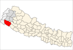
 Joshipur Rural Municipality Location in Nepal  Joshipur Rural Municipality Joshipur Rural Municipality (Nepal) | |
| Coordinates: 28.5674°N 81.0147°E | |
| Country | |
| Province | Sudurpashchim Pradesh |
| District | Kailali District |
| Government | |
| • Chairman | Ram Krishna Chaudhary ( Nepali Congress |
| • Vice-Chairman | Gita Kathariya ( Nepali Congress |
| Area | |
| • Total | 65.6 km2 (25.3 sq mi) |
| Population (2011) | |
| • Total | 36,459 |
| • Density | 560/km2 (1,400/sq mi) |
| Time zone | UTC+5:45 (NST) |
| Post code | 10900 |
| Area code(s) | 091 |
| Website | http://joshipurmun.gov.np |
Temples
- Ram Janaki Mandir, Jabahi
- Shree Someswarnath Mandir, Badhariya
- Shree Baneshwar baba sibha Mandir Dham, Bani
gollark: Great, back in maybe an hour or so.
gollark: I was going to go just then, but I guess I'll read your next message...
gollark: We discuss other things, so I know the people involved fairly well and am able to have decent conversations with them.
gollark: It's somewhat less work for me, especially if we have bots to ease things.
gollark: And a dedicated ControversialEsolangs definitely would, which could probably bring its own problems if it's *entirely* that.
See also
- Sudurpashchim Pradesh
- Kailali District
- Lamki Chuha Municipality
References
- "Nepal Census 2001". Nepal's Village Development Committees. Digital Himalaya. Archived from the original on 12 October 2008. Retrieved 15 November 2009..
This article is issued from Wikipedia. The text is licensed under Creative Commons - Attribution - Sharealike. Additional terms may apply for the media files.
