Jackson Township, Jackson County, Indiana
Jackson Township is one of twelve townships in Jackson County, Indiana, United States. As of the 2010 census, its population was 20,042 and it contained 8,741 housing units.[1]
Jackson Township | |
|---|---|
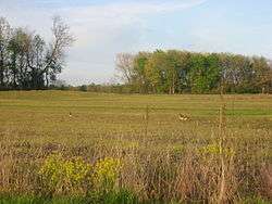 A field on the Muscatatuck National Wildlife Refuge | |
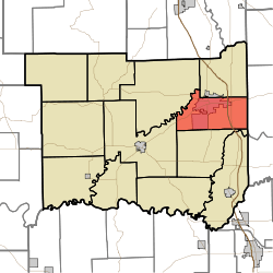 Location in Jackson County | |
| Coordinates: 38°56′27″N 85°52′46″W | |
| Country | United States |
| State | Indiana |
| County | Jackson |
| Government | |
| • Type | Indiana township |
| Area | |
| • Total | 34.78 sq mi (90.1 km2) |
| • Land | 34.44 sq mi (89.2 km2) |
| • Water | 0.34 sq mi (0.9 km2) 0.98% |
| Elevation | 600 ft (183 m) |
| Population (2010) | |
| • Total | 20,042 |
| • Density | 581.9/sq mi (224.7/km2) |
| GNIS feature ID | 0453451 |
History
Bell Ford Post Patented Diagonal "Combination Bridge", Low Spur Archeological Site (12J87), and Sand Hill Archeological Site 12J62 are listed on the National Register of Historic Places.[2]
Geography
According to the 2010 census, the township has a total area of 34.78 square miles (90.1 km2), of which 34.44 square miles (89.2 km2) (or 99.02%) is land and 0.34 square miles (0.88 km2) (or 0.98%) is water.[1] The streams of Buck Creek, Heddy Run, Myers Branch, Sandy Branch and South Fork Creek run through this township.
Cities and towns
- Seymour (vast majority)
Unincorporated towns
Adjacent townships
- Redding Township (north)
- Spencer Township, Jennings County (east)
- Washington Township (south)
- Brownstown Township (west)
- Hamilton Township (west)
Cemeteries
The township contains six cemeteries: Crane, Driftwood, Farmington, Gardner, Lutheran and Saint Ambrose.
Major highways


Airports and landing strips
References
- "Jackson Township, Jackson County, Indiana". Geographic Names Information System. United States Geological Survey. Retrieved 2009-09-24.
- United States Census Bureau cartographic boundary files
- "Population, Housing Units, Area, and Density: 2010 - County -- County Subdivision and Place -- 2010 Census Summary File 1". United States Census. Archived from the original on 2020-02-12. Retrieved 2013-05-10.
- "National Register Information System". National Register of Historic Places. National Park Service. July 9, 2010.
External links
Municipalities and communities of Jackson County, Indiana, United States | ||
|---|---|---|
| City | Map of Indiana highlighting Jackson County | |
| Towns | ||
| Townships | ||
| CDPs | ||
| Other unincorporated communities | ||