Hamilton Township, Jackson County, Indiana
Hamilton Township is one of twelve townships in Jackson County, Indiana, United States. As of the 2010 census, its population was 1,660 and it contained 675 housing units.[1] It was named for James Hamilton, an early local politician.[2]
Hamilton Township | |
|---|---|
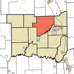 Location in Jackson County | |
| Coordinates: 38°58′46″N 86°00′06″W | |
| Country | United States |
| State | Indiana |
| County | Jackson |
| Government | |
| • Type | Indiana township |
| Area | |
| • Total | 63.34 sq mi (164.0 km2) |
| • Land | 62.58 sq mi (162.1 km2) |
| • Water | 0.76 sq mi (2.0 km2) 1.20% |
| Elevation | 561 ft (171 m) |
| Population (2010) | |
| • Total | 1,660 |
| • Density | 26.5/sq mi (10.2/km2) |
| GNIS feature ID | 0453365 |
History
Bell Ford Post Patented Diagonal "Combination Bridge", Beatty-Trimpe Farm, and Shields' Mill Covered Bridge are listed on the National Register of Historic Places.[3][4]
Geography
According to the 2010 census, the township has a total area of 63.34 square miles (164.0 km2), of which 62.58 square miles (162.1 km2) (or 98.80%) is land and 0.76 square miles (2.0 km2) (or 1.20%) is water.[1] Lakes in this township include Docs Lake. The streams of Buck Branch, Cooley Creek, East Fork White Creek and Indian Creek run through this township.
Adjacent townships
- Jackson Township, Bartholomew County (north)
- Wayne Township, Bartholomew County (northeast)
- Redding Township (east)
- Jackson Township (east-southeast)
- Brownstown Township (southwest)
- Pershing Township (west)
Cemeteries
The township contains three cemeteries: Cortland, Robinson and Weddell. There is also an old abandoned cemetery known as Brown Cemetery.
Major highways
References
- "Hamilton Township, Jackson County, Indiana". Geographic Names Information System. United States Geological Survey. Retrieved 2009-09-24.
- United States Census Bureau cartographic boundary files
- "Population, Housing Units, Area, and Density: 2010 - County -- County Subdivision and Place -- 2010 Census Summary File 1". United States Census. Archived from the original on 2020-02-12. Retrieved 2013-05-10.
- History of Jackson County, Indiana: From the Earliest Time to the Present, with Biographical Sketches, Notes, Etc., Together with an Extended History of the Northwest, the Indiana Territory and the State of Indiana. Unigraphic. 1886. p. 405.
- "National Register Information System". National Register of Historic Places. National Park Service. July 9, 2010.
- "National Register of Historic Places Listings". Weekly List of Actions Taken on Properties: 6/06/16 through 6/10/16. National Park Service. 2016-06-17.
External links
Municipalities and communities of Jackson County, Indiana, United States | ||
|---|---|---|
| City | Map of Indiana highlighting Jackson County | |
| Towns | ||
| Townships | ||
| CDPs | ||
| Other unincorporated communities | ||