Grassy Fork Township, Jackson County, Indiana
Grassy Fork Township is one of twelve townships in Jackson County, Indiana, United States. As of the 2010 census, its population was 668 and it contained 288 housing units.[1] It was named from the Grassy Fork Creek.[2]
Grassy Fork Township | |
|---|---|
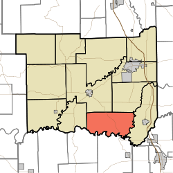 Location in Jackson County | |
| Coordinates: 38°47′22″N 85°57′55″W | |
| Country | United States |
| State | Indiana |
| County | Jackson |
| Government | |
| • Type | Indiana township |
| Area | |
| • Total | 39.75 sq mi (103.0 km2) |
| • Land | 39.67 sq mi (102.7 km2) |
| • Water | 0.08 sq mi (0.2 km2) 0.20% |
| Elevation | 522 ft (159 m) |
| Population (2010) | |
| • Total | 668 |
| • Density | 16.8/sq mi (6.5/km2) |
| GNIS feature ID | 0453339 |
Geography
According to the 2010 census, the township has a total area of 39.75 square miles (103.0 km2), of which 39.67 square miles (102.7 km2) (or 99.80%) is land and 0.08 square miles (0.21 km2) (or 0.20%) is water.[1] The streams of Grassy Fork, Knob Creek and Pond Creek run through this township.
Unincorporated towns
Adjacent townships
- Washington Township (northeast)
- Vernon Township (east)
- Gibson Township, Washington County (south)
- Monroe Township, Washington County (southwest)
- Driftwood Township (west)
- Brownstown Township (northwest)
Cemeteries
The township contains eleven cemeteries: Blair, Lubker, Mount Pleasant, Pioneer, Riechers/Niermans, Rucker, Russell Chapel, Stunkel, Sturgeon, Tuell, and Waskom.
Major highways
Education
Grassy Fork Township residents may obtain a free library card from the Brownstown Public Library in Brownstown.[3]
References
- "Grassy Fork Township, Jackson County, Indiana". Geographic Names Information System. United States Geological Survey. Retrieved 2009-09-24.
- United States Census Bureau cartographic boundary files
- "Population, Housing Units, Area, and Density: 2010 - County -- County Subdivision and Place -- 2010 Census Summary File 1". United States Census. Archived from the original on 2020-02-12. Retrieved 2013-05-10.
- History of Jackson County, Indiana: From the Earliest Time to the Present, with Biographical Sketches, Notes, Etc., Together with an Extended History of the Northwest, the Indiana Territory and the State of Indiana. Unigraphic. 1886. p. 397.
- "Overview". Brownstown Public Library. Retrieved 8 March 2018.
External links
Municipalities and communities of Jackson County, Indiana, United States | ||
|---|---|---|
| City | Map of Indiana highlighting Jackson County | |
| Towns | ||
| Townships | ||
| CDPs | ||
| Other unincorporated communities | ||
| Authority control |
|
|---|