Carr Township, Jackson County, Indiana
Carr Township is one of twelve townships in Jackson County, Indiana, United States. As of the 2010 census, its population was 1,510 and it contained 645 housing units.[1]
Carr Township | |
|---|---|
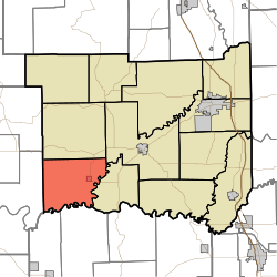 Location in Jackson County | |
| Coordinates: 38°48′45″N 86°12′54″W | |
| Country | United States |
| State | Indiana |
| County | Jackson |
| Government | |
| • Type | Indiana township |
| Area | |
| • Total | 41.95 sq mi (108.7 km2) |
| • Land | 41.32 sq mi (107.0 km2) |
| • Water | 0.63 sq mi (1.6 km2) 1.50% |
| Elevation | 761 ft (232 m) |
| Population (2010) | |
| • Total | 1,510 |
| • Density | 36.5/sq mi (14.1/km2) |
| GNIS feature ID | 0453159 |
Carr Township was named for Thomas Carr, an early county commissioner.[2]
History
Carr High School and Medora Covered Bridge are listed on the National Register of Historic Places.[3][4]
Geography
According to the 2010 census, the township has a total area of 41.95 square miles (108.7 km2), of which 41.32 square miles (107.0 km2) (or 98.50%) is land and 0.63 square miles (1.6 km2) (or 1.50%) is water.[1] The streams of Dry Creek and Greasy Creek run through this township.
Cities and towns
Unincorporated towns
(This list is based on USGS data and may include former settlements.)
Adjacent townships
- Owen Township (north)
- Brownstown Township (northeast)
- Driftwood Township (east)
- Jefferson Township, Washington County (south)
- Brown Township, Washington County (southwest)
- Guthrie Township, Lawrence County (west)
Cemeteries
The township contains ten cemeteries: Beem, Brown, Goss, Heighton Hill, Hinderlider, Holmes, Lanning Spur, Shoemaker, Stewart and Zollman.
Major highways
References
- "Carr Township, Jackson County, Indiana". Geographic Names Information System. United States Geological Survey. Retrieved 2009-09-24.
- United States Census Bureau cartographic boundary files
- "Population, Housing Units, Area, and Density: 2010 - County -- County Subdivision and Place -- 2010 Census Summary File 1". United States Census. Archived from the original on 2020-02-12. Retrieved 2013-05-10.
- History of Jackson County, Indiana: From the Earliest Time to the Present, with Biographical Sketches, Notes, Etc., Together with an Extended History of the Northwest, the Indiana Territory and the State of Indiana. Unigraphic. 1886. p. 372.
- "National Register Information System". National Register of Historic Places. National Park Service. July 9, 2010.
- "National Register of Historic Places Listings". Weekly List of Actions Taken on Properties: 12/12/11 through 12/16/112. National Park Service. 2011-11-23. Archived from the original on 2015-10-06.
External links
Municipalities and communities of Jackson County, Indiana, United States | ||
|---|---|---|
| City | Map of Indiana highlighting Jackson County | |
| Towns | ||
| Townships | ||
| CDPs | ||
| Other unincorporated communities | ||