Hot Springs, South Dakota
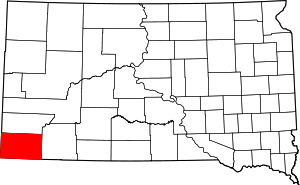
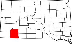
Hot Springs (Lakota: mni kȟáta;[7] "hot water") is a city in and county seat of Fall River County, South Dakota, United States. As of the 2010 census, the city population was 3,711.[8] In addition, neighboring Oglala Lakota County contracts the duties of Auditor, Treasurer and Register of Deeds to the Fall River County authority in Hot Springs.[8]
Hot Springs Mni Kȟáta | |
|---|---|
| Hot Springs, South Dakota | |
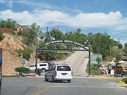 Welcome Sign in Hot Springs | |
| Motto(s): "Southern Gateway To The Black Hills" | |
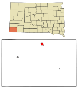 Location in Fall River County and the state of South Dakota | |
 Hot Springs Location within the state of South Dakota  Hot Springs Hot Springs (the United States) | |
| Coordinates: 43°25′54″N 103°28′27″W | |
| Country | |
| State | |
| County | Fall River |
| Incorporated | 1890[1] |
| Government | |
| • Mayor | Don DeVries |
| Area | |
| • Total | 4.34 sq mi (11.24 km2) |
| • Land | 4.34 sq mi (11.24 km2) |
| • Water | 0.00 sq mi (0.00 km2) |
| Elevation | 3,448 ft (1,051 m) |
| Population | |
| • Total | 3,711 |
| • Estimate (2019)[4] | 3,502 |
| • Density | 806.91/sq mi (311.57/km2) |
| Time zone | UTC−7 (Mountain (MST)) |
| • Summer (DST) | UTC−6 (MDT) |
| ZIP code | 57747 |
| Area code(s) | 605 |
| FIPS code | 46-30220[5] |
| GNIS feature ID | 1265256[6] |
| Website | www |
Geography
Hot Springs is located at 43°26′N 103°29′W, in Fall River County at the southern edge of South Dakota's Black Hills.[9] The Fall River runs through the city.
According to the United States Census Bureau, the city has a total area of 3.61 square miles (9.35 km2), all of it land.[10] Hot Springs has been assigned the ZIP code 57747 and the FIPS place code 30220.
History
The Sioux and Cheyenne people had long frequented the area, appreciating its warm springs. According to several accounts, including a ledger art piece by the Oglala Lakota artist Amos Bad Heart Bull, Native Americans considered the springs sacred.[11][12] European settlers arrived in the second half of the 19th century. They first named the city "Minnekahta" after its Lakota name. It was renamed Hot Springs in 1882, which is a translation of the Native American name.[13] A variety of health resorts were built on the tourism offered by the springs.[14][15]
Tourism
.jpg)
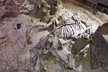
Some of the attractions in the Hot Springs area are the Mammoth Site of Hot Springs and Evans Plunge, built in 1890, with its naturally warm 87 °F (31 °C) spring water. The town is also a gateway to the attractions of the southern Black Hills, particularly Wind Cave National Park. Hot Springs holds the annual Miss South Dakota pageant. In recognition of its historic value, the National Trust for Historic Preservation listed Hot Springs as one of its 2009 Dozen Distinctive Destinations.[16] The city center contains over 35 sandstone buildings.[16]
The Angostura Reservoir, a 4,407 acres (17.83 km2) lake is located 10 miles southeast of the city and is a popular fishing, camping, and recreation area.[17] Cold Brook Dam, which creates Cold Brook Lake is a 36-acre lake is located just north of the city, and Cottonwood Springs Dam and lake is located about 5 miles west.[18]
Hot Springs is also the home of a United States Department of Veterans Affairs hospital (Black Hills Healthcare System - Hot Springs Campus), which was designated in 2011 as a National Historic Landmark. Formerly known as the Battle Mountain Sanitarium, the 100-bed center was built in 1907 for patients suffering from rheumatism or tuberculosis. In the early 21st century, it offers extensive outpatient treatment, acute hospital care, PTSD treatment, and an alcohol and drug treatment facility. The Battle Mountain Sanitarium was declared a National Treasure by the National Trust for Historic Preservation following a December 2011 proposal announced by the Department of Veterans Affairs to close the facility. Community and state leaders, including Senator Tim Johnson, Senator John Thune, and Representative Kristi Noem opposed the closing. A concerned group of veterans and citizens organized a "Save the VA" Campaign; they have countered the VA's proposal based on the results of multiple Freedom of Information Act requests, getting as far as meeting with Secretary of Veterans Affairs Eric Shinseki to show how they believe VA leadership manipulated data to justify the proposed closure of the Landmark. After the Veterans Health Administration scandal of 2014, Hot Springs was visited by members of the United States House Committee on Veterans' Affairs for a Congressional field hearing regarding the proposed closure and the committee heard testimony from members of the Save the VA Committee and others opposed to the closure, as well as two VA administrators in favor of the closure.[19]
Climate
Hot Springs has a cool semi-arid climate (Köppen BSk) bordering on a humid continental climate (Dfa/Dwa). Owing to its location in an area particularly prone to chinook winds, Hot Springs is one of the warmest places in South Dakota, with an annual mean temperature of 48.6 °F (9.2 °C).[20] During the three winter months from December to February, twenty-five afternoons can be expected to exceed 50 °F or 10 °C and five winter afternoons will climb to 60 °F or 15.6 °C due to these warm winds. Nonetheless, extreme cold occurs frequently during the winter when the Föhn effect is absent: the average window for minima below or reaching 0 °F or −17.8 °C is from December 3 to February 27, and fifteen mornings get this cold during an average winter, with −20 °F or −28.9 °C reached twice per winter on average. Thirty afternoons each winter stay below 32 °F or 0 °C, with all but seven in the severe month of January 1937 not topping the freezing point.
Snowfall averages 29.7 inches or 0.75 metres – vastly less than the extremely snowy high parts of the Black Hills – due to the very dry winters and relatively warm temperatures. The record for snowfall in a single month was 29.6 inches (0.75 m) in April 2013, and the most in one full season was 72.3 inches (1.84 m) from July 1975 to June 1976; in contrast, the 1988–1989 season had less than 11 inches or 0.28 metres of snow all winter. The record for snowfall in a single day was 15.0 inches (0.38 m) on March 12, 2006. The most snow on the ground was 22 inches (0.56 m) on April 18, 1920, and the mean in January peaks at a mere 1.2 inches or 0.030 metres.
Spring warms up early: the first afternoon climbing to 70 °F or 21.1 °C can be expected as early as March 22, and the first 80 °F or 26.7 °C maximum as early as April 22. Spring is usually the wettest season, especially in its later stages, due to occasionally very heavy thunderstorm rains. The wettest month on record was May 1935, which saw 9.65 inches (245.1 mm) of precipitation, whilst the wettest calendar year overall was 1915, with 32.01 inches (813.1 mm), and the driest was 1960, with only 6.15 inches (156.2 mm). The most precipitation in a single day occurred on April 19, 2000, when 4.31 inches (109.5 mm) fell, part of which fell as 10 inches (0.25 m) of snow.
Summers are warm, with two mornings each year on average stay above 20 °C or 68 °F, with three mornings on record remaining at or above 77 °F or 25 °C, although five afternoons each summer top 100 °F or 37.8 °C and forty afternoons will top 90 °F or 32.2 °C. The hottest temperature ever recorded in Hot Springs is 112 °F (44.4 °C), which was achieved on each of three separate occasions: July 25 of 1931, July 10 of 1933, and July 10 of 1939. The fall season is usually dry and sees increasingly variable temperatures: the first freeze can be expected as early as September 23, but maxima in the eighties Fahrenheit have occurred as late as November 8 (in 1999).
| Climate data for Hot Springs, South Dakota (1981-2010, extremes since 1895) | |||||||||||||
|---|---|---|---|---|---|---|---|---|---|---|---|---|---|
| Month | Jan | Feb | Mar | Apr | May | Jun | Jul | Aug | Sep | Oct | Nov | Dec | Year |
| Record high °F (°C) | 71 (22) |
72 (22) |
86 (30) |
93 (34) |
102 (39) |
108 (42) |
112 (44) |
111 (44) |
103 (39) |
94 (34) |
80 (27) |
72 (22) |
112 (44) |
| Mean maximum °F (°C) | 60 (16) |
63 (17) |
73 (23) |
81 (27) |
88 (31) |
95 (35) |
101 (38) |
99 (37) |
94 (34) |
84 (29) |
70 (21) |
59 (15) |
101 (38) |
| Average high °F (°C) | 41.3 (5.2) |
44.5 (6.9) |
53.4 (11.9) |
62.4 (16.9) |
71.3 (21.8) |
80.7 (27.1) |
89.2 (31.8) |
88.4 (31.3) |
79.1 (26.2) |
65.3 (18.5) |
50.1 (10.1) |
40.2 (4.6) |
63.8 (17.7) |
| Daily mean °F (°C) | 27.8 (−2.3) |
30.3 (−0.9) |
38.6 (3.7) |
47.1 (8.4) |
56.6 (13.7) |
65.7 (18.7) |
73.2 (22.9) |
72.0 (22.2) |
62.0 (16.7) |
49.5 (9.7) |
36.5 (2.5) |
27.0 (−2.8) |
48.9 (9.4) |
| Average low °F (°C) | 14.4 (−9.8) |
16.1 (−8.8) |
23.7 (−4.6) |
31.7 (−0.2) |
42.0 (5.6) |
50.6 (10.3) |
57.2 (14.0) |
55.6 (13.1) |
45.0 (7.2) |
33.7 (0.9) |
22.9 (−5.1) |
13.9 (−10.1) |
33.9 (1.0) |
| Mean minimum °F (°C) | −14 (−26) |
−10 (−23) |
−1 (−18) |
15 (−9) |
27 (−3) |
38 (3) |
45 (7) |
43 (6) |
29 (−2) |
18 (−8) |
3 (−16) |
−10 (−23) |
−14 (−26) |
| Record low °F (°C) | −41 (−41) |
−41 (−41) |
−22 (−30) |
−11 (−24) |
13 (−11) |
26 (−3) |
36 (2) |
28 (−2) |
13 (−11) |
−5 (−21) |
−21 (−29) |
−37 (−38) |
−41 (−41) |
| Average precipitation inches (mm) | 0.35 (8.9) |
0.49 (12) |
1.05 (27) |
1.97 (50) |
3.13 (80) |
2.83 (72) |
2.39 (61) |
1.77 (45) |
1.43 (36) |
1.28 (33) |
0.50 (13) |
0.38 (9.7) |
17.57 (447.6) |
| Average snowfall inches (cm) | 4.5 (11) |
5.1 (13) |
7.3 (19) |
3.5 (8.9) |
0 (0) |
0 (0) |
0 (0) |
0 (0) |
0 (0) |
0 (0) |
3.6 (9.1) |
5.7 (14) |
29.7 (75) |
| Average precipitation days (≥ 0.01 inch) | 4 | 4 | 6 | 8 | 10 | 10 | 8 | 7 | 6 | 6 | 4 | 4 | 77 |
| Average snowy days (≥ 0.1 inch) | 3 | 3 | 2 | 1 | 0 | 0 | 0 | 0 | 0 | 0 | 2 | 3 | 14 |
| Source: NOAA[21] | |||||||||||||
Demographics
| Historical population | |||
|---|---|---|---|
| Census | Pop. | %± | |
| 1890 | 1,423 | — | |
| 1900 | 1,319 | −7.3% | |
| 1910 | 2,140 | 62.2% | |
| 1920 | 2,141 | 0.0% | |
| 1930 | 3,486 | 62.8% | |
| 1940 | 4,083 | 17.1% | |
| 1950 | 5,030 | 23.2% | |
| 1960 | 4,943 | −1.7% | |
| 1970 | 4,434 | −10.3% | |
| 1980 | 4,742 | 6.9% | |
| 1990 | 4,325 | −8.8% | |
| 2000 | 4,129 | −4.5% | |
| 2010 | 3,711 | −10.1% | |
| Est. 2019 | 3,502 | [4] | −5.6% |
| U.S. Decennial Census[22] 2017 Estimate[23] | |||
2010 census
As of the census[3] of 2010, there were 3,711 people, 1,730 households, and 910 families residing in the city. The population density was 1,028.0 inhabitants per square mile (396.9/km2). There were 1,958 housing units at an average density of 542.4 per square mile (209.4/km2). The racial makeup of the city was 85.4% White, 1.1% African American, 9.3% Native American, 0.5% Asian, 0.1% Pacific Islander, 0.2% from other races, and 3.5% from two or more races. Hispanic or Latino of any race were 2.1% of the population.
There were 1,730 households, of which 21.0% had children under the age of 18 living with them, 38.4% were married couples living together, 11.0% had a female householder with no husband present, 3.2% had a male householder with no wife present, and 47.4% were non-families. 42.9% of all households were made up of individuals, and 20.3% had someone living alone who was 65 years of age or older. The average household size was 2.03 and the average family size was 2.79.
The median age in the city was 49.8 years. 19.1% of residents were under the age of 18; 5.6% were between the ages of 18 and 24; 18.8% were from 25 to 44; 32.9% were from 45 to 64; and 23.7% were 65 years of age or older. The gender makeup of the city was 50.4% male and 49.6% female.
2000 census
As of the census[5] of 2000, there were 4,129 people, 1,704 households, and 962 families residing in the city. The population density was 1,417.3 people per square mile (547.8/km2). There were 1,900 housing units at an average density of 652.2 per square mile (252.1/km2). The racial makeup of the city was 88.06% White, 0.39% African American, 7.82% Native American, 0.36% Asian, 0.05% Pacific Islander, 0.19% from other races, and 3.12% from two or more races. Hispanic or Latino of any race were 1.91% of the population. There were 1,704 households, out of which 23.5% had children under the age of 18 living with them, 42.0% were married couples living together, 10.8% had a female householder with no husband present, and 43.5% were non-families. 39.8% of all households were made up of individuals, and 17.4% had someone living alone who was 65 years of age or older. The average household size was 2.16 and the average family size was 2.88.
In the city, the population was spread out, with 24.0% under the age of 18, 6.7% from 18 to 24, 19.4% from 25 to 44, 25.7% from 45 to 64, and 24.2% who were 65 years of age or older. The median age was 45 years. For every 100 females, there were 113.3 males. For every 100 females age 18 and over, there were 106.7 males.
As of 2000 the median income for a household in the city was $27,079, and the median income for a family was $35,786. Males had a median income of $28,750 versus $18,333 for females. The per capita income for the city was $16,618. About 8.1% of families and 14.8% of the population were below the poverty line, including 20.9% of those under age 18 and 12.4% of those age 65 or over.
Notable people
- Albert R. Anderson, U.S. Representative, mayor of Lead, and lawyer
- Joseph Bottum, writer
- Dan Dryden, educator and politician
- Charles S. Eastman, lawyer and politician lived and worked in Hot Springs[24]
- Jarrod Emick, musical theatre actor
- Orlando Ferguson, Early Proponent of Flat Earth Theory[25]
- Charles Hargens, painter
- Leslie Jensen, 15th Governor of South Dakota
- Jacqueline Left Hand Bull, Continental Counselor and Chair of the National Spiritual Assembly of the Bahá'ís of the United States
- Jess Thomas, American operatic tenor[26]
See also
References
- "SD Towns" (PDF). South Dakota State Historical Society. Archived from the original (PDF) on February 10, 2010. Retrieved February 13, 2010.
- "2019 U.S. Gazetteer Files". United States Census Bureau. Retrieved July 30, 2020.
- "U.S. Census website". United States Census Bureau. Retrieved 2012-06-21.
- "Population and Housing Unit Estimates". United States Census Bureau. May 24, 2020. Retrieved May 27, 2020.
- "U.S. Census website". United States Census Bureau. Retrieved 2008-01-31.
- U.S. Geological Survey Geographic Names Information System: Hot Springs
- Ullrich, Jan F. (2014). New Lakota Dictionary (2nd ed.). Bloomington, IN: Lakota Language Consortium. ISBN 978-0-9761082-9-0. Archived from the original on 2016-10-18. Retrieved 2014-02-12.
- "Welcome". South Dakota Association of County Officials. Retrieved 2009-11-24.
- "US Gazetteer files: 2010, 2000, and 1990". United States Census Bureau. 2011-02-12. Retrieved 2011-04-23.
- "US Gazetteer files 2010". United States Census Bureau. Archived from the original on 2012-01-25. Retrieved 2012-06-21.
- Linea Sundstrom (1997-07-01). "The Sacred Black Hills – An Ethnohistorical Review". Great Plains Quarterly via Digital Commons at University of Nebraska – Lincoln. Retrieved 2014-08-25.
- "THE BLACK HILLS AS SACRED GROUND: THE CHRONOLOGY AND CONTROVERSY" (PDF). National Park Service. Retrieved 2014-08-25.
- Chicago and North Western Railway Company (1908). A History of the Origin of the Place Names Connected with the Chicago & North Western and Chicago, St. Paul, Minneapolis & Omaha Railways. p. 84.
- "Hot Springs, South Dakota". Encyclopædia Britannica. Retrieved 2009-07-26.
- Lund, John W. (December 1997). "Hot Springs, South Dakota" (PDF). Geo-Heat Center Quarterly Bulletin. 8 (4): 6–11. Retrieved 2014-02-09.
- "National Trust for Historic Preservation Names Hot Springs, South Dakota to its 2009 list of America's Dozen Distinctive Destinations". National Trust for Historic Preservation. Retrieved 2009-07-26.
- https://gfp.sd.gov/parks/detail/angostura-recreation-area/
- http://www.nwo.usace.army.mil/Missions/Dam-and-Lake-Projects/Additional-Dams-Lakes/
- "Hot Springs VA gains at least one new friend". Retrieved 2014-09-10.
- "Hot Springs, South Dakota 1961-1990 NCDC Monthly Normals". Western Regional Climate Center. Retrieved 2009-11-24.
- "NOWData - NOAA Online Weather Data". National Oceanic and Atmospheric Administration. Retrieved May 5, 2013.
- United States Census Bureau. "Census of Population and Housing". Retrieved September 23, 2013.
- "Population Estimates". United States Census Bureau. Retrieved October 5, 2018.
- Biodata-Charles Eastman
- Sirvaitis, Karen (1 September 2001). South Dakota. Lerner Publications. p. 69. ISBN 978-0-8225-4070-0.
External links
| Wikimedia Commons has media related to Hot Springs, South Dakota. |
