Hobbs, New Mexico
Hobbs is a city in Lea County, New Mexico, United States. The population was 34,122 at the 2010 census,[2] increasing from 28,657 at the 2000 census.
Hobbs, New Mexico | |
|---|---|
City | |
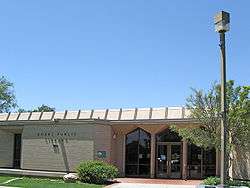
 Hobbs Public Library | |
| Motto(s): "It All Happens Here" | |
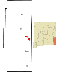
 Location of Hobbs, New Mexico | |
 Hobbs, New Mexico Location in the United States | |
| Coordinates: 32°42′44″N 103°8′26″W | |
| Country | United States |
| State | New Mexico |
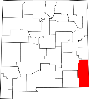
| County | Lea |
| Government | |
| • Mayor | Sam Cobb |
| • City Manager | Sam Cobb |
| Area | |
| • Total | 26.44 sq mi (68.47 km2) |
| • Land | 26.40 sq mi (68.37 km2) |
| • Water | 0.04 sq mi (0.10 km2) |
| Elevation | 3,622 ft (1,104 m) |
| Population | |
| • Total | 34,122 |
| • Estimate (2019)[3] | 39,141 |
| • Density | 1,482.61/sq mi (572.45/km2) |
| Time zone | UTC−7 (Mountain (MST)) |
| • Summer (DST) | UTC−6 (MDT) |
| ZIP codes | 88240-88242 |
| Area code(s) | 575 |
| FIPS code | 35-32520 |
| GNIS feature ID | 0923609 |
| Website | www |
Hobbs is the principal city of the Hobbs, New Mexico Micropolitan Statistical Area, which includes all of Lea County.
History
Hobbs was founded in 1907 when James Isaac Hobbs (1852–1923) established a homestead and named the settlement.[4] In 1910 the Hobbs post office opened, with James Hobbs as the first postmaster.[5] By 1911 there were about 25 landowners in Hobbs.[6]
The small, isolated settlement expanded rapidly following the discovery of oil by the Midwest Oil Company in 1927. A refinery was built in the following year, and in 1929 the town of Hobbs was officially incorporated.[7] At the peak of this oil boom, over 12,000 people lived in Hobbs. When the Great Depression hit in 1931, oil prices dropped and the population fell to only about 3,000. However, a few years later activity picked up in the oilfields and the population climbed to about 14,000 in 1940.[6]
On 23 June 1938 seven local men were killed and five more injured when an explosive charge used in oil drilling detonated prematurerly.[8]
Following the outbreak of World War II, in 1942 Hobbs Army Airfield was built north of town. In 1948 the city bought the air base and converted it into the Hobbs Industrial Air Park, which is still used for soaring competitions.
The first college in Hobbs opened in 1956. It was initially the First Baptist College, and in 1962 it became the College of the Southwest. The name was changed again to University of the Southwest in 2008. A second college, New Mexico Junior College, opened in 1966.
Geography
Hobbs is in eastern Lea County, less than 4 miles (6 km) west of the Texas border. U.S. Route 62 passes through the city, leading east 29 miles (47 km) to Seminole, Texas, and west 69 miles (111 km) to Carlsbad, New Mexico. State Road 18 also passes through Hobbs, leading northwest 21 miles (34 km) to Lovington, the Lea county seat, and south 61 miles (98 km) to Kermit, Texas.
According to the United States Census Bureau, the city of Hobbs has a total area of 26.4 square miles (68.5 km2), of which 0.04 square miles (0.1 km2), or 0.14%, are water.[9] Land in the city drains either east to Seminole Draw or southeast to Monument Draw, both of which are tributaries of Mustang Draw in Texas and ultimately part of the Colorado River watershed.
Climate
Hobbs experiences a semi-arid climate (Köppen climate classification BSk).
| Climate data for Hobbs, New Mexico | |||||||||||||
|---|---|---|---|---|---|---|---|---|---|---|---|---|---|
| Month | Jan | Feb | Mar | Apr | May | Jun | Jul | Aug | Sep | Oct | Nov | Dec | Year |
| Average high °F (°C) | 56.4 (13.6) |
61.8 (16.6) |
69.1 (20.6) |
78.0 (25.6) |
85.7 (29.8) |
93.1 (33.9) |
93.9 (34.4) |
92.4 (33.6) |
86.0 (30.0) |
77.1 (25.1) |
65.2 (18.4) |
57.5 (14.2) |
76.3 (24.6) |
| Average low °F (°C) | 27.9 (−2.3) |
31.9 (−0.1) |
37.6 (3.1) |
46.4 (8.0) |
55.4 (13.0) |
63.6 (17.6) |
66.7 (19.3) |
65.8 (18.8) |
59.3 (15.2) |
48.4 (9.1) |
36.8 (2.7) |
29.4 (−1.4) |
47.4 (8.6) |
| Average precipitation inches (mm) | 0.46 (12) |
0.46 (12) |
0.54 (14) |
0.79 (20) |
1.93 (49) |
1.85 (47) |
2.16 (55) |
2.37 (60) |
2.54 (65) |
1.54 (39) |
0.55 (14) |
0.55 (14) |
15.75 (400) |
| Average snowfall inches (cm) | 1.5 (3.8) |
1.2 (3.0) |
0.5 (1.3) |
0.2 (0.51) |
0.0 (0.0) |
0.0 (0.0) |
0.0 (0.0) |
0.0 (0.0) |
0.0 (0.0) |
0.1 (0.25) |
0.6 (1.5) |
1.0 (2.5) |
5.1 (13) |
| Source: WRCC [10] | |||||||||||||
Demographics
| Historical population | |||
|---|---|---|---|
| Census | Pop. | %± | |
| 1930 | 598 | — | |
| 1940 | 10,619 | 1,675.8% | |
| 1950 | 13,875 | 30.7% | |
| 1960 | 26,275 | 89.4% | |
| 1970 | 26,025 | −1.0% | |
| 1980 | 29,153 | 12.0% | |
| 1990 | 29,115 | −0.1% | |
| 2000 | 28,657 | −1.6% | |
| 2010 | 34,122 | 19.1% | |
| Est. 2019 | 39,141 | [3] | 14.7% |
| U.S. Decennial Census[11] | |||
As of 2011 there were 33,405 people, 10,040 households, and 7,369 families residing in the city. The population density was 1,514.0 people per square mile (584.5/km2). There were 11,968 housing units at an average density of 632.3 per square mile (244.1/km2). The racial makeup of the city was 63.52% White, 6.79% African American, 1.07% Native American, 0.43% Asian, 0.04% Pacific Islander, 24.42% from other races, and 3.73% from two or more races. Hispanic or Latino of any race were 42.18% of the population.
There were 10,040 households out of which 39.8% had children under the age of 18 living with them, 54.1% were married couples living together, 14.6% had a female householder with no husband present, and 26.6% were non-families. 23.4% of all households were made up of individuals and 10.1% had someone living alone who was 65 years of age or older. The average household size was 2.72 and the average family size was 3.22.
In the city, the population was spread out with 30.4% under the age of 18, 10.3% from 18 to 24, 28.0% from 25 to 44, 19.4% from 45 to 64, and 11.9% who were 65 years of age or older. The median age was 32 years. For every 100 females, there were 100.2 males. For every 100 females age 18 and over, there were 99.2 males.
The median income for a household in the city was $28,100, and the median income for a family was $33,017. Males had a median income of $31,352 versus $20,841 for females. The per capita income for the city was $14,209. About 20.2% of families and 24.2% of the population were below the poverty line, including 32.3% of those under age 18 and 15.5% of those age 65 or over.
Climate
Hobbs, like many parts of eastern New Mexico, has a semi-arid climate.[12] The city experiences hot summers and chilly winters. With right around 70% of precipitation coming in the high solar half of the year, Hobbs may also be defined as a dry humid subtropical climate.
Economy
The largest industries in Hobbs are mining/quarrying and oil & gas extraction, followed by retail trade and educational services.[13]
Arts and culture
Located in Hobbs are the headquarters of the Soaring Society of America and Zia Park Casino, Hotel and Racetrack, which offers live and simulcast racing, casino games, dining, and a 154-room hotel. The property is owned and operated by Penn National Gaming, Inc..[14]
Education
- University of the Southwest:[15] is a small Christian institution of higher education.
- New Mexico Junior College:[16] has a baseball team won the NJCAA World Series in 2005, and was runner up in the NJCAA World Series in 2007.
- Hobbs High School[17]
- Listed among the top 1000 public schools in the country[18]
- 17 State Boys Basketball Championships – the most in New Mexico history
Notable people
- Tony Benford, assistant coach with TCU's men's basketball team
- Birthplace of Ryan Bingham, country singer/songwriter
- Bill Bridges, professional basketball player
- James O. Browning, federal judge
- Diane Denish, former Lieutenant Governor of New Mexico
- Tharon Drake, swimmer, U.S. Paralympic medalist 2016
- Rob Evans, former head basketball coach at the University of Mississippi and Arizona State University
- Colt McCoy, quarterback for the Washington Football Team
- Steve Pearce, former Republican congressman from New Mexico's 2nd congressional district
- Guy Penrod, gospel music singer; boyhood home
- Timmy Smith, former Washington Football Team player
- Ralph Tasker, high school basketball coach
- Jeff Taylor and son Jeffery Taylor, professional basketball players
- Harry Teague, former Democratic congressman from New Mexico's 2nd congressional district
- Polo Urias, singer
References
- "2019 U.S. Gazetteer Files". United States Census Bureau. Retrieved July 27, 2020.
- "Total Population: 2010 Census DEC Summary File 1 (P1), Hobbs city, New Mexico". data.census.gov. U.S. Census Bureau. Retrieved May 6, 2020.
- "Population and Housing Unit Estimates". United States Census Bureau. May 24, 2020. Retrieved May 27, 2020.
- Hellmann, Paul T. (February 14, 2006). Historical Gazetteer of the United States. Routledge. p. 741. ISBN 1-135-94859-3.
- "Lea County". Jim Forte Postal History. Retrieved April 16, 2015.
- [Sholin, Terry M. (January 3, 2001). "History of Hobbs". Hobbs New Sun. Hobbs. Archived from the original on August 14, 2015. Retrieved September 15, 2015.
- Archuletta, Phil T.; Holden, Sharyl (2004). Traveling New Mexico: A Guide to the Historical and State Park Markers. Sunstone Press. p. 152. ISBN 978-1-61139-117-6.
- "SEVEN KILLED, FIVE HURT IN NITRO BLAST IN NEW MEXICO". The Helena Independent. Associated Press. June 23, 1938. Retrieved June 20, 2020.
- "U.S. Gazetteer Files: 2019: Places: New Mexico". U.S. Census Bureau Geography Division. Retrieved May 6, 2020.
- "HOBBS, NEW MEXICO - Climate Summary". Retrieved October 13, 2018.
- "Census of Population and Housing". Census.gov. Archived from the original on April 26, 2015. Retrieved June 4, 2015.
- http://1.bp.blogspot.com/-AnOY3bX30oI/TZvUMicLbUI/AAAAAAAAABg/J5l2PgBA2Cc/s1600/climatemapusa2yv3.png
- "About Hobbs, NM". DataUSA. Retrieved June 10, 2019.
- "About Zia Park Casino". Zia Park Casino, Hotel & Racetrack. Retrieved November 15, 2017.
- "Welcome - University of Southwest". usw.edu.
- "New Mexico Junior College". www.nmjc.edu.
- "Home - Hobbs Municipal Schools". www.hobbsschools.net.
- Newsweek Magazine for the years 2005, 2006, 2007, 2008 (Number 269 in 2008)

