Gunstett
Gunstett is a commune in the Bas-Rhin department in Grand Est in north-eastern France.
Gunstett Gunschtett | |
|---|---|
.jpg) The wash house in the Sauer river in Gunstett | |
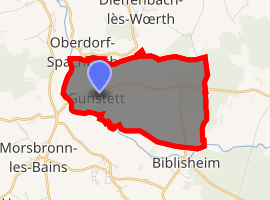
Location of Gunstett 
| |
 Gunstett  Gunstett | |
| Coordinates: 48°54′56″N 7°45′53″E | |
| Country | France |
| Region | Grand Est |
| Department | Bas-Rhin |
| Arrondissement | Haguenau-Wissembourg |
| Canton | Reichshoffen |
| Government | |
| • Mayor (1995–2014) | Jean-Marie Haas |
| Area 1 | 6.3 km2 (2.4 sq mi) |
| Population (2017-01-01)[1] | 655 |
| • Density | 100/km2 (270/sq mi) |
| Time zone | UTC+01:00 (CET) |
| • Summer (DST) | UTC+02:00 (CEST) |
| INSEE/Postal code | 67177 /67360 |
| Elevation | 152–222 m (499–728 ft) |
| 1 French Land Register data, which excludes lakes, ponds, glaciers > 1 km2 (0.386 sq mi or 247 acres) and river estuaries. | |
Geography
The village is positioned slightly to the east of the Departmental Road RD27, a short distance north of Haguenau. The surrounding countryside is dominated by arable agriculture: the soil type is alluvial, reflecting the proximity of the river Rhine to the east.
Neighbouring villages are Oberdorf to the north, Biblisheim to the south-east, Durrenbach to the south, Morsbronn-les-Bains to the south-south-west and the formerly independent commune of Eberbach-Woerth to the West.
Points of interest
- The Pear Conservation Orchard comprises 300 trees of 250 different varieties.
- St Michael's Church contains an organ built in 1857 by Seltz organ builder Joseph Stiehr.
- Public wash house.
gollark: How ditherous!
gollark: Also, for those who complain about Rust being big: somehow a Pytorch/CUDA setup is 10GB?!
gollark: Sometimes I worry that I'll encounter a problem of some kind for which Go will be the best solution, even though ÆÆÆÆÆÆÆÆÆÆÆÆÆÆÆÆÆA GOLANG.
gollark: I occasionally look at htop.
gollark: I *can* do many things. I choose not to do the majority, for purposes.
See also
References
- "Populations légales 2017". INSEE. Retrieved 6 January 2020.
| Wikimedia Commons has media related to Gunstett. |
This article is issued from Wikipedia. The text is licensed under Creative Commons - Attribution - Sharealike. Additional terms may apply for the media files.