Grove, Oxfordshire
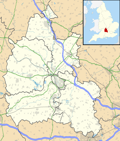
Grove is a village and civil parish on Letcombe Brook, about 1 1⁄2 miles (2.4 km) north of Wantage in the Vale of White Horse. Historically, a part of Berkshire until the 1974 boundary changes transferred it to Oxfordshire. The 2011 Census recorded the parish's population as 7,178.[1] It is also home to Williams Racing.
| Grove | |
|---|---|
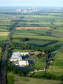
 De Havilland Venom aircraft on static display at Grove Technology Park | |
 Grove Location within Oxfordshire | |
| Population | 7,178 (2011 Census) |
| OS grid reference | SU4090 |
| Civil parish |
|
| District | |
| Shire county | |
| Region | |
| Country | England |
| Sovereign state | United Kingdom |
| Post town | Wantage |
| Postcode district | OX12 |
| Dialling code | 01235 |
| Police | Thames Valley |
| Fire | Oxfordshire |
| Ambulance | South Central |
| UK Parliament | |
| Website | Grove Parish Council |
Parish churches
King Stephen granted land at Grove to the Benedictine Abbey of Bermondsey in 1142.[2]
Grove is said to have had a chapel of St. John the Baptist until it was destroyed in 1733.[2] It would have been a chapelry of the ecclesiastical parish of Wantage, of which Grove was a part until the 1830s.[2] A new Church of England parish church was built in 1832 and Grove was made into a separate ecclesiastical parish in 1835.[2]
The 1832 building was replaced by a new parish church of St. James the Great built in 1900[2] or 1901.[3] St. James' was a Gothic Revival building in an Early English Gothic style with six bays and a south aisle.[3] It was designed by P.A. Robson,[3] son of the architect Edward Robert Robson. The font is an 18th-century wooden one brought from All Saints' parish church, Pusey.[2] In the 1960s Sir Nikolaus Pevsner found St. James' to be derelict.[3]
In the 1960s a new parish church of St. John the Baptist was built to replace St. James'. The foundation stone is dated 1965.[4] It incorporates items from St. James' including the font, a stained glass window depicting St. James and a panel listing successive vicars of the parish.[4]
History
In 1622 Thomas Grove had a watermill at Grove.[2]
Grove Farmhouse is dated 1684.[3] It is a chequer brick building of three bays and its doorway has bolection moulding.[3]
The common lands of Wantage and Grove were enclosed by an Act of Parliament passed in 1803.[2] The land awards under the Act seem to have been made in 1806.[2]
In 1770 the turnpike road was built as a more direct route between Wantage and Oxford. Between 1796 and 1810 the Wilts & Berks Canal was built. Its main route passed through the village and a branch of the canal was built between Grove and Wantage.
In 1840 the Great Western Railway opened Wantage Road railway station on the northern boundary of Grove. In 1875, the Wantage Tramway was built. This was a single track laid alongside the turnpike road linking Wantage Road Station and Wantage. It was operated by steam tram locomotives which pulled both a passenger tramcar and a goods wagons.
Competition from the railway and tramway reduced canal traffic, and the Wilts and Berks fell into disuse in 1901. Increasing competition from road transport reduced traffic on the tram, and passenger tram services were ended in 1925.

In 1942 RAF Grove was opened as a Bomber Command training base. In 1943 it was transferred to the United States Army Air Forces and the 45th Air Depot Group established one of the largest and busiest supply airfields in Europe. In 1946 the USAAF returned the airfield to the RAF, who relegated it for non-flying operations. In 1955 the station was transferred to the United Kingdom Atomic Energy Authority, which used it until the 1960s. The site was then sold off and private housing was built on part of the former airfield.
In 1945 the Wantage Tramway closed to freight traffic. One of its steam tram engines is preserved at Didcot Railway Centre. In 1965 British Railways closed Wantage Road station. Oxfordshire County Council has a policy to seek a new station to be built to serve Wantage and Grove.
Parts of the Wilts and Berks Canal around Grove are still visible, providing some local walks. The Wilts & Berks Canal Trust is working to reopen the entire canal, and several small sections around Grove have already been restored.
Grove has lately been a site of extensive housing development, greatly increasing its size and almost merging with the nearby town of Wantage. Grove is now the largest village in the Vale of White Horse.
Amenities
Grove has two primary schools:
Grove has three public houses:
- The Baytree, Denchworth Road
- The Bell,[7] Main Street
- The Volunteer Inn, Station Road (closed in 2012 but re-opened in 2016)
Grove rugby union and association football clubs play at the Cane Lane parish recreation ground on the outskirts of the village.
- Grove Rugby Football Club[8] was founded in 1971 and plays in the Southern League North division,[9] making it one of the four highest-rated sides in Oxfordshire. The Club fields four senior sides, including Veterans. Grove RFC has a Youth section, across twelve Mini (mixed, Under-7 to Under-12) and Junior groups (Under-13 to Under-18; including two Girls' -- Under 15 and Under 18). One of its alumni is Jon Dunbar, who captained Grove in the early 2000s before moving to Newcastle Falcons and then Leeds Carnegie on a professional contract.
- Grove Challengers FC, the local association football junior side, was founded in 1971. Few make it further than the youth teams of local clubs, such as Oxford United and Wycombe Wanderers.
Nearby places
References
- "Area: Grove (Parish): Key Figures for 2011 Census: Key Statistics". Neighbourhood Statistics. Office for National Statistics. Retrieved 11 November 2013.
- Page & Ditchfield 1924, pp. 319–332
- Pevsner 1966, p. 150
- "Photo Gallery: How the Church Looks Now". Welcome to Grove Parish Church. Archived from the original on 19 July 2011. Retrieved 22 December 2010.
- Millbrook Primary School Archived 14 September 2009 at the Wayback Machine
- Grove Church of England Primary School Archived 6 October 2011 at the Wayback Machine
- The Bell at Grove
- Grove Rugby Football Club
- RFU Southern League North division
Sources
- Page, W.H.; Ditchfield, P.H., eds. (1924). A History of the County of Berkshire. Victoria County History. 4. assisted by John Hautenville Cope. London: The St Katherine Press. pp. 319–332.CS1 maint: ref=harv (link)
- Pevsner, Nikolaus (1966). Berkshire. The Buildings of England. Harmondsworth: Penguin Books. p. 150.CS1 maint: ref=harv (link)
External links
![]()
