Coleshill, Oxfordshire
Coleshill is a village and civil parish in the Vale of White Horse district of Oxfordshire, England. Coleshill was part of Berkshire until the 1974 boundary changes transferred it to Oxfordshire.
| Coleshill | |
|---|---|
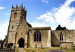
 All Saints' parish church | |
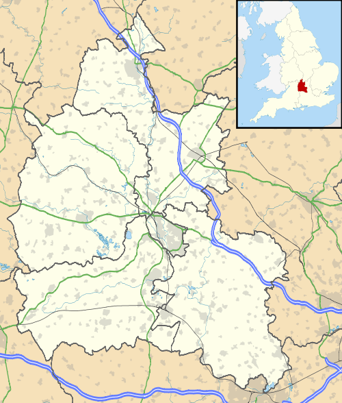
 Coleshill Location within Oxfordshire | |
| Population | 156 (2011 Census) |
| OS grid reference | SU2393 |
| Civil parish |
|
| District | |
| Shire county | |
| Region | |
| Country | England |
| Sovereign state | United Kingdom |
| Post town | Swindon |
| Postcode district | SN6 |
| Dialling code | 01793 |
| Police | Thames Valley |
| Fire | Oxfordshire |
| Ambulance | South Central |
| UK Parliament | |
The village is beside the River Cole, which forms both the western boundary of the parish and also the county boundary with Wiltshire. Coleshill is about 3 miles (5 km) west of the market town of Faringdon, about 2 miles (3 km) east of the Wiltshire town of Highworth. The village is on the B4019 road that links the two towns.
The 2011 Census recorded the population of the parish as 156.[1]
Toponym
The toponym "Coleshill" is derived from the Old English kollr, meaning "head", "top" or "hill". It may be that the river was named after the hill, and then "hill" was added as a suffix to "Cole".[2]
The earliest known record of it is Colleshyll in a Saxon will dated AD 950. The Domesday Book of 1086 records it as Coleselle and Coleshalle. A document dated 1220 and included in the Book of Fees records it as Coleshull.[2] Coleshull and Colleshulle were used from the 14th to the 16th century,[3] before the current form came to be used.
Coleshill estate
The National Trust Coleshill Estate[4] is in the parish. In the Second World War, Coleshill House,[5] on the estate, was the headquarters of the secret Auxiliary Units, who were to resist Nazi German forces if the United Kingdom were invaded.[6] Coleshill House burned down in 1952.[7]
Parish church
The oldest parts of the Church of England parish church of All Saints are late 12th-century;[8] other parts are 13th-century and the tower is 15th-century. The building was refashioned in the 18th century and restored by Street.[9]
In 1708 Abraham I Rudhall of Gloucester cast a ring of five bells for the west tower. In 1884 Mears and Stainbank of the Whitechapel Bell Foundry recast the third bell.[3] In 1938 Mears and Stainbank cast a new treble bell to increase the ring to six.[10]
All Saints is a Grade II* listed building.[8]

Notable people
The record producer Sir George Martin lived at the former rectory until his death in March 2016. His private funeral was held in All Saints parish church.[13]
References
- "Coleshill Parish". nomis. Office for National Statistics. Retrieved 31 July 2018.
- Ekwall 1960, Coleshill
- Ditchfield & Page 1924, pp. 517–523.
- "The Buscot and Coleshill Estates". National Trust. Retrieved 25 August 2015.
- "Coleshill House Pre War". Coleshill Auxiliary Research Team. Retrieved 27 February 2012.
- "The Auxiliary Units History". Coleshill Auxiliary Research Team. Retrieved 27 February 2012.
- "Coleshill House Post War". Coleshill Auxiliary Research Team. Retrieved 27 February 2012.
- Historic England. "Church of All Saints (Grade II*) (1368120)". National Heritage List for England. Retrieved 31 July 2018.
- Betjeman, J. (ed.) (1968) Collins Pocket Guide to English Parish Churches: the South. London: Collins; p. 112
- Davies, Peter (1 February 2018). "Coleshill All Saints". Dove's Guide for Church Bell Ringers. Central Council of Church Bell Ringers. Retrieved 31 July 2018.
- Historic England. "The Radnor Arms public house (Grade II) (1052658)". National Heritage List for England. Retrieved 31 July 2018.
- The Radnor Arms
- "Sir George Martin: Private funeral held for producer". BBC News. 15 March 2016.
Bibliography
- Ditchfield, PH; Page, William, eds. (1924). "Coleshill". A History of the County of Berkshire. Victoria County History. IV. assisted by John Hautenville Cope. London: The St Katherine Press. pp. 517–523.CS1 maint: ref=harv (link)
- Ekwall, Eilert (1960) [1936]. Concise Oxford Dictionary of English Place-Names (4th ed.). Oxford: Oxford University Press. Coleshill. ISBN 0198691033.CS1 maint: ref=harv (link)
- Pevsner, Nikolaus (1966). Berkshire. The Buildings of England. Harmondsworth: Penguin Books. pp. 117–119.CS1 maint: ref=harv (link)
