Grade I listed buildings in Vale of White Horse
There are more than 9,000 Grade I listed buildings in England. This page is a list of these buildings in the district of Vale of White Horse in Oxfordshire.
List of buildings
| Name | Location | Type | Completed [note 1] | Date designated | Grid ref.[note 2] Geo-coordinates |
Entry number [note 3] | Image |
|---|---|---|---|---|---|---|---|
| Abbey Gate | Abingdon Abbey | Gateway | Late 15th century | 19 January 1951 | SU4985097076 51°40′13″N 1°16′50″W |
1368671 | 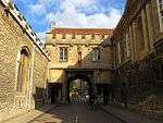 Abbey Gate |
| Brick Alley Almshouses | Abingdon | Almshouse | 1718 | 10 December 1971 | SU4969696732 51°40′02″N 1°16′58″W |
1200005 | .jpg) Brick Alley Almshouses |
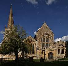
| Church of St Helen | Abingdon | Church | Late 12th or early 13th century | 19 January 1951 | SU4969496775 51°40′03″N 1°16′58″W |
1300979 | |
| Church of St Nicholas | Abingdon | Church | c.1170 | 19 January 1951 | SU4984397082 51°40′13″N 1°16′50″W |
1048110 | 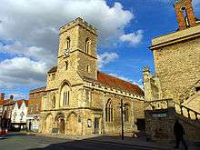 Church of St Nicholas |
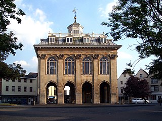
| County Hall and Market House | Abingdon | County hall | 1678–83 | 19 January 1951 | SU4978597051 51°40′12″N 1°16′53″W |
1199601 | |
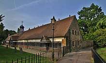
| Long Alley Almshouses | Abingdon | Almshouses | c.1500 | 19 January 1951 | SU4966396729 51°40′02″N 1°17′00″W |
1048811 | |
| The Checker Unicorn Theatre | Abingdon Abbey | Abbey | 13th century | 19 January 1951 | SU4997397022 51°40′11″N 1°16′44″W |
1048108 | 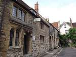 The Checker Unicorn Theatre |
| The Long Gallery | Abingdon Abbey | Abbey | c.1500 | 19 January 1951 | SU4999097035 51°40′12″N 1°16′43″W |
1048107 | 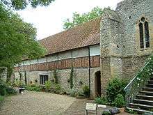 The Long Gallery |
| Unicorn Theatre | Abingdon Abbey | House | 13th century | 19 January 1951 | SU4996397012 51°40′11″N 1°16′44″W |
1048844 | Unicorn Theatre |
| Ashdown House | Ashbury | Country house | c.1662 | 10 November 1952 | SU2820382009 51°32′11″N 1°35′41″W |
1048765 | |
| Ashdown House, pavilion and attached wall approximately 20 metres south-east | Ashbury | Pavilion | c.1662 | 10 November 1952 | SU2823482003 51°32′10″N 1°35′40″W |
1048767 | 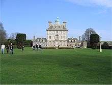 Ashdown House, pavilion and attached wall approximately 20 metres south-east |
| Ashdown House, pavilion approximately 20 metres north-east | Ashbury | Pavilion | c.1662 | 10 November 1952 | SU2822582033 51°32′11″N 1°35′40″W |
1048766 | Ashdown House, pavilion approximately 20 metres north-east |
| Church of St Mary | Ashbury | Church | 12th century | 21 November 1966 | SU2653284919 51°33′45″N 1°37′07″W |
1048770 | 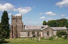 Church of St Mary |
| Church of St Nicholas | Baulking | Church | Mid-13th century | 21 November 1966 | SU3172690705 51°36′51″N 1°32′36″W |
1048680 | 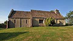 Church of St Nicholas |
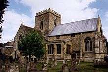
| Church of St Michael | Blewbury | Church | 11th century | 24 November 1966 | SU5314685917 51°34′11″N 1°14′05″W |
1368625 | 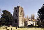 Church of St Michael |
| Church of St Mary | Buckland | Church | 1707 | 21 November 1966 | SU3427398205 51°40′54″N 1°30′20″W |
1181905 | 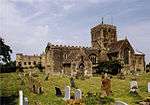 Church of St Mary |
| The Church of St Mary | Buscot | Church | 13th century | 21 November 1966 | SU2265998142 51°40′54″N 1°40′25″W |
1368093 | 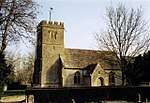 The Church of St Mary |
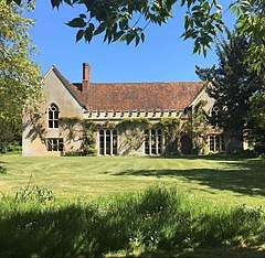
| Charney Manor | Charney Bassett | Manor house | Late 13th century | 10 November 1952 | SU3810794442 51°38′51″N 1°27′02″W |
1182077 | |
| Church of St Peter | Charney Bassett | Church | Early 12th century | 21 November 1966 | SU3809994425 51°38′50″N 1°27′03″W |
1182087 | 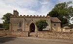 Church of St Peter |
| Church of St Mary | Childrey | Church | Early 13th century | 24 November 1966 | SU3600387794 51°35′16″N 1°28′54″W |
1048743 | 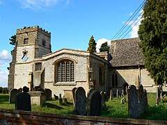 Church of St Mary |
| Coleshill Park, Great Piers, including cast-iron gates | Coleshill | Gate | Late 18th century | 10 November 1952 | SU2422093902 51°38′36″N 1°39′05″W |
1052691 | 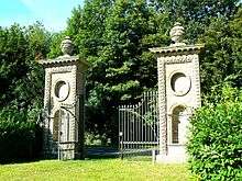 Coleshill Park, Great Piers, including cast-iron gates |
| Compton Beauchamp House and walling and attached bridge to north | Compton Beauchamp | Country house | 16th century | 10 November 1952 | SU2798686926 51°34′50″N 1°35′51″W |
1368367 | 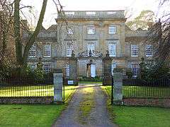 Compton Beauchamp House and walling and attached bridge to north |
| Church of St Michael | Cumnor | Church | Late 12th century | 9 February 1966 | SP4614704134 51°44′02″N 1°19′59″W |
1048342 | 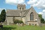 Church of St Michael |
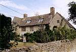
| Jesus Chapel and Attached House | East Hendred | House | 15th century | 25 October 1951 | SU4604688891 51°35′49″N 1°20′12″W |
1048167 | 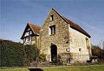 Jesus Chapel and Attached House |
| Church of All Saints | Faringdon | Church | 12th century | 21 November 1966 | SU2887395724 51°39′34″N 1°35′02″W |
1199147 | 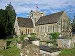 Church of All Saints |
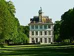
| Faringdon House | Faringdon | Country house | 1770–85 | 10 November 1952 | SU2879195900 51°39′40″N 1°35′07″W |
1048410 |  |
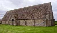
| The Great Barn | Great Coxwell | Barn | Early 13th century | 21 November 1966 | SU2689694029 51°38′40″N 1°36′46″W |
1183045 | |
| Church of St Mary | Longworth | Church | Early 13th century | 21 November 1966 | SU3840599468 51°41′34″N 1°26′45″W |
1048616 | |
| Milton Manor Cottage and Milton Manor House | Milton | Manor house | c.1776 | 6 August 1952 | SU4841392385 51°37′42″N 1°18′07″W |
1048220 | 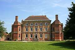 Milton Manor Cottage and Milton Manor House |
| Church of St Faith | Shellingford | Church | 12th century | 2 November 1966 | SU3195193515 51°38′22″N 1°32′23″W |
1368447 | 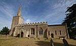 Church of St Faith |
| China House to west of Beckett Hall | Shrivenham | Fishing lodge | c.1635–55 | 21 July 1982 | SU2460189120 51°36′01″N 1°38′46″W |
1048793 | |
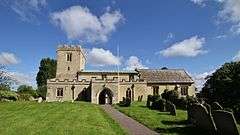
| Church of St Andrew | Shrivenham | Church | Early 15th century | 21 November 1966 | SU2407589078 51°36′00″N 1°39′14″W |
1284309 | 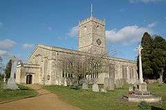 Church of St Andrew |
| Church of the Holy Rood | Sparsholt | Church | Late 12th century | 24 November 1966 | SU3468487540 51°35′08″N 1°30′03″W |
1048702 | 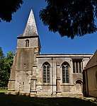 Church of the Holy Rood |
| Church of St Denys | Stanford in the Vale | Church | Late 12th century | 21 November 1966 | SU3419693468 51°38′20″N 1°30′26″W |
1048607 | 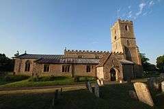 Church of St Denys |
| Church of St Michael and All Angels | Steventon | Church | Early 14th century | 9 February 1966 | SU4644191427 51°37′11″N 1°19′50″W |
1181950 | 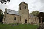 Church of St Michael and All Angels |
| Church of All Saints | Sutton Courtenay | Church | 13th to 15th century | 9 February 1966 | SU5048594194 51°38′39″N 1°16′18″W |
1182209 | 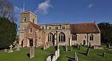 Church of All Saints |
| The Abbey | Sutton Courtenay | House | 16th century | 6 September 1952 | SU5026994000 51°38′33″N 1°16′30″W |
1052729 | |
| The Norman Hall | Sutton Courtenay | House | Late 12th century | 6 August 1952 | SU5042694266 51°38′42″N 1°16′21″W |
1182314 | 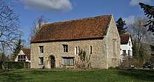 The Norman Hall |
| Church of St Mary | Uffington | Church | c.1250 | 11 December 1985 | SU3023089317 51°36′07″N 1°33′54″W |
1198865 | 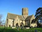 Church of St Mary |
| Church of St Peter and St Paul | Wantage | Church | Late 13th century | 22 April 1950 | SU3969087912 51°35′19″N 1°25′43″W |
1048567 | |
| Church of the Holy Trinity | West Hendred | Church | 14th century | 24 November 1966 | SU4473288281 51°35′30″N 1°21′20″W |
1200322 | 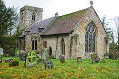 Church of the Holy Trinity |
| Wytham Abbey and attached wall | Wytham | Country house | Late 15th and 16th century | 6 August 1952 | SP4741608515 51°46′24″N 1°18′51″W |
1368599 | 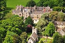 Wytham Abbey and attached wall |
gollark: !pingwhen online @join.liftA2(<>)inits tails
gollark: !pingwhen online @join.liftA2(<>)inits tails
gollark: ++exec```haskellwithIndices :: [a] -> [(Int, a)]withIndices = zip [1..]doStuff :: String -> [(Int, Int, Char)]doStuff s = (\(lineIx, l) -> fmap (\(charIx, char) -> (lineIx, charIx, char)) $ withIndices l) `concatMap` withIndices (lines s)main = print . doStuff $ "abcd"```
gollark: >eval 1 + 9
gollark: >fortune
See also
Notes
- The date given is the date used by Historic England as significant for the initial building or that of an important part in the structure's description.
- Sometimes known as OSGB36, the grid reference is based on the British national grid reference system used by the Ordnance Survey.
- The "List Entry Number" is a unique number assigned to each listed building and scheduled monument by Historic England.
External links
![]()
This article is issued from Wikipedia. The text is licensed under Creative Commons - Attribution - Sharealike. Additional terms may apply for the media files.