Frœschwiller
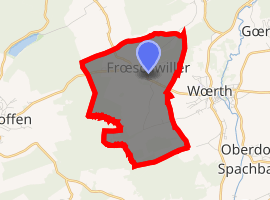
Frœschwiller (German: Fröschweiler) is a commune in the Bas-Rhin department in Grand Est in north-eastern France. Of note is Château de Frœschwiller.
Frœschwiller Freschwiller | |
|---|---|
The town hall in Frœschwiller | |
.svg.png) Coat of arms | |
Location of Frœschwiller 
| |
 Frœschwiller  Frœschwiller | |
| Coordinates: 48°56′40″N 7°43′22″E | |
| Country | France |
| Region | Grand Est |
| Department | Bas-Rhin |
| Arrondissement | Haguenau-Wissembourg |
| Canton | Reichshoffen |
| Government | |
| • Mayor (2008–2014) | Jean Muller |
| Area 1 | 5.75 km2 (2.22 sq mi) |
| Population (2017-01-01)[1] | 503 |
| • Density | 87/km2 (230/sq mi) |
| Time zone | UTC+01:00 (CET) |
| • Summer (DST) | UTC+02:00 (CEST) |
| INSEE/Postal code | 67147 /67360 |
| Elevation | 188–262 m (617–860 ft) |
| 1 French Land Register data, which excludes lakes, ponds, glaciers > 1 km2 (0.386 sq mi or 247 acres) and river estuaries. | |
The commune lies within the North Vosges regional natural park.
Historical vignettes
- In 1552 the Protestant Reformation reached Frœschwiller when Kuno Eckbrecht of Dürckheim ordered the construction of the village's first church on the seigneurial lands.
- On 22 December 1793 republican troops under General Lazare Hoche defeated the Habsburg army under Field Marshal Dagobert Sigmund von Wurmser in the Battle of Froeschwiller. This success helped to evict the Austrians from French territory.
- On 6 August 1870, as a result of the Battle of Frœschwiller-Wœrth, the two Alsatian départements (apart from the area that subsequently became the Territory of Belfort) as well as most of the Moselle département were lost. They would remain under German control until 1918.
gollark: Why would they special-case collatzen?
gollark: Hahahahahahahano.
gollark: Excellent, GTech™ apio{REDACTED} successful.
gollark: No, we just found it convenient to pretend that, for purposes.
gollark: Just use... gluon?
See also
References
- "Populations légales 2017". INSEE. Retrieved 6 January 2020.
| Wikimedia Commons has media related to Frœschwiller. |
This article is issued from Wikipedia. The text is licensed under Creative Commons - Attribution - Sharealike. Additional terms may apply for the media files.