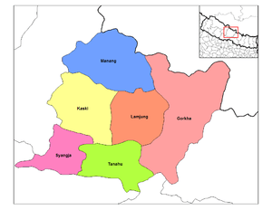
Former administrative units of Nepal
Former administrative units of Nepal are administrative divisions during Kingdom of Nepal. In 2008 Nepal was proclaimed a federal republic and old administrative units restricted after adoption of new constitution on 20 September 2015.[1]
| This article is part of a series on |
| Administrative divisions of Nepal |
|---|
 |
| Federal Democratic Republic of Nepal (Since 2015) |
|
Provinces: 7 (First level) |
|
Districts: 77 (Second level) |
|
Local level body: 753 (Third level)
|
|
Wards: 6743 (last level)
|
| Kingdom of Nepal (1768-2008) |
|
Development regions: 5 (First level)
|
|
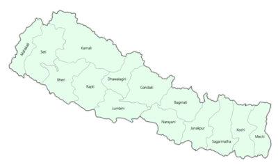
Zones of Nepal: 14 (Second level) Mechi Zone • Kosi Zone • Sagarmatha Zone • Janakpur Zone • Bagmati Zone • Narayani Zone • Gandaki Zone • Lumbini Zone • Dhaulagiri Zone • Rapti Zone • Karnali Zone • Bheri Zone • Seti Zone • Mahakali Zone |
|
Districts: 75 (Third level)
|
|
VDC:3157 (fourth level) |
|
Wards (last level)
|
|
Nepal Portal Administrative divisions by country |
Formerly, Nepal was divided into 5 development regions, 14 zones, 75 districts, 58 municipalities (before 2014) and 3157 village development committee.[2][3][4][5]
History
Kingdom of Nepal was formed in 1768, by unification of Nepal.[6]
Before the treaty of Sugauli in 1814-16, the territories under Nepalese control included Darjeeling to the South-east, whole of Sikkim to the east, Nainital to the south-west and the Kumaon Kingdom and Garhwal Kingdom to the west.[7]
After the Sugauli treaty in 1814-16 Nepal came to existence in today's shape. During the time of king Rajendra Bir Bikram Shah and prime minister Bhimsen Thapa, Nepal was divided into 10 districts.[8]
During the time of prime minister Bir Shumsher Jang Bahadur Rana (1885-1901) Nepal was divided into 32 districts and Doti, Palpa and Dhankuta were 3 gaunda (Nepali: गौंडा) (english meaning: Cantonment). Hilly region had 20 districts and Terai had 12 districts.[8]
Even after Bir Shumsher Jang Bahadur Rana to the end of Rana rule in Nepal in 1951 and till the proclamation of new constitution of Kingdom of Nepal in 1962, Nepal remained divided into 32 districts. Each had a headquarters and Bada Haqim (District Administrator) as its head. From 1951 to 1962 many acts and constitutions passed which shows name of 32 districts.[9][10][11]
In 1962, the reorganisation of traditional 35 districts into 14 zones and 75 development Districts.[12]
In 1972 (2029 B.S.). The late King Birendra in assistance with renowned scholar late Dr. Hark Gurung brought forth the concept of regional development for the harmonious developments of all parts of the country. Subsequently, he divided Nepal into 4 Development Regions in 1972: Eastern, Central, Western and Far Western. Since the Far Western Development Region became too large in size, it was further divided by creating the Mid-Western Development Region in 1981. Mid-western Development Region was created out of Karnali, Rapti and Bheri zones. It was done with the objective to achieve balanced, effective and rapid development programs in the country.[13]
Development Regions
Prior to September 2015, Nepal was divided into 5 Development regions. They were first-level of administrative divisions.[14]

| sr. | Development Regions | Nepali Name | Headquarters | Area (km2.) | Population (2011) |
|---|---|---|---|---|---|
| 1 | Eastern Development Region | पुर्वाञ्चल विकास क्षेत्र | Dhankuta | 28,456 | 5,811,555 |
| 2 | Central Development Region | मध्यमाञ्चल विकास क्षेत्र | Kathmandu | 27,410 | 9,656,985 |
| 3 | Western Development Region | पश्चिमाञ्चल विकास क्षेत्र | Pokhara | 29,398 | 4,926,765 |
| 4 | Mid-Western Development Region | मध्य पश्चिमाञ्चल विकास क्षेत्र | Birendranagar | 42,378 | 3,546,682 |
| 5 | Far-Western Development Region | सुदुर पश्चिमाञ्चल विकास क्षेत्र | Dipayal | 19,539 | 2,552,517 |
| Nepal | नेपाल | Kathmandu | 147,181 | 26,494,504 |
Zones
There were 14 zones divided into 5 development regions. Each development region had 3 zones. Only the Far-Western Development Region had 2 zones.
| sr. | Regions | Zones | Headquarters | Area (km2.) | Population (2011) |
|---|---|---|---|---|---|
| 1 | Eastern | Mechi Zone | Ilam | 8,196 | 1,422,182 |
| 2 | Koshi Zone | Biratnagar | 9,669 | 2,335,047 | |
| 3 | Sagarmatha Zone | Rajbiraj | 10,591 | 2,054,326 | |
| 4 | Central | Janakpur Zone | Jaleshwar | 9,669 | 2,837,481 |
| 5 | Bagmati Zone | Kathmandu | 9,428, | 3,843,596 | |
| 6 | Narayani Zone | Birgunj | 8,313 | 2,975,908 | |
| 7 | Western | Gandaki Zone | Pokhara | 12,275 | 1,549,857 |
| 8 | Lumbini Zone | Butwal | 8,975 | 2,834,612 | |
| 9 | Dhawalagiri Zone | Baglung | 8,148 | 542,296 | |
| 10 | Mid-West | Rapti Zone | Tulsipur | 10,482 | 1,456202 |
| 11 | Karnali Zone | Chandannath | 21,351 | 388,713 | |
| 12 | Bheri Zone | Nepalganj | 10,545 | 1701,767 | |
| 13 | Far-West | Seti Zone | Dhangadhi | 12,550 | 1,575,003 |
| 14 | Mahakali Zone | Bhimdatta | 6,989 | 977,514 | |
| Nepal | 14 Zones | Kathmandu | 147,181 | 26,494,504 |
Districts
There were 75 districts in Nepal before 2015. They were grouped together to form zones. 2 new districts formed after 2015. District Development Committees (DDCs) were established to carry out all the administrative as well as clerical functions of a district.
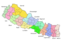
List of Districts (Zonewise):
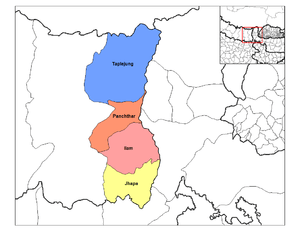
Mechi Zone
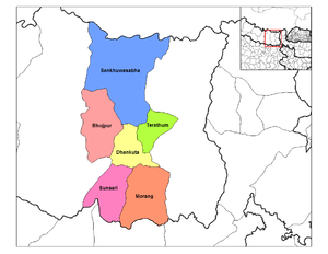
Koshi Zone
- Outer Terai
- Morang District (Biratnagar)
- Sunsari District (Inaruwa)
- Hill
- Bhojpur District (Bhojpur)
- Dhankuta District (Dhankuta)
- Terhathum District (Myanglung)
- Mountain
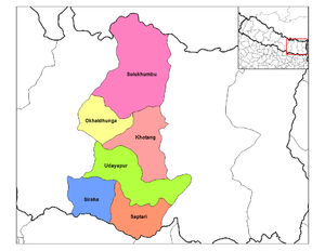
Sagarmatha Zone
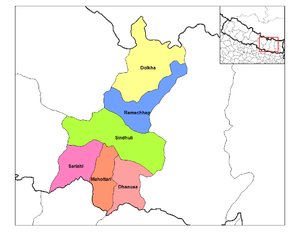
Janakpur Zone
- Outer Terai
- Dhanusa District (Janakpur)
- Mahottari District (Jaleswar)
- Sarlahi District (Malangwa)
- Inner Terai
- Hill
- Ramechhap District (Manthali)
- Mountain
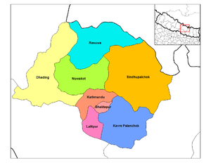
Bagmati Zone
Narayani Zone
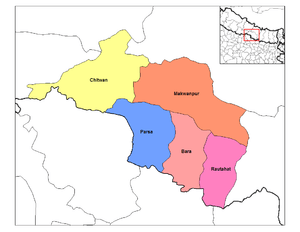
Lumbini Zone

Daulagiri Zone
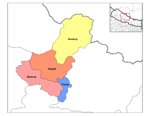
- Hill
- Baglung District (Baglung)
- Myagdi District (Beni)
- Parbat District (Kusma)
- Mountain
Rapti Zone
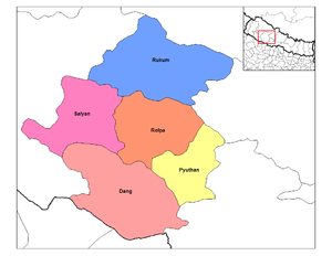
- Inner Terai
- Hill
- Pyuthan District (Pyuthan Khalanga)
- Rolpa District (Liwang)
- Rukum District (Musikot)
- Salyan District (Salyan Khalanga)
Karnali Zone
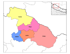
Bheri Zone
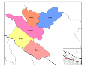
- Outer Terai
- Banke District (Nepalganj)
- Bardiya District (Gulariya)
- Inner Terai
- Hill
- Dailekh District (Narayan)
- Jajarkot District (Khalanga)
Seti Zone
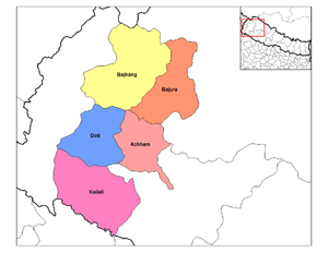
Mahakali Zone
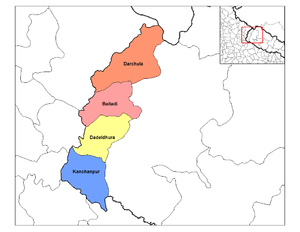
- Outer Terai
- Kanchanpur District (Bhim Datta)
- Inner Terai and Hill
- Hill
- Mountain
Municipalities
Municipalities are an administrative units to work in urban area. There were only 58 following Municipalities in Nepal before 2014.[15]
|
|
|
|
|
Village Development Committees
Formally, Villages were administered by Village development committees in Nepal. They were dissolved before the new constitution in 2015 and formed Gaunpalika.
National Association of Village Development Committees in Nepal (NAVIN) was established in the year 1996 as an umbrella organization to represent and provide support to Nepal's 3915 VDCs (Village Government in Nepal). In a short span of its origin, NAVIN has been able to establish itself, both nationally and internationally, as a reputable representative organization of VDCs and has founded itself as a pioneer partner organization for decentralization and democratization process in Nepal.[16] The Village Development Committee were defunct in March 2017 and replaced with Gaupalika
See also
- Development Regions of Nepal
- List of zones of Nepal
- List of village development committees of Nepal
External links
- Digitalhimalaya.com: Collection of Nepalese District maps — from the Digital Himalaya database project.
- Myholidaynepal.com: Places of Nepal
References
- Kathmandu Post (2017). "744 new local units come into effect". Kantipur Publications Pvt. Ltd.
- "Administratively Nepal is divided into 5 Regions, 14 Zones and 75 Districts. Population figure". digitallibrary.usc.edu. International Mission Photography Archive (IMPA). Retrieved 31 January 2018.
- "75 Districts 14 Zones and 5 Development Regions". www.weallnepali.com. Retrieved 31 January 2018.
- "Village Development Committees (VDCs) in Nepal - list and details". www.weallnepali.com. Retrieved 31 January 2018.
- "New Municipalities: A Decision Without Vision". nepaliheadlines.com. Retrieved 31 January 2018.
- "TIMELINE: Milestones in political history of Nepal". www.reuters.com. 28 May 2008. Retrieved 6 February 2018.
..." "
- "Gorkhas Unrest in India and Their Nepal Connections". southasiajournal.net. 16 July 2017. Retrieved 6 February 2018.
..."Historically, the present Indian Gorkhas territories, Darjeeling, and the surroundings were part of Nepal. The current border between Nepal and India was set after the former’s defeat at the hands of British in 1814 which led to the Treaty of Sugauli with Nepal losing the territories of Darjeeling to the East and Kumaon and Garhwal up to Sutlez river in the West."
- संक्षिप्त परिचय [Short Intro]. ddcdhankuta.gov.np (in Nepali). Govt of Nepal. Retrieved 6 February 2018.
..."श्री ५ राजेन्द्रविक्रम शाह र प्रधानमन्त्री भीमसेन थापाको शासनकालमा प्रशासनिक दृष्टिकोणले वि.सं.१८७३ साल पश्चात देश १० जिल्लामा विभाजन भयो।"
- "Government of Nepal Act 1948" (PDF).
- प्रशासकीय पुनर्गठन समिति (बुच कमिशन) को प्रतिवेदन, २००९ (PDF).
- नेपालको जिल्ला प्रशासन पुनर्गठनको रिपोर्ट, २०१३ (PDF).
- "Memorial Step of King Mahendra in 1st Poush 2017 BS". reviewnepal.com. 13 December 2017. Retrieved 6 February 2018.
..." "
- "Where is Nepal?". www.expeditionsnepal.com. Retrieved 6 February 2018.
..." In 1972, King Birendra divided the nation into four development regions, 14 zones and 75 districts. He further divided nation and added one more development region in 1982. "
- "Nepal population statistics". GeoHive.com. Archived from the original on 2015-07-04. Retrieved 2015-06-02.
- "Municipalities and VDCs". www.geocities.ws/. Retrieved 28 May 2018.
- "National Association of VDCs in Nepal". Navin.org.np. Retrieved 2015-06-02.
