Dhaulagiri Zone
Dhaulagiri (Nepali: धौलागिरी अञ्चल![]()
Dhaulagiri Zone धौलागिरी अञ्चल | |
|---|---|
Zone | |
 Dhaulagiri Zone | |
| Country | |
| Area | |
| • Total | 8,148 km2 (3,146 sq mi) |
| Population (2001) | |
| • Total | 556,191 |
| • Density | 68/km2 (180/sq mi) |
| Time zone | [[UTC+5:45]] (Nepal Time) |
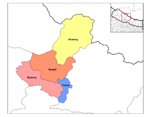
Districts
Dhaulagiri was divided into 4 districts; since 2015, these districts have been redesignated as parts of Gandaki Pradesh .
| District | Type | Headquarters |
|---|---|---|
| Baglung | Hill | Baglung |
| Mustang | Mountain | Jomsom |
| Myagdi | Hill | Beni |
| Parbat | Hill | Kusma |
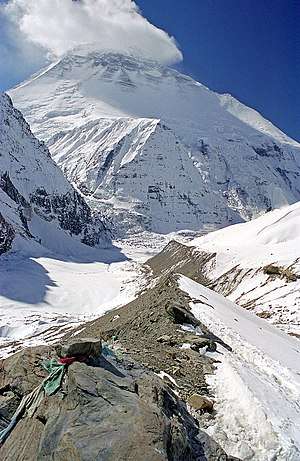
Dhaulagiri Mountain Range
gollark: https://blindsight.space/
gollark: Never actually got round to reading it, although I did watch the short film thing they made of it recently.
gollark: Oh yes, that's apparently pretty good.
gollark: Probably someone else does.
gollark: I don't really have any recommendations like that, then.
See also
- Development Regions of Nepal (Former)
- List of zones of Nepal (Former)
- List of districts of Nepal
| Eastern Region (Purwanchal) |
| |
|---|---|---|
| Central Region (Madhyamanchal) | ||
| Western Region (Pashchimanchal) | ||
| Mid-Western Region (Madhya Pashchimanchal) | ||
| Far-Western Region (Sudur Pashchimanchal) | ||
This article is issued from Wikipedia. The text is licensed under Creative Commons - Attribution - Sharealike. Additional terms may apply for the media files.