Eilean Shona
Eilean Shona (Scottish Gaelic: Eilean Seòna) is a tidal island in Loch Moidart, Scotland. The modern name may be from the Old Norse for "sea island". The pre-Norse Gaelic name, as recorded by Adomnán was Airthrago or Arthràigh, meaning 'foreshore island', similar to the derivation of Erraid.[1][6]


| Gaelic name | Eilean Seòna[1] |
|---|---|
| Pronunciation | [ˈelan ˈʃɔːnə] ( |
| Meaning of name | Possibly from the Norse for 'sea island' |
| Location | |
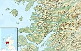
 Eilean Shona Eilean Shona shown within Highland Scotland | |
| OS grid reference | NM645739 |
| Coordinates | 56.8°N 5.9°W |
| Physical geography | |
| Island group | Inner Hebrides |
| Area | 525 hectares (1,300 acres) |
| Area rank | 72 [2] |
| Highest elevation | Beinn a' Bhàillidh, 265 metres (869 ft) |
| Administration | |
| Sovereign state | United Kingdom |
| Country | Scotland |
| Council area | Highland |
| Demographics | |
| Population | 2[3] |
| Population rank | 86= [2] |
| Population density | 0.4 people/km2[3][4] |
| Largest settlement | Invermoidart |
| References | [4][5] |
It was leased to writer J. M. Barrie in the 1920s, who used it as a summer holiday retreat for himself, his foster sons Michael and Nicholas Llewelyn Davies, and a few of their friends.[7] It was here that he wrote a screenplay for the 1924 film adaptation of Peter Pan.
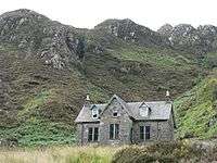
In 1851 there were reports of evacuations and emigrations of 37 families from the island and the nearby settlement of Dorlinn in the wake of potato blight.[8] In 1856 the sale price of the island was just £6,500. Until the middle of the 18th century, Eilean Shona was populated with a number of crofters. The main house was a small hunting lodge owned, in the middle of the 19th century, by a seafaring Captain Swinburne. He collected numerous types of pine on his travels and established what became one of the most diverse Pinetum's in Europe. At the end of the 19th century Edinburgh architect Robert Lorimer was commissioned by the island's owner, a Mr. Thompson, to remodel the main house, doubling its size.
In the 1930s Eilean Shona was given to Lady Howard De Walden as a wedding present by her future husband. During this period numerous improvements to the island, particularly to the grounds and gardens, were made at the beginning of the 20th century by the De Walden family.
Mr and Mrs Digby Vane bought the island in 1962 and sold it to the Stead family in 1982. The island has belonged to the Devereux-Branson family since 1995. Vanessa Branson and Robert Devereux purchased the island in 1995 for around £1.3 million.[4] The current usually resident population is 2,[3] down from 9 in 2001.[9]
Other isles in the loch include Riska Island, Eilean an Fhèidh and Eilean Tioram. Eilean Shona House overlooks Riska and Castle Tioram. The old Schoolhouse (on the North Shore track between Sawmill and Baramore) is in an isolated position, some two miles down a track, reputedly because when it was built in the nineteenth century the wife of the island's owner did not wish to be disturbed by children.[4]
The peninsula of Shona Beag is accessible from the mainland by a short causeway at low tide (grid reference NM 669 739). Eilean Shona is one of 43 tidal islands that can be walked to from the mainland of Great Britain and one of 17 that can be walked to from the Scottish mainland.[10]
| Pronunciation | ||
|---|---|---|
| Scots Gaelic: | Arthraigh | |
| Pronunciation: | [ˈaɾhɾaj] ( | |
| Scots Gaelic: | Beinn a’ Bhàillidh | |
| Pronunciation: | [ˈpeɲ ə ˈvaːʎɪ] ( | |
| Scots Gaelic: | Eilean an Fhèidh | |
| Pronunciation: | [ˈelan ə ˈɲeː] ( | |
| Scots Gaelic: | Eilean Seòna | |
| Pronunciation: | [ˈelan ˈʃɔːnə] ( | |
References
- Mac an Tàilleir, Iain (2003) Ainmean-àite/Placenames. (pdf) Pàrlamaid na h-Alba. Retrieved 26 August 2012.
- Area and population ranks: there are c. 300 islands over 20 ha in extent and 93 permanently inhabited islands were listed in the 2011 census.
- National Records of Scotland (15 August 2013). "Appendix 2: Population and households on Scotland's Inhabited Islands" (PDF). Statistical Bulletin: 2011 Census: First Results on Population and Household Estimates for Scotland Release 1C (Part Two) (PDF) (Report). SG/2013/126. Retrieved 14 August 2020.
- Haswell-Smith, Hamish. (2004) The Scottish Islands. Edinburgh. Canongate.
- Ordnance Survey: Landranger map sheet 40 Mallaig & Glenfinnan (Loch Shiel) (Map). Ordnance Survey. 2009. ISBN 9780319231647.
- Watson, W. J. (1994) The Celtic Place-Names of Scotland. Edinburgh; Birlinn. ISBN 1841583235. First published 1926. pp. 75-76
- Birkin, Andrew, The Lost Boys, (Yale University Press)
- Moidart.org Retrieved 9 July 2007.
- General Register Office for Scotland (28 November 2003) Scotland's Census 2001 – Occasional Paper No 10: Statistics for Inhabited Islands. Retrieved 26 February 2012.
- Caton, Peter (2011) No Boat Required - Exploring Tidal Islands. Matador.

