Droylsden
Droylsden is a town in Tameside, Greater Manchester, England, 4.1 miles (6.6 km) east of Manchester city centre and 2.2 miles (3.5 km) west of Ashton-under-Lyne, with a population at the 2011 Census of 22,689.[1]
| Droylsden | |
|---|---|
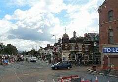 Droylsden town centre | |
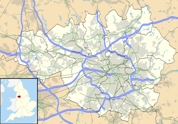 Droylsden Location within Greater Manchester | |
| Population | 22,689 (2011 Census) |
| OS grid reference | SJ8998 |
| • London | 161 miles (259 km) SSE |
| Metropolitan borough | |
| Metropolitan county | |
| Region | |
| Country | England |
| Sovereign state | United Kingdom |
| Post town | MANCHESTER |
| Postcode district | M43 |
| Dialling code | 0161 |
| Police | Greater Manchester |
| Fire | Greater Manchester |
| Ambulance | North West |
| UK Parliament | |
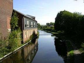
Historically in Lancashire, in the mid-19th century Droylsden grew as a mill town on the Ashton canal. Beginning in the early 1930s, Droylsden's population expanded rapidly as it became a housing overflow area for neighbouring Manchester.
Since 1785, the Fairfield area of Droylsden has been home to a Moravian Church.[2]
History
Droylsden was settled around AD 900. Before Droylsden became a part of Greater Manchester, it was popularly referred to by Mancunians as "The Silly Country".[3] One suggestion as to the source of that nickname is that once a year, some of the townsfolk used to watch an annual carnival by bringing a pig and sitting it on a wall to watch the passing entertainment with them. The Pig on the Wall public house, converted from a farm in 1978, takes its name from that story.
The first machine woven towel in the world – the terry towel – was produced by W. M. Christy and Sons of Fairfield Mills, in Droylsden, in 1851. William Miller Christy's son, Henry Christy, had brought back a looped towel from Turkey in the 1840s, which Christy's managed to copy on an adapted loom. Their Royal Turkish towels became famous, with Queen Victoria having a regular order. The mill closed at the end of the 1980s, and in 1997 Tesco opened a supermarket on the site.[4]
Construction of a marina began in March 2007, and was completed in 2012. The marina has 92 three and four-bedroom houses, and 291 one and two-bedroom apartments as well as waterside offices, restaurants, and shops.[5]
Geography
Droylsden is located at 53°28′58″N 2°9′30″W (53.4826, −2.1582), about 4 miles (6 km) to the east of Manchester city centre, close to Ashton-under-Lyne, Failsworth, Clayton, Openshaw and Newton Heath.
Transport
Rail
Droylsden is not directly served by railway with the nearest station being Fairfield railway station approximately 1 mile south of the town centre, providing a service to Manchester Piccadilly and Rose Hill Marple. The town's former railway station was open between 1846 and 1968 and located on Lumb Lane, approximately 1 mile north of the town centre on the Huddersfield Line. The nearest station on this line is Ashton-under-Lyne.
Metrolink
From 2013, Droylsden became a terminus on the East Manchester line of the Manchester Metrolink tram network, with services running to Manchester and Bury.[6] Trams now run from Droylsden to Ashton-under-Lyne via Audenshaw and Ashton Moss.[7]
Bus
The town has frequent bus services, the majority operated by Stagecoach Manchester, including the high frequency 216 service running between Manchester city centre and Ashton-under-Lyne.
Education
In January 2009, the closure of Droylsden School Mathematics and Computing College for Girls and Littlemoss High School for Boys was approved by Tameside Council. This was conditional on the Secretary of State signing an Academy Funding Agreement by 30 April 2009 for the two schools to be replaced by Droylsden Academy. Droylsden Academy, which was sponsored by Tameside College, opened in September 2009, in the existing buildings of the two former schools. The new Droylsden Academy building opened on the school site of Droylsden School Mathematics and Computing College for Girls in January 2012.[8]
Fairfield High School for Girls was unaffected by these changes and has been granted Specialist Science College status.
Tameside College also operates a Local Learning Centre for adult learners in Droylsden.
Governance
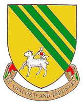
Droylsden was anciently a chapelry in the parish of Manchester, within the historic county boundaries of Lancashire.[9] It became an urban district of the administrative county of Lancashire under the Local Government Act 1894, and was granted its arms on 16 October 1950.[10] In 1974, as a result of the Local Government Act 1972, Droylsden became a part of the Metropolitan Borough of Tameside within the metropolitan county of Greater Manchester.
Droylsden was once a large township, including Big Droylsden, Little Droylsden, and Clayton. In 1889 Little Droylsden was subsumed into Openshaw, and in 1890 Clayton was ceded from Droylsden's control to become part of Manchester.[4]
From 1918 until 1950, Droylsden was represented by the parliamentary constituency of Mossley. Manchester's expansion to the east and the increase in the electorate, resulted in the seat being divided in the 1950 boundary change. The areas adjacent to Manchester, including Droylsden, formed the new Droylsden constituency, with the remainder forming part of Ashton-under-Lyne. The Droylsden constituency was abolished in 1955, when Droylsden itself became part of the Ashton-under-Lyne constituency.
David Heyes MP represented the constituency of Ashton-under-Lyne from 2001 to 2015. He was replaced by his fellow Labour Party member Angela Rayner in the 2015 UK General Election.
Culture
The Droylsden Little Theatre has been running amateur productions since 1931.[11]
Population change
| Population growth in Droylsden since 1801 | |||||||||||||||||||||||||||||
|---|---|---|---|---|---|---|---|---|---|---|---|---|---|---|---|---|---|---|---|---|---|---|---|---|---|---|---|---|---|
| Year | 1801 | 1811 | 1821 | 1831 | 1841 | 1851 | 1861 | 1871 | 1881 | 1891 | 1901 | 1911 | 1921 | 1931 | 1939 | 1951 | 1961 | 1971 | 2001 | 2011 | |||||||||
| Population | 1,552 | 2,201 | 2,855 | 2,996 | 4,933 | 6,280 | 8,798 | 8,973 | 8,679 | 9,482 | 11,087 | 13,259 | 13,878 | 13,274 | 25,279 | 26,363 | 25,461 | 24,167 | 23,172 | 22,834 | |||||||||
| Source:A Vision of Britain through Time[12] | |||||||||||||||||||||||||||||
Economy
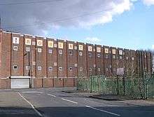
During the 1930s, Droylsden's population expanded rapidly, as it became a housing overflow area for Manchester. Today the area is predominately occupied by employed home owners.
Robertson's Jam was a significant employer in the area. The factory was established in 1891, on the banks of the Ashton Canal, on Ashton Hill Lane. At its peak it employed around 1,000 workers; that number was reduced to around 400 before closing during 2008. The factory was demolished during the early part of 2010.
Sport
Droylsden is home to Droylsden F.C. who won the Conference North league in 2006–07, gaining promotion to the Conference National for the 2007–08 season, although they were relegated back to Conference North for 2008–09, and into the Northern Premier League Premier Division in 2012–13. Now Droylsden play in the Northern Premier League Division One North.
Droylsden is one of a number of locations which are promoted as the birthplace of speedway racing in the UK. Britain's first ever Speedway meeting was staged in Droylsden on 25 June 1927, billed as dirt track racing.
Notable people
England's rugby union captain from 1956 to 1958, Eric Evans MBE, was born in Droylsden in 1921. Harry Pollitt, General Secretary of the Communist Party of Great Britain, was born in the town in 1890.[13]
Rev Arthur Herbert Procter, Victoria Cross recipient, was Rector of St Mary's parish church from 1946 to 1951.[14] A Blue Plaque is at the church.
James Ellor was born in Droylsden on 26 November 1819. At the age of 19, he composed one of the most popular Protestant hymn tunes, Diadem, for the words "All Hail the Power of Jesus' Name" by Edward Perronet. Ellor was a hatter by trade and emigrated to USA in 1843.
Scott Bruton, X Factor finalist in 2008, was raised in the town. Other famous people who grew up in the town include 10cc's Eric Stewart, Howard Donald of Take That, cult author Jeff Noon, actress Stephanie Bishop who starred in the Ken Loach movie Looking for Eric, professional boxer Prince Arron, and the musician known as "Damian".
Cyril Lord (1911-1984), 'the Carpet King', was born and raised in Droylsden. He later established a huge carpet factory in Donaghadee, County Down, Northern Ireland.
Eric Stewart singer-songwriter, multi-instrumentalist and record producer.
Twin Town
- Villemomble, Paris, France
See also
References
Notes
| Wikimedia Commons has media related to Droylsden. |
- "2011 census for Droylsden". Archived from the original on 4 February 2015. Retrieved 4 February 2015.
- "Moravian Atlas UK Congregation Locations 2003". Moravian Church in the British Province. Archived from the original on 17 June 2007. Retrieved 16 May 2007.
- "Memories of the Hollinwood Branch Canal (2)". Hollinwood Canal Society. Retrieved 16 May 2007.
- "Facts about Droylsden". Tameside Metropolitan Borough Council. Archived from the original on 26 September 2007. Retrieved 17 June 2007.
- David Thame (22 November 2007). "Ashton's mall on the up". Manchester Evening News. Retrieved on 4 September 2008.
- "It's the final countdown". Transport for Greater Manchester. Archived from the original on 22 October 2013. Retrieved 8 February 2013.
- "East Manchester line". Metrolink. Retrieved 8 February 2013.
- "Background and vision". About us. Droylsden Academy. Retrieved 28 December 2012.
- "Droylsden". GENUKI. Retrieved 17 June 2007.
- "Civic Heraldry of England & Wales". Retrieved 20 May 2007.
- "Droylesden Little Theatre", Droylsden Little Theatre list of productions, retrieved 25 July 2011
- Nevell (1993), p. 12.
- "A Tribute to Harry Pollitt, 1890–1960". The Tameside Citizen. 12 September 2007. Retrieved 5 October 2008.
- Crockford's Clerical Directory, 1971–72. Oxford University Press. p. 779.
Bibliography
- Nevell, Mike (1993). Tameside 1700–1930. Tameside Metropolitan Borough and University of Manchester Archaeological Unit. ISBN 1-871324-08-4.