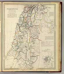
Damascus Eyalet
Damascus Eyalet (Ottoman Turkish: ایالت شام; Eyālet-i Šām)[2] was an eyalet of the Ottoman Empire. Its reported area in the 19th century was 51,900 square kilometres (20,020 sq mi).[3] It became an eyalet after the Ottomans conquered it from the Mamluks in 1516.[4] Janbirdi al-Ghazali, a Mamluk traitor, was made the first beylerbey of Damascus.[5] The Damascus Eyalet was one of the first Ottoman provinces to become a vilayet after an administrative reform in 1865, and by 1867 it had been reformed into the Syria Vilayet.[6]
| Eyalet-i Şam إيالة شام | |||||||||||
|---|---|---|---|---|---|---|---|---|---|---|---|
| Eyalet of the Ottoman Empire | |||||||||||
| 1516–1865 | |||||||||||
.png) The Damascus Eyalet in 1795 | |||||||||||
| Capital | Damascus[1] | ||||||||||
| History | |||||||||||
• Battle of Marj Dabiq | 1516 | ||||||||||
• Disestablished | 1865 | ||||||||||
| |||||||||||
Territorial jurisdiction
The Ottoman Empire conquered Syria from the Mamluks following the Battle of Marj Dabiq in August 1516 and the subsequent pledges of allegiance paid to the Ottoman sultan, Selim I, in Damascus by delegations of notables from throughout Syria.[7] The Ottomans established Damascus as the center of an eyalet (Ottoman province) whose territories consisted of the mamlakat (Mamluk provinces) of Damascus, Hama, Tripoli, Safad and Karak.[8] The mamlaka of Aleppo, which covered much of northern Syria, became the Aleppo Eyalet.[8] For a few months in 1521, Tripoli and its district were separated from Damascus Eyalet, but after 1579, the Tripoli Eyalet permanently became its own province.[8]
At the close of the 16th century, the Damascus Eyalet was administratively divided into the sanjaks (districts) of Tadmur, Safad, Lajjun, Ajlun, Nablus, Jerusalem, Gaza and Karak, in addition to the city of Damascus and its district.[9] There was also the sanjak of Sidon-Beirut, though throughout the late 16th century, it frequently switched hands between the eyalets of Damascus and Tripoli.[10] Briefly in 1614, and then permanently after 1660, the Sidon-Beirut and Safad sanjaks were separated from Damascus to form the Sidon Eyalet.[8] These administrative divisions largely held place with relatively minor changes until the mid-19th century.[11]
Governors
- Janbirdi al-Ghazali (1518–1521)
- Ahmad ibn Ridwan (1601–1607)
- Sulayman Pasha al-Azm (1733–1737; 1741–1743)
- As'ad Pasha al-Azm (1743–1757)
- Uthman Pasha al-Kurji (1760-1771)
- Abdullah Pasha al-Azm (1795-1798; 1799-1803; 1804–1807)
- Mehmed Emin Rauf Pasha (October 1828 - July 1831)
- Mehmed Selim Pasha (1830–1831)
Administrative divisions

Sanjaks of Damascus Eyalet in the 17th century:[12]
- Khass sanjaks (i.e. yielded a land revenue):
- Sanjak of Damascus
- Sanjak of Jerusalem
- Sanjak of Gaza
- Sanjak of Karak
- Sanjak of Safad
- Sanjak of Nablus
- Sanjak of Ajlun
- Sanjak of Lajjun
- Sanjak of Beqaa
- Salyane sanjaks (i.e. had an annual allowance from government):
References
- Commercial statistics: A digest of the productive resources, commercial... By John Macgregor, p. 12, at Google Books
- "Some Provinces of the Ottoman Empire". Geonames.de. Archived from the original on 27 August 2013. Retrieved 25 February 2013.
- The Popular encyclopedia: or, conversations lexicon, Volume 6 , p. 698, at Google Books
- Encyclopedia of the Ottoman Empire, p. 169, at Google Books By Gábor Ágoston, Bruce Alan Masters
- D. E. Pitcher (1972). An Historical Geography of the Ottoman Empire: From Earliest Times to the End of the Sixteenth Century. Brill Archive. p. 105. Retrieved 2 June 2013.
- Almanach de Gotha: annuaire généalogique, diplomatique et statistique. J. Perthes. 1867. pp. 827–829. Retrieved 2013-06-01.
- Ze'evi, pp. 1–2.
- Abu Husayn, p. 11.
- Bakhit 1982, p. 91.
- Abu Husayn, pp. 11–12.
- Salibi, pp. 63–64.
- Narrative of travels in Europe, Asia, and Africa in the ..., Volume 1, p. 90, at Google Books By Evliya Çelebi, Joseph von Hammer-Purgstall
Bibliography
- Abu Husayn, Abdul Rahim (2004). The View from Istanbul: Ottoman Lebanon and the Druze Emirate. I.B.Tauris. ISBN 9781860648564.
- Bakhit, Muhammad Adnan (1982). The Ottoman Province of Damascus in the Sixteenth Century. Librairie du Liban.
- Salibi, Kamal S. (1988). A House of Many Mansions: The History of Lebanon Reconsidered. University of California Press. ISBN 9780520071964.
- Ze'evi, Dror (1996). An Ottoman Century: The District of Jerusalem in the 1600s. Albany: State University of New York Press. ISBN 0-7914-2915-6.