Culbokie
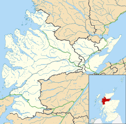
Culbokie (An Cùil Bhàicidh in Gaelic, meaning 'the haunted nook') is a small village in Ross and Cromarty, Highland, Scotland.[1][2][3] It is located on the north side of the Black Isle. The village is 3 miles (5 km) south-east of Dingwall and about 9 miles (14 km) north of Inverness.
Culbokie
| |
|---|---|
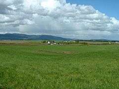
 Culbokie area with lots of nice green pasture. | |
 Culbokie Location within the Ross and Cromarty area | |
| Area | 33 sq mi (85 km2) |
| Population | 1,179 |
| • Density | 36/sq mi (14/km2) |
| OS grid reference | NH 6033 5925 |
| • Edinburgh | 122 mi (196 km) |
| • London | 454 mi (731 km) |
| District |
|
| Council area | |
| Lieutenancy area |
|
| Country | Scotland |
| Sovereign state | United Kingdom |
| Post town | Dingwall |
| Postcode district | IV7 8 |
| Dialling code | 01349 |
| Police | Scotland |
| Fire | Scottish |
| Ambulance | Scottish |
| UK Parliament | |
| Scottish Parliament | |
Village

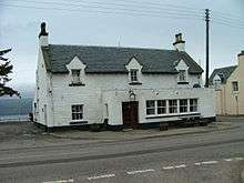
There is one school, a shop/post office, a public house (the Culbokie Inn) and Findon Hall Community Centre. Culbokie has a range of community and youth groups, including Beavers, Cubs, Scouts, Badminton, Playgroup, Football and a Senior Citizens club.
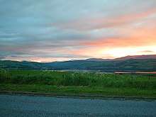
It is known for its spectacular scenery and its old world ambiance including an authentic water pump from the early 19th century.
Since the mid-2000s, the village has expanded significantly and this has resulted in a mismatch of developments. It is unusual in that there is agricultural land separating the east from the west end of the village, in effect making it two entities.

The village is a commuter location for people who work in Inverness. The new Culbokie Primary School opened at Easter 2007.
Community Trust
In 2014, The Culbokie Community Trust was formed[4] following a consultation with the villagers. The village has seen a rapid growth in population due to new housing developments. Despite this, there was no extra facilities built. A major issue that was raised was the fact that there is no health centre nearby for the village and surrounding area.
In 2015, The Trust purchased 0.5 hectares (1.2 acres)[5] of land adjacent to the current village shop and post office. The first phase of development is planned to include the building of a new community hub. The new hub intends to house a cafe, meeting rooms and a healthcare room.
Part of the land is earmarked for affordable housing and as of late-2018 plans have been submitted to the Highland Council for consideration.
Other projects begun by the Trust include; a monthly community market, which sells everything from fresh food to art, and projects in the nearby Culbokie Woods.
References
- "Culbokie". The Gazetteer for Scotland. School of GeoSciences, University of Edinburgh and The Royal Scottish Geographical Society. Retrieved 17 June 2018.
- Ordnance Survey: Landranger map sheet 26 Inverness & Loch Ness (Strathglass) (Map). Ordnance Survey. 2011. ISBN 9780319231128.
- "Ordnance Survey: 1:50,000 Scale Gazetteer" (csv (download)). www.ordnancesurvey.co.uk. Ordnance Survey. 1 January 2016. Retrieved 18 February 2016.
- "Culbokie Community Trust | About the Trust". www.culbokiect.org. Retrieved 12 November 2018.
- "Culbokie Community Trust | GLASCAIRN COMMUNITY PROJECT". www.culbokiect.org. Retrieved 12 November 2018.