Cedarville, Kentucky
Cedarville is a former city in Pike County, Kentucky, United States. The population was 52 at the 2000 census. On December 14, 2009, Cedarville became a part of Elkhorn City.[1]
Cedarville, Kentucky | |
|---|---|
Former city | |
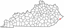 Location of Cedarville, Kentucky | |
| Coordinates: 37°18′51″N 82°21′37″W | |
| Country | United States |
| State | Kentucky |
| County | Pike |
| Incorporated | July 20, 1963 |
| Area | |
| • Total | 0.1 sq mi (0.2 km2) |
| • Land | 0.1 sq mi (0.2 km2) |
| • Water | 0.0 sq mi (0.0 km2) |
| Elevation | 994 ft (303 m) |
| Population (2000) | |
| • Total | 52 |
| • Density | 808.3/sq mi (312.1/km2) |
| Time zone | UTC-5 (Eastern (EST)) |
| • Summer (DST) | UTC-4 (EDT) |
| ZIP code | 41522 |
| Area code(s) | 606 |
| FIPS code | 21-13798 |
| GNIS feature ID | 1669495 |
Geography
Cedarville is located at 37°18′51″N 82°21′37″W (37.314057, -82.360233).[2]
According to the United States Census Bureau, the city has a total area of 0.1 square miles (0.26 km2), all land.
Demographics
| Historical population | |||
|---|---|---|---|
| Census | Pop. | %± | |
| 1970 | 140 | — | |
| 1980 | 81 | −42.1% | |
| 1990 | 65 | −19.8% | |
| 2000 | 52 | −20.0% | |
| U.S. Census Bureau[3] | |||
As of the census[4] of 2000, there were 52 people, 24 households, and 16 families residing in the city. The population density was 808.3 people per square mile (334.6/km2). There were 29 housing units at an average density of 450.8/sq mi (186.6/km2). The racial makeup of the city was 100.00% White. Hispanic or Latino of any race were 9.62% of the population.
There were 24 households, out of which 25.0% had children under the age of 18 living with them, 50.0% were married couples living together, 4.2% had a female householder with no husband present, and 33.3% were non-families. 29.2% of all households were made up of individuals, and 25.0% had someone living alone who was 65 years of age or older. The average household size was 2.17 and the average family size was 2.69.
In the city the population was spread out, with 17.3% under the age of 18, 5.8% from 18 to 24, 28.8% from 25 to 44, 25.0% from 45 to 64, and 23.1% who were 65 years of age or older. The median age was 44 years. For every 100 females, there were 108.0 males. For every 100 females age 18 and over, there were 104.8 males.
The median income for a household in the city was $46,500, and the median income for a family was $50,125. Males had a median income of $50,375 versus $0 for females. The per capita income for the city was $21,045. None of the population and none of the families were below the poverty line.
See also
- Breaks Interstate Park
- Russell Fork River
References
- "Geographic Boundary Change Notes". Population Division, United States Census Bureau. January 1, 2012. Retrieved September 20, 2012.
- "US Gazetteer files: 2010, 2000, and 1990". United States Census Bureau. 2011-02-12. Retrieved 2011-04-23.
- Census Bureau Retrieved on 2010-06-21
- "U.S. Census website". United States Census Bureau. Retrieved 2008-01-31.
Municipalities and communities of Pike County, Kentucky, United States | ||
|---|---|---|
| Cities | 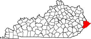 Location of Pike County, Kentucky | |
| CDPs | ||
| Other unincorporated communities |
| |
| Ghost towns | ||