Prestonsburg, Kentucky
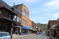
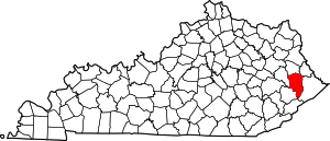
Prestonsburg is a small home rule-class city[4] in and the county seat of Floyd County, Kentucky, United States.[5] It is in the eastern part of the state in the valley of the Big Sandy River. The population was 3,255 at the time of the 2010 census,[6] down from 3,612 at the 2000 census.
Prestonsburg, Kentucky | |
|---|---|
City | |
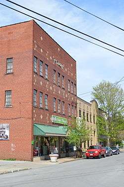
 Front Street | |
| Nickname(s): "Star City of Eastern Kentucky" | |
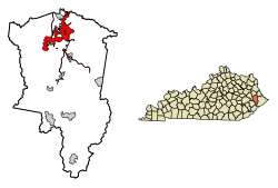
 Location of Prestonsburg in Floyd County, Kentucky. | |
 Prestonsburg Location in Kentucky | |
| Coordinates: 37°40′4″N 82°45′32″W | |
| Country | United States |
| State | Kentucky |
| County | Floyd |
| Established | January 2, 1818[1] |
| Incorporated | March 9, 1867[1] |
| Named for | John Preston, a local landowner |
| Government | |
| • Type | Mayor-Council |
| • Mayor | Les Stapleton |
| Area | |
| • Total | 14.30 sq mi (37.04 km2) |
| • Land | 14.11 sq mi (36.53 km2) |
| • Water | 0.20 sq mi (0.50 km2) |
| Elevation | 633 ft (193 m) |
| Population (2010) | |
| • Total | 3,255 |
| • Estimate (2019)[3] | 3,532 |
| • Density | 250.41/sq mi (96.68/km2) |
| Time zone | UTC-5 (Eastern (EST)) |
| • Summer (DST) | UTC-4 (EDT) |
| ZIP code | 41653 |
| Area code(s) | 606 Exchanges: 236,886,889 |
| FIPS code | 21-62940 |
| GNIS feature ID | 0501307 |
| Website | prestonsburgcity |
History
The area was part of the 100,000-acre (400 km2) grant in the early 1700s to the family of John Preston's wife, born Elizabeth Patton, which he administered on her behalf. The grant was intended to permit British colonization beyond the Blue Ridge Mountains, but subsequent French and Indian resistance and a reversal of British policy limited its impact. The land was not settled until John Spurlock of Montgomery County, Virginia, arrived in 1791. He laid out the town of "Preston's Station" in 1797.[7] It became the seat of Floyd County upon its formation in 1799 and was formally established in 1818.[1] The post office was known as "Floyd Court House" from its establishment in 1816 until the late 1820s, when it was renamed "Prestonsburg".[7]
On January 10, 1862, nearby Middle Creek was the scene of the largest battle of the Civil War to occur in eastern Kentucky. The town was also the site of one of the worst school bus disasters in American history on February 28, 1958.
The town had a pack horse library in the late 1930s to bring library materials to rural mountain residents.[8]
Culture

U.S. Route 23, also called "The Country Music Highway" to celebrate the region's rich heritage of music, runs through Prestonsburg. Country music stars including Loretta Lynn, Crystal Gayle, Wynonna Judd, Naomi Judd, Billy Ray Cyrus, Tom T. Hall, Ricky Skaggs, Keith Whitley, Dwight Yoakam, and Patty Loveless are all from the Big Sandy Valley. Heavy metal singer and guitarist Dave Reffett also grew up near this area.
Prestonsburg is mentioned in Dwight Yoakam's "Readin', Rightin', Rt. 23" (from his album Hillbilly Deluxe), a song about the yearning of local coal miners to escape their plight by traveling up U.S. Route 23 to find employment in the factories in the North, not knowing that they were only trading one miserable life for another.
Prestonsburg is the location of the Mountain Arts Center, which hosts music concerts and is home to the Kentucky Opry. Middle Creek National Battlefield is the site of the largest and most significant Civil War battle in Eastern Kentucky.
Prestonsburg is home to the Samuel May House Living History Museum. It is the oldest known brick home remaining in the Big Sandy Valley. Built by Samuel May in 1817, the house was utilized by the Confederate forces as a recruiting station during the American Civil War. The 5th Kentucky Infantry CSA and 10th Kentucky Cavalry was organized at this location. The house was being used as a residence until 1981 and was donated to the City of Prestonsburg in 1992. The Samuel May House has since been restored and maintained as a living history museum.
The Jenny Wiley Theatre is located in Prestonsburg and offers theatrical productions all year long at both the outdoor Jenny Wiley Amphitheater, located within the Jenny Wiley State Resort Park, and the nearby Mountain Arts Center. The Theatre's presentations of classic Broadway musicals, comedies, historical dramas and holiday productions have kept theatre-goers entertained for the past 40 years.
Prestonsburg is also the home of the East Kentucky Science Center. Opened in 2004, the Science Center contains one of the most technologically advanced planetariums in the United States.
Geography
Prestonsburg is located in northern Floyd County at 37°39′56″N 82°46′18″W (37.6656527, -82.7715486)[9] in the eastern part of the state, along the banks of the Levisa Fork of the Big Sandy River. It is 13 miles (21 km) south of Paintsville and 25 miles (40 km) northwest of Pikeville. According to the United States Census Bureau, Prestonsburg has a total area of 12.9 square miles (33.4 km2), of which 12.7 square miles (32.9 km2) is land and 0.2 square miles (0.5 km2), or 1.52%, is water.[6]
Climate
| Climate data for Prestonsburg, Kentucky | |||||||||||||
|---|---|---|---|---|---|---|---|---|---|---|---|---|---|
| Month | Jan | Feb | Mar | Apr | May | Jun | Jul | Aug | Sep | Oct | Nov | Dec | Year |
| Record high °F (°C) | 80 (27) |
83 (28) |
88 (31) |
93 (34) |
94 (34) |
101 (38) |
105 (41) |
105 (41) |
99 (37) |
89 (32) |
87 (31) |
82 (28) |
105 (41) |
| Average high °F (°C) | 44 (7) |
49 (9) |
60 (16) |
70 (21) |
78 (26) |
86 (30) |
89 (32) |
88 (31) |
81 (27) |
71 (22) |
59 (15) |
48 (9) |
69 (20) |
| Average low °F (°C) | 24 (−4) |
26 (−3) |
34 (1) |
41 (5) |
52 (11) |
61 (16) |
66 (19) |
65 (18) |
57 (14) |
43 (6) |
34 (1) |
27 (−3) |
44 (7) |
| Record low °F (°C) | −26 (−32) |
−16 (−27) |
−4 (−20) |
20 (−7) |
29 (−2) |
36 (2) |
46 (8) |
47 (8) |
35 (2) |
21 (−6) |
13 (−11) |
−10 (−23) |
−26 (−32) |
| Average precipitation inches (mm) | 3.31 (84) |
3.20 (81) |
3.95 (100) |
3.55 (90) |
4.54 (115) |
4.24 (108) |
4.51 (115) |
3.88 (99) |
3.43 (87) |
2.97 (75) |
3.44 (87) |
3.60 (91) |
44.62 (1,133) |
| Source: The Weather Channel.[10] | |||||||||||||
Demographics
| Historical population | |||
|---|---|---|---|
| Census | Pop. | %± | |
| 1840 | 84 | — | |
| 1870 | 179 | — | |
| 1880 | 265 | 48.0% | |
| 1890 | 305 | 15.1% | |
| 1900 | 409 | 34.1% | |
| 1910 | 1,120 | 173.8% | |
| 1920 | 1,667 | 48.8% | |
| 1930 | 2,105 | 26.3% | |
| 1940 | 2,328 | 10.6% | |
| 1950 | 3,585 | 54.0% | |
| 1960 | 3,133 | −12.6% | |
| 1970 | 3,422 | 9.2% | |
| 1980 | 4,011 | 17.2% | |
| 1990 | 3,558 | −11.3% | |
| 2000 | 3,612 | 1.5% | |
| 2010 | 3,255 | −9.9% | |
| Est. 2019 | 3,532 | [3] | 8.5% |
| U.S. Decennial Census[11] | |||
As of the census[12] of 2000, there were 3,612 people, 1,563 households, and 956 families residing in the city. The population density was 332.2 people per square mile (128.3/km2). There were 1,683 housing units at an average density of 154.8 per square mile (59.8/km2). The racial makeup of the city was 97.51% White, 0.33% African American, 0.50% Native American, 0.53% Asian, 0.44% from other races, and 0.69% from two or more races. Hispanic or Latino of any race were 1.02% of the population.
There were 1,563 households, out of which 26.4% had children under the age of 18 living with them, 43.4% were married couples living together, 14.5% had a female householder with no husband present, and 38.8% were non-families. 37.0% of all households were made up of individuals, and 17.0% had someone living alone who was 65 years of age or older. The average household size was 2.09 and the average family size was 2.72.
In the city, the population was spread out, with 20.2% under the age of 18, 9.2% from 18 to 24, 26.1% from 25 to 44, 23.9% from 45 to 64, and 20.5% who were 65 years of age or older. The median age was 41 years. For every 100 females, there were 83.1 males. For every 100 females age 18 and over, there were 80.8 males.
The median income for a household in the city was $20,810, and the median income for a family was $27,852. Males had a median income of $30,809 versus $22,439 for females. The per capita income for the city was $18,013. About 26.3% of families and 27.5% of the population were below the poverty line, including 44.2% of those under the age of 18 and 10.3% of those 65 and older.
Education
- Prestonsburg Elementary School
- James D. Adams Middle School
- Prestonsburg High School
- Big Sandy Community & Technical College
Prestonsburg has a public library, a branch of the Floyd County Public Library.[13]
Recreation
- Archer Park
- Jenny Wiley State Resort Park
- Sugarcamp Mountain Trails
Notable people
- Allison Ball, Kentucky State Treasurer.
- Bert Combs, 50th Governor of Kentucky.
- Boyd Holbrook, actor and fashion model.
- Greg Stumbo, former speaker of the Kentucky House of Representatives.
- Janet Stumbo, former Kentucky Supreme Court justice.
See also
- Highlands Regional Medical Center
- The Floyd County Times
- Big Sandy Area Development District
- East Kentucky Science Center
References
- Commonwealth of Kentucky. Office of the Secretary of State. Land Office. "Prestonsburg, Kentucky". Accessed 27 September 2013.
- "2019 U.S. Gazetteer Files". United States Census Bureau. Retrieved July 24, 2020.
- "Population and Housing Unit Estimates". United States Census Bureau. May 24, 2020. Retrieved May 27, 2020.
- "Summary and Reference Guide to House Bill 331 City Classification Reform" (PDF). Kentucky League of Cities. Retrieved December 30, 2014.
- "Find a County". National Association of Counties. Retrieved 2011-06-07.
- "Geographic Identifiers: 2010 Census Summary File 1 (G001), Prestonsburg city, Kentucky". American FactFinder. U.S. Census Bureau. Archived from the original on February 13, 2020. Retrieved May 23, 2016.
- Rennick, Robert. Kentucky Place Names, p. 242. University Press of Kentucky (Lexington), 1987. Accessed 1 August 2013.
- "At an 'open house' held at". The Courier-Journal. 14 May 1938. Retrieved 3 September 2017 – via Newspapers.com.
- "US Gazetteer files: 2010, 2000, and 1990". United States Census Bureau. 2011-02-12. Retrieved 2011-04-23.
- "MONTHLY AVERAGES for Prestonsburg, KY". The Weather Channel. Retrieved 2010-04-24.
- "Census of Population and Housing". Census.gov. Retrieved June 4, 2015.
- "U.S. Census website". United States Census Bureau. Retrieved 2008-01-31.
- "Kentucky Public Library Directory". Kentucky Department for Libraries and Archives. Archived from the original on 11 January 2019. Retrieved 5 June 2019.
