Canteen Township, St. Clair County, Illinois
Canteen Township is located in St. Clair County, Illinois. As of the 2010 census, its population was 10,263 and it contained 4,027 housing units.[2] Canteen Township was formed from Centreville Station Township when it was subdivided on March 5, 1910.
Canteen Township | |
|---|---|
Township | |
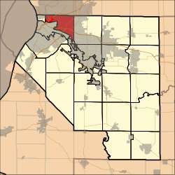 Location in St. Clair County | |
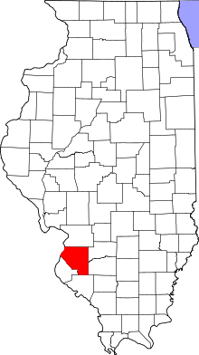 St. Clair County's location in Illinois | |
| Country | United States |
| State | Illinois |
| County | St. Clair |
| Established | March 5, 1910 |
| Area | |
| • Total | 17.37 sq mi (45.0 km2) |
| • Land | 16.96 sq mi (43.9 km2) |
| • Water | 0.41 sq mi (1.1 km2) 2.36% |
| Population (2010) | |
| • Estimate (2016)[1] | 9,698 |
| • Density | 605.1/sq mi (233.6/km2) |
| Time zone | UTC-6 (CST) |
| • Summer (DST) | UTC-5 (CDT) |
| FIPS code | 17-163-10968 |
Geography
According to the 2010 census, the township has a total area of 17.37 square miles (45.0 km2), of which 16.96 square miles (43.9 km2) (or 97.64%) is land and 0.41 square miles (1.1 km2) (or 2.36%) is water.[2]
Demographics
| Historical population | |||
|---|---|---|---|
| Census | Pop. | %± | |
| Est. 2016 | 9,698 | [1] | |
| U.S. Decennial Census[3] | |||
gollark: > allowing developers to utilize blockchain technology without AAAAAAAAAAAAAAAA IT IS ETHEREUM AAAAAAAAAAAAAA
gollark: Waaaaait, is this for Ethereum? Hmm. Bees.
gollark: I mean, they might be reading your crypto secrets out of RAM, and... do you just assume that *some* of them won't be evil and just rerun the computation if the result don't match, or something?
gollark: If you don't trust your compute nodes, you basically can't do anything.
gollark: > The Internet Computer is a decentralized cloud computing platform that will host secure software and a new breed of open internet services. It uses a strong cryptographic consensus protocol to safely replicate computations over a peer-to-peer network of (potentially untrusted) compute nodes, possibly overlayed with many virtual subnetworks (sometimes called shards). Wasm’s advantageous properties made it an obvious choice for representing programs running on this platform. We also liked the idea of not limiting developers to just one dedicated platform language, but making it potentially open to “all of ’em.”How is *that* meant to work?
References
- "Population and Housing Unit Estimates". Retrieved June 9, 2017.
- "Population, Housing Units, Area, and Density: 2010 - County -- County Subdivision and Place -- 2010 Census Summary File 1". United States Census. Archived from the original on 2020-02-12. Retrieved 2013-05-28.
- "Census of Population and Housing". Census.gov. Retrieved June 4, 2016.
External links
Municipalities and communities of St. Clair County, Illinois, United States | ||
|---|---|---|
| Cities | Map of Illinois highlighting St. Clair County | |
| Villages | ||
| Townships | ||
| CDPs | ||
| Other unincorporated communities | ||
| Footnotes | ‡This populated place also has portions in an adjacent county or counties | |

This article is issued from Wikipedia. The text is licensed under Creative Commons - Attribution - Sharealike. Additional terms may apply for the media files.