Buxerolles, Côte-d'Or
Buxerolles is a commune in the Côte-d'Or department in eastern France.
Buxerolles | |
|---|---|
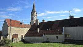 A view within Buxerolles | |
Location of Buxerolles 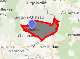
| |
 Buxerolles  Buxerolles | |
| Coordinates: 47°48′28″N 4°55′59″E | |
| Country | France |
| Region | Bourgogne-Franche-Comté |
| Department | Côte-d'Or |
| Arrondissement | Montbard |
| Canton | Châtillon-sur-Seine |
| Intercommunality | Pays Châtillonnais |
| Government | |
| • Mayor (2008–2014) | Jeanne Colombet |
| Area 1 | 11.97 km2 (4.62 sq mi) |
| Population (2017-01-01)[1] | 31 |
| • Density | 2.6/km2 (6.7/sq mi) |
| Time zone | UTC+01:00 (CET) |
| • Summer (DST) | UTC+02:00 (CEST) |
| INSEE/Postal code | 21123 /21290 |
| Elevation | 324–444 m (1,063–1,457 ft) (avg. 374 m or 1,227 ft) |
| 1 French Land Register data, which excludes lakes, ponds, glaciers > 1 km2 (0.386 sq mi or 247 acres) and river estuaries. | |
Population
| Year | Pop. | ±% |
|---|---|---|
| 1962 | 36 | — |
| 1968 | 57 | +58.3% |
| 1975 | 32 | −43.9% |
| 1982 | 34 | +6.2% |
| 1990 | 39 | +14.7% |
| 1999 | 37 | −5.1% |
| 2008 | 24 | −35.1% |
gollark: A fun feature of python is that it actually will run `__main__.py` or something from ZIP files, and ZIP files are weird and backward and can be concatenated onto the end of another file without decoders caring much.
gollark: PNG has some mandatory header parts at the start and I don't think you could make something both a valid PNG and valid in any modern executable format.
gollark: PNG files aren't "run", they're opened and displayed by some sort of image viewer program. And no PNG has no metadata, or it's not actually a valid file. While you can mix hidden data in with the image data, computers will not randomly run that, barring some sort of extremely bad vulnerability.
gollark: It's probably going to be treated as multiple sub-objects for collision detection though.
gollark: I see.
See also
References
- "Populations légales 2017". INSEE. Retrieved 6 January 2020.
| Wikimedia Commons has media related to Buxerolles (Côte-d'Or). |
| Authority control |
|
|---|
This article is issued from Wikipedia. The text is licensed under Creative Commons - Attribution - Sharealike. Additional terms may apply for the media files.