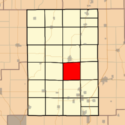
Brushy Mound Township, Macoupin County, Illinois
Brushy Mound Township (T9N R7W) is located in Macoupin County, Illinois, United States. As of the 2010 census, its population was 714 and it contained 357 housing units.[2]
Brushy Mound Township | |
|---|---|
Township | |
 | |
.svg.png) Location of Illinois in the United States | |
| Coordinates: 39°13′N 89°51′W | |
| Country | United States |
| State | Illinois |
| County | Macoupin |
| Settled | November 1, 1870 |
| Area | |
| • Total | 35.74 sq mi (92.6 km2) |
| • Land | 35.23 sq mi (91.2 km2) |
| • Water | 0.51 sq mi (1.3 km2) |
| Elevation | 679 ft (207 m) |
| Population (2010) | |
| • Estimate (2016)[1] | 689 |
| • Density | 20.3/sq mi (7.8/km2) |
| Time zone | UTC-6 (CST) |
| • Summer (DST) | UTC-5 (CDT) |
| FIPS code | 17-117-09135 |
Geography
According to the 2010 census, the township has a total area of 35.74 square miles (92.6 km2), of which 35.23 square miles (91.2 km2) (or 98.57%) is land and 0.51 square miles (1.3 km2) (or 1.43%) is water.[2]
- Carlinville Township (north)
- Shaws Point Township (northeast)
- Honey Point Township (east)
- Cahokia Township (southeast)
- Gillespie Township (south)
- Hillyard Township (southwest)
- Polk Township (west)
- Bird Township (northwest)
Demographics
| Historical population | |||
|---|---|---|---|
| Census | Pop. | %± | |
| Est. 2016 | 689 | [1] | |
| U.S. Decennial Census[3] | |||
gollark: * when
gollark: Generally it *implies* money being involved.
gollark: <https://en.wikipedia.org/wiki/Lobbying>
gollark: > Lobbying, persuasion, or interest representation is the act of attempting to influence the actions, policies, or decisions of officials, most often legislators or members of regulatory agencies. Lobbying, which usually involves direct, face-to-face contact, is done by many types of people, associations and organized groups, including individuals in the private sector, corporations, fellow legislators or government officials, or advocacy groups (interest groups).
gollark: ...
References
- "Population and Housing Unit Estimates". Retrieved June 9, 2017.
- "Population, Housing Units, Area, and Density: 2010 - County -- County Subdivision and Place -- 2010 Census Summary File 1". United States Census. Archived from the original on 2020-02-12. Retrieved 2013-05-28.
- "Census of Population and Housing". Census.gov. Retrieved June 4, 2016.
External links
Municipalities and communities of Macoupin County, Illinois, United States | ||
|---|---|---|
| Cities | Map of Illinois highlighting Macoupin County | |
| Town | ||
| Villages | ||
| Townships | ||
| Unincorporated communities | ||
| Footnotes | ‡This city also has portions in adjacent county or counties | |

This article is issued from Wikipedia. The text is licensed under Creative Commons - Attribution - Sharealike. Additional terms may apply for the media files.