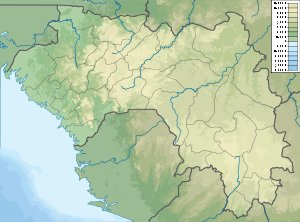
Baie de Sangareya
Sangareya Bay (French: Baie de Sangareya)[1] is a bay in the coast of Guinea on the Atlantic Ocean.
| Sangareya Bay | |
|---|---|
 Sangareya Bay Location in Guinea | |
| Coordinates | 9°38′N 13°45′W |
| Native name | Baie de Sangareya (French) |
| Ocean/sea sources | Atlantic Ocean |
| Basin countries | Guinea |
| Max. length | 15 km (9.3 mi) |
| Max. width | 27 km (17 mi) |
| Islands | Banana Islands |
| Settlements | Conakry |
Geography
The Sangareya Bay opens to the west and is located just to the north of Conakry. The Los Islands (Îles de Los) are located about 2 km off the headland limiting the bay on its southern side.
gollark: I made TomatOS too, which was designed as a stealthier, lightweight potatOS which wouldn't do as much, but it turned out somewhat unreliable.
gollark: I mean, it reads events for its window AND elsewhere.
gollark: No.
gollark: Unless we switch to Wayland, so does Linux.
gollark: On Linux there's some xev command which is able to read *any* input event.
See also
This article is issued from Wikipedia. The text is licensed under Creative Commons - Attribution - Sharealike. Additional terms may apply for the media files.