Altevatnet
Altevatnet (Norwegian) or Álddesjávri (Northern Sami) is Norway’s 11th largest lake. The 79.71-square-kilometre (30.78 sq mi) lake lies in the Bardu Municipality in Troms og Finnmark county, Norway. The lake is the largest lake in the county. It is approximately 38 kilometres (24 mi) long and about 2.5 kilometres (1.6 mi) wide. The lake is regulated by a dam on the northwestern end of the lake. The surface lies 489 metres (1,604 ft) above sea level and reaches a maximum depth of 99 metres (325 ft) below the surface of the lake.[1]
| Altevatnet (Norwegian) | |
|---|---|
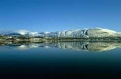 View of the lake | |
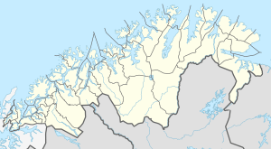 Altevatnet Location of the lake 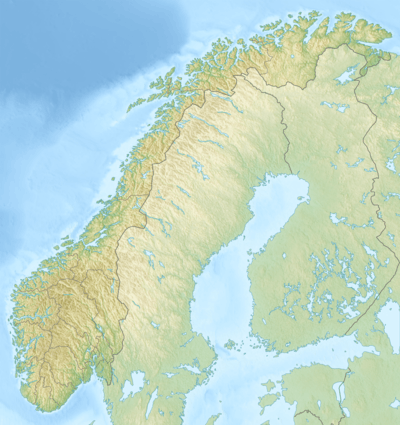 Altevatnet Altevatnet (Norway) | |
| Location | Troms og Finnmark |
| Coordinates | 68.6424°N 19.0859°E |
| Native name | Álddesjávri (Northern Sami) |
| Primary inflows | Barduelva |
| Basin countries | Norway |
| Max. length | 38 kilometres (24 mi) |
| Max. width | 2 kilometres (1.2 mi) |
| Surface area | 79.71 km2 (30.78 sq mi) |
| Max. depth | 99 metres (325 ft) |
| Surface elevation | 489 metres (1,604 ft) |
| References | NVE |
The lake lies about 10 kilometres (6.2 mi) from Sweden and it is located right between the two national parks: Øvre Dividal National Park and Rohkunborri National Park. The water discharges to the north into the Barduelva river, which empties into Målselva river, which in turn empties into the Malangen fjord.[2]
References
- "De største innsjøene i Norge" ["The largest lakes in Norway"] (in Norwegian). Norges vassdrags- og energidirektorat. 2009-04-01. Archived from the original on 2012-05-25. Retrieved 2012-09-19.
- Store norske leksikon. "Altevatnet" (in Norwegian). Retrieved 2012-09-19.