AH51
Asian Highway 51 or AH51 is a route located entirely in Pakistan, running 825 kilometres (513 mi) from Peshawar, Khyber Pakhtunkhwa Province to Quetta, Balochistan Province.[1][2][3]
| ||||
|---|---|---|---|---|
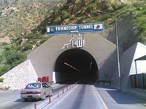 Kohat Tunnel on AH51 | ||||
| Route information | ||||
| Length | 825 km (513 mi) | |||
| Major junctions | ||||
| North end | Peshawar, Khyber Pakhtunkhwa Province | |||
| South end | Quetta, Balochistan Province | |||
| Location | ||||
| Countries | Pakistan | |||
| Highway system | ||||
Asian Highway Network
| ||||

Route
Junctions


gollark: Bees it, this can't even do ARITHMETIC without this recursion.
gollark: I do not want to use this æ regexes. They have a function for something like "split on zero size regexes".
gollark: Fin's parser is some very æ regexes.
gollark: Wait, how do I make an *arithmetic* parser not left-recurse?
gollark: Well, I did that, and people didn't like it.
See also
- Asian Highway 1
- List of Asian Highways
References
- "Asian Highway Handbook" (PDF). New York: UNESCAP. 2003. Retrieved 14 December 2014.
- "Asian Highway Route Map" (PDF). Economic and Social Commission for Asia and the Pacific. Retrieved 14 December 2018.
- "Status paper on Asian Highway - Pakistan" (PDF). UNESCAP. Retrieved 14 December 2018.
- "Asian Highway Database - Country wise". UNESCAP. Retrieved 14 December 2018.
- "Asian Highway route map in Pakistan" (PDF). UNESCAP. Retrieved 14 December 2018.
External links
Treaty on Asian Highways with routes
| Across the whole continent | 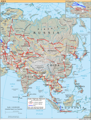 | |
|---|---|---|
| Southeast Asia | ||
| East Asia, Northeast Asia and Southeast Asia | ||
| South Asia | ||
| North Asia, Central Asia and Southwest Asia | ||
This article is issued from Wikipedia. The text is licensed under Creative Commons - Attribution - Sharealike. Additional terms may apply for the media files.