AH60
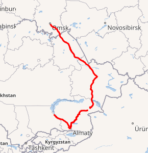
Asian Highway 60 (AH60) is an international route running 2,105 kilometres (1,308 mi) from Omsk, Omsk Oblast, in Russia to Burubaytal, Jambyl Region, in Kazakhstan. About 177 km (110 mi) of route is located in Russia and 1,928 km (1,198 mi) is located in Kazakhstan.[1][2]
| ||||
|---|---|---|---|---|

Map of AH60 in red | ||||
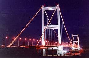
 Semey Bridge on Irtysh River on AH60 | ||||
| Route information | ||||
| Length | 2,105 km (1,308 mi) | |||
| Major junctions | ||||
| North end | Omsk, Omsk Oblast, Russia | |||
| South end | Burubaytal, Kazakhstan | |||
| Location | ||||
| Countries | ||||
| Highway system | ||||
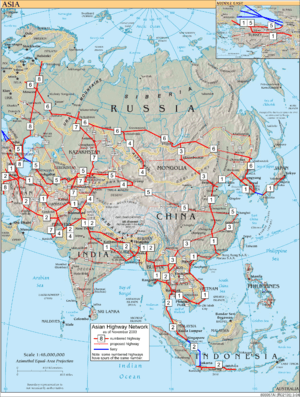
Asian Highway Network
| ||||
Route
Omsk - Cherlak - (Russia–Kazakhstan border) – Pnirtyshskoe – Pavlodar – Semipalatinsk – Georgievka – Taskesken – Ucharal – Almaty – Kaskelen – Burubaytal
Associated routes
Russia

Kazakhstan


Junctions
gollark: Backdoor time!
gollark: Initiate.
gollark: Notification: bee is to deployment.
gollark: \🐝
gollark: [REDACTED] [REDACTED]-meaning.
References
- "Asian Highway Handbook" (PDF). New York. 2003. Retrieved 22 December 2018.
- "Asian Highway Route Map" (PDF). Economic and Social Commission for Asia and the Pacific. Retrieved 22 December 2018.
- "Asian Highway Database - Country wise". UNESCAP. Retrieved 22 December 2018.
- "Asian Highway route map in Russia" (PDF). UNESCAP. Retrieved 22 December 2018.
- "Asian Highway route map in Kazakhstan" (PDF). UNESCAP. Retrieved 22 December 2018.
This article is issued from Wikipedia. The text is licensed under Creative Commons - Attribution - Sharealike. Additional terms may apply for the media files.

