AH11
Asian Highway 11 (AH11) is a road in the Asian Highway Network running 1567 km from Vientiane, Laos to Sihanoukville, Cambodia connecting AH12 to AH1 and continuing to Gulf of Thailand. This international highway connects capitals of Laos and Cambodia.[1][2]
| ||||
|---|---|---|---|---|
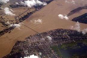 Kizuna Bridge across Mekong river on AH11 | ||||
| Route information | ||||
| Length | 1,567 km (974 mi) | |||
| Major junctions | ||||
| North end | Vientiane, Laos | |||
| South end | Sihanoukville, Cambodia | |||
| Location | ||||
| Countries | Laos, Cambodia | |||
| Highway system | ||||
Asian Highway Network
| ||||

Laos
Cambodia


Junctions
- Laos


- Cambodia
gollark: Oh, I see, it's doing IDN things™.
gollark: Huh, whichever resolver I use seems to be... entirely happy with random somewhat URL-unsafe characters in my queries?
gollark: Wait, it actually does work with an underscore? Hmm. DNS is more permissive than I had thought. This may permit [REDACTED, THEN REDACTED AGAIN, THEN UNREDACTED, THEN EXPUNGED].
gollark: It's awful-server with a hyphen, bee.
gollark: The convenient thing for data sending™ purposes is that if you make a DNS query for something, resolvers will probably eventually forward it to the appropriate server even on internal networks and such.
See also
References
- "Asian Highway Handbook" (PDF). New York. 2003. Retrieved 21 December 2014.
- "Asian Highway Route Map" (PDF). Economic and Social Commission for Asia and the Pacific. Retrieved 21 December 2018.
- "Asian Highway Database - Country wise". UNESCAP. Retrieved 21 December 2018.
- "Asian Highway route map in Laos" (PDF). UNESCAP. Retrieved 21 December 2018.
- "Asian Highway route map in Cambodia" (PDF). UNESCAP. Retrieved 21 December 2018.
External links
Treaty on Asian Highways with routes
| Across the whole continent | 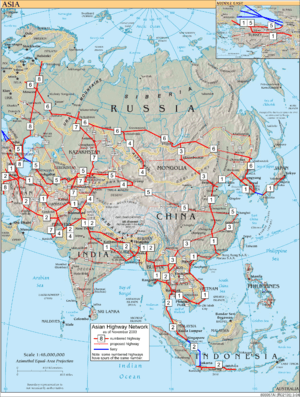 | |
|---|---|---|
| Southeast Asia | ||
| East Asia, Northeast Asia and Southeast Asia | ||
| South Asia | ||
| North Asia, Central Asia and Southwest Asia | ||
This article is issued from Wikipedia. The text is licensed under Creative Commons - Attribution - Sharealike. Additional terms may apply for the media files.