A33 autoroute
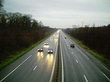
The A33 autoroute is a 26.8 kilometres (16.7 mi) long motorway in northeastern France. It forms part of European route E23.
| |
|---|---|
| Route information | |
| Part of | |
| Length | 26.8 km (16.7 mi) |
| Highway system | |
| Autoroutes of France | |

Route
The road is only 27 km (17 mi) long and connects Nancy to Dombasle-sur-Meurthe. After Lunéville the road becomes the N333 to Blâmont. The road forms an upgrade of the N4 which is now called the N4a.
Junctions
Near Laxou city
| Exit/Junction | Destination |
| Exchange A31-N4-A33 Autoroute starts with junction on the | |
| (Vandoeuvre-les-Nancy) Towns served: Nancy, Neuves-Maisons | |
| Exchange A330-A33 Autoroute has junction with the | |
| (Fleville-devant-Nancy) Towns served: Fleville, Lupcourt | |
| (St-Nicolas) Towns served: St-Nicolas-de-Port | |
| (Rosières) Towns served: Rosières-aux-Salines, Damelevieres | |
| (Dombasle) Towns served: Dombasle-sur-Meurthe | |
| (Hudiviller) Towns served: Hudiviller | |
| The road then becomes the dual carriageway | |
gollark: Also, there is none.
gollark: [REDACTED]
gollark: https://media.discordapp.net/attachments/461970193728667648/779802718075355166/unknown.png
gollark: Sure?
gollark: Troubling.
References
External links
 |
| | |
This article is issued from Wikipedia. The text is licensed under Creative Commons - Attribution - Sharealike. Additional terms may apply for the media files.