Shopian
Shopian or Shupiyan is a apple town and administrative division of the Shopian district, located in southern part of Kashmir Valley, of Jammu and Kashmir, India.[2] [3]
Shopian شوپیان | |
|---|---|
town | |
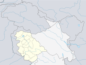 Shopian Location in Jammu and Kashmir, India  Shopian Shopian (India) | |
| Coordinates: 33.72°N 74.83°E | |
| Country | |
| Union territory | Jammu and Kashmir[1] |
| District | Shopian |
| Government | |
| • Type | District Magistrate - Presidential Rule |
| Area | |
| • Total | 412.87 km2 (159.41 sq mi) |
| Elevation | 2,057 m (6,749 ft) |
| Population (2011) | |
| • Total | 40,360 |
| • Density | 98/km2 (250/sq mi) |
| Languages | |
| • Official | Kashmiri |
| Time zone | UTC+5:30 (IST) |
| PIN | 192303 |
| Area code(s) | 01933 |
| Vehicle registration | JK22,JK22B,JK22A |
| Sex ratio | 756 ♂/ ♀ |
| Website | shopian |
General
The geologist Frederic Drew stated that Shopian derived its name from a distortion of word shah-payan, i.e. "royal stay". However, the local people hold the view that Shopian was earlier named as "Shin-Van" meaning "snow forest". The Shias have a different view, believing it was earlier inhabited by Shias so it is "Shin-Van" that is "The Forest of Shias". Shopian is an ancient town of Kashmir and had an importance due to it being situated on the ancient imperial route, commonly known as Mughal Road, which connects Lahore and Srinagar.[4] Shopian was one out of six Wazarat Headquarters in Kashmir from 1872-1892 A.D. [5]
Shopian town is 51 kilometres (32 mi) from Srinagar and 20 kilometres (12 mi) from Pulwama at an elevation of 2,146 metres (7,041 ft) above sea level. It has decades-old road connectivity with Anantnag as well as Kulgam.
Geography
Shupiyan is located at 33.72°N 74.83°E.[6] It has an average elevation of 2057 metres (6748 feet). It is 54 km from Srinagar.
Demographics
According to 2011 Census of India, Shopian Municipal Committee has population of 16,360 which further extends to 9,319 (males) and 7,041 (females), The average population of the town is 6 persons each house. [7]
Population
According to 2011 Census report, Shopian Town had a population of 12,396. Males constitute 51% of the population and females 49%. Shupiyan has an average literacy rate of 59%, lower than the national average of 59.5%: male literacy is 67%, and female literacy is 51%. In Shupiyan, 11% of the population is under 6 years of age. [8]
Education
In 1988, The Government of J&K established a college namely Government Degree College, Shopian which provides higher education infrastructure to the people of Shopian district. The Govt. Polytechnic college was established recently in the Shopian town, which provides technical engineering diploma level education.
Tourism
People from all around the globe visit the tourist places like Peer Ki Gali which is on a mountain top of Mughal road. Mughal Sarai - this palace is situated on the bank of river which flows on the side of Mughal road. This palace was used by Mughal rulers as their resting place during their travels. Dabjan forests - this place is another tourist place of Shopian, where a spring is present in the middle of Dabjan forest.
References
- https://www.dailyexcelsior.com/advisor-khan-visits-shopian-takes-stock-of-peoples-grievances/
- "Snowfall in south Kashmir's Shopian". greaterkashmir.com. Greater Kashmir.
- "Shopian - Dc Msme" (PDF). dcmsme.gov.in. Development Commissioner Ministry of Micro, Small & Medium Enterprises.
- Bloeria, Sudhir S. (2000). Pakistan's Insurgency vs India's Security: Tackling Militancy in Kashmir. New Delhi: Manas Publications. p. 172. ISBN 978-81-7049-116-3.
- "Districts of India".
- Falling Rain Genomics, Inc - Shupiyan
- "Shupiyan Population Census 2011 - 2018". census2011.co.in. 2011 Census of India.
- "Shupiyan District Population Census 2011". Census Commission of India.
External links
Places adjacent to Shopian | ||||||||||
|---|---|---|---|---|---|---|---|---|---|---|
| ||||||||||