Kupwara
Kupwara is a town and a municipal committee in Kupwara district in the Indian union territory of Jammu and Kashmir.
Kupwara Kupwore Kupwada | |
|---|---|
Town | |
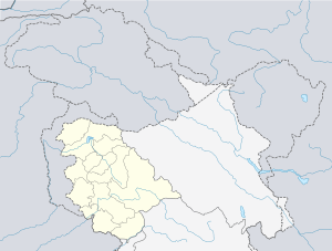 Kupwara Location in Jammu and Kashmir, India  Kupwara Kupwara (India) | |
| Coordinates: 34°31′33″N 74°15′19″E | |
| Country | |
| Union Territory | Jammu and Kashmir |
| District | Kupwara |
| Government | |
| • Type | Democratic |
| Elevation | 1,615 m (5,299 ft) |
| Population (2011) | |
| • Total | 70,000 |
| Time zone | UTC+5:30 (IST) |
| PIN | 193222 (for the town) |
| Vehicle registration | JK09 |
| Website | http://kupwara.gov.in |
Municipal Committee Kupwara is an Urban Local Body with 13 elected members, which administrates the town.
Transport
Air
Kupwara doesn't have its own airport. A helipad is located in Kunan village which is located at a distance of 2 kilometres from Kupwara. The nearest airport is Srinagar International Airport located at a distance of 94 kilometres and is a 2.5-hr drive. There are plans to build an airport in Kupwara at Panzgam.[1]
Rail
Kupwara doesn't have railway connectivity yet. The nearest railway stations are Baramulla railway station and Sopore railway station, located 42 and 50 kilometres from Kupwara respectively. There are plans to connect Kupwara by rail by extending the Jammu–Baramulla Rail Line up to Kupwara.[2]
Road
Kupwara is well-connected by road to other towns and villages in J&K and India by the Sopore-Kupwara Road, Kupwara-Trehgam Road, etc. The NH 701 passes through Kupwara.
Religion
The dominant religion in Kupwara is Islam, followed by over 90% of the people living in Kupwara. Other religions include Hinduism, Christianity and Sikhism followed by 6.8%, 0.4% and 1.6% respectively.[3]
Religion in Kupwara Town (2011)[4]
Politics
| # | Name[5] | Municipal Ward | Reservation Status | Party |
|---|---|---|---|---|
| 1 | Shareefa Begum | Jamia Qadeem Darusalam | Women Open | Independent |
| 2 | Mohd Sayed Masoodi | Quat Ul Islam | Open | Independent |
| 3 | Mushtaq Ahmed Wani | Darzipora | Open | Independent |
| 4 | Posha Begum | Doodwan | Women Open | Independent |
| 5 | Mohd. Iqbal Shah | Brunwari | Open | Independent |
| 6 | Ab. Ahad Sheikh | Regipora | Open | Independent |
| 7 | Posha Begum | Usman Abad | Women Open | Independent |
| 8 | Gh. Mohdin Mir | Sayeedabad | Open | Independent |
| 9 | Tariq Ah. Malik | Malik Mohalla | Open | Independent |
| 10 | Gulshana Begum | Ganie Mohalla | Women Open | Independent |
| 11 | Reyaz Ah. Mir | Galizoo | Open | Independent |
| 12 | Bashir Ahmad Khan | Zangli | Open | Independent |
| 13 | Bashir Ahmad Mareed | Goose | Open | Independent |
Climate
| Climate data for Kupwara (1981–2010, extremes 1977–2012) | |||||||||||||
|---|---|---|---|---|---|---|---|---|---|---|---|---|---|
| Month | Jan | Feb | Mar | Apr | May | Jun | Jul | Aug | Sep | Oct | Nov | Dec | Year |
| Record high °C (°F) | 16.2 (61.2) |
19.7 (67.5) |
27.3 (81.1) |
31.7 (89.1) |
34.8 (94.6) |
36.9 (98.4) |
37.6 (99.7) |
36.6 (97.9) |
35.8 (96.4) |
33.6 (92.5) |
25.7 (78.3) |
18.4 (65.1) |
37.6 (99.7) |
| Average high °C (°F) | 6.9 (44.4) |
9.0 (48.2) |
14.6 (58.3) |
20.7 (69.3) |
24.9 (76.8) |
28.6 (83.5) |
30.3 (86.5) |
30.4 (86.7) |
28.8 (83.8) |
23.3 (73.9) |
16.3 (61.3) |
9.5 (49.1) |
20.3 (68.5) |
| Average low °C (°F) | −2.7 (27.1) |
−1.0 (30.2) |
2.6 (36.7) |
6.5 (43.7) |
9.8 (49.6) |
13.2 (55.8) |
16.7 (62.1) |
16.4 (61.5) |
11.1 (52.0) |
5.1 (41.2) |
0.4 (32.7) |
−2.0 (28.4) |
6.3 (43.3) |
| Record low °C (°F) | −15.7 (3.7) |
−12.0 (10.4) |
−7.0 (19.4) |
0.1 (32.2) |
0.6 (33.1) |
6.5 (43.7) |
9.0 (48.2) |
8.0 (46.4) |
4.0 (39.2) |
−1.5 (29.3) |
−5.5 (22.1) |
−9.4 (15.1) |
−15.7 (3.7) |
| Average rainfall mm (inches) | 92.5 (3.64) |
128.3 (5.05) |
190.9 (7.52) |
151.4 (5.96) |
95.8 (3.77) |
54.3 (2.14) |
90.9 (3.58) |
72.2 (2.84) |
34.8 (1.37) |
43.6 (1.72) |
45.8 (1.80) |
68.6 (2.70) |
1,069.1 (42.09) |
| Average rainy days | 7.4 | 9.4 | 10.5 | 9.2 | 7.3 | 4.7 | 6.3 | 5.2 | 2.9 | 3.1 | 3.2 | 4.9 | 74.2 |
| Average relative humidity (%) (at 17:30 IST) | 77 | 73 | 68 | 62 | 59 | 56 | 62 | 62 | 56 | 58 | 65 | 73 | 64 |
| Source: India Meteorological Department[6][7] | |||||||||||||
References
- "Centre plans to build 11 new airports in J&K, 2 in Ladakh". Kashmir Life. Retrieved 17 March 2020.
- "Centre approves Baramulla-Kupwara rail link". Economic Times. Retrieved 17 March 2020.
- "C-1 Population By Religious Community". Census. Retrieved 10 June 2019.
- "C-1 Population By Religious Community". Census. Retrieved 10 June 2019.
- http://ceojammukashmir.nic.in/pdf/municipal%20Election/Result_Notifi_Corp.pdf
- "Station: Kupwara Climatological Table 1981–2010" (PDF). Climatological Normals 1981–2010. India Meteorological Department. January 2015. pp. 441–442. Archived from the original (PDF) on 5 February 2020. Retrieved 24 March 2020.
- "Extremes of Temperature & Rainfall for Indian Stations (Up to 2012)" (PDF). India Meteorological Department. December 2016. p. M77. Archived from the original (PDF) on 5 February 2020. Retrieved 24 March 2020.