Moulins – Montbeugny Airport
Moulins – Montbeugny Airport (French: Aérodrome de Moulins - Montbeugny) (ICAO: LFHY) is an aerodrome or airport located in Toulon-sur-Allier, 7 km (4 NM) southeast of Moulins and west of Montbeugny,[1] all communes in the Allier department of the Auvergne region in central France.
Moulins - Montbeugny Airport Aérodrome de Moulins - Montbeugny | |||||||||||||||||||
|---|---|---|---|---|---|---|---|---|---|---|---|---|---|---|---|---|---|---|---|
 | |||||||||||||||||||
| Summary | |||||||||||||||||||
| Airport type | Public | ||||||||||||||||||
| Operator | CCI de Moulins et Vichy | ||||||||||||||||||
| Serves | Moulins / Montbeugny, France | ||||||||||||||||||
| Location | Toulon-sur-Allier | ||||||||||||||||||
| Elevation AMSL | 915 ft / 279 m | ||||||||||||||||||
| Coordinates | 46°32′04″N 003°25′18″E | ||||||||||||||||||
| Map | |||||||||||||||||||
 LFHY Location of airport in Allier department Location of Allier department in France 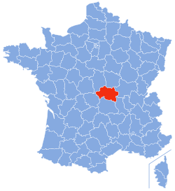 | |||||||||||||||||||
| Runways | |||||||||||||||||||
| |||||||||||||||||||
Facilities
The airport resides at an elevation of 915 feet (279 m) above mean sea level. It has one runway designated 08/26 with an asphalt surface measuring 1,300 by 30 metres (4,265 ft × 98 ft). There are also two parallel grass runways measuring 843 by 80 metres (2,766 ft × 262 ft) and 330 by 30 metres (1,083 ft × 98 ft).[1]
Airlines and destinations
There is no scheduled commercial air service at this time.
References
- LFHY – MOULINS MONTBEUGNY. AIP from French Service d'information aéronautique, effective 13 August 2020.
External links
- Aéroport de Moulins - Montbeugny at Union des Aéroports Français (in French)
- Airport information for LFHY at World Aero Data. Data current as of October 2006.
This article is issued from Wikipedia. The text is licensed under Creative Commons - Attribution - Sharealike. Additional terms may apply for the media files.