Maysville, Missouri
Maysville is a city in DeKalb County, Missouri, United States. The population was 1,212 at the 2010 census. Maysville is the county seat of DeKalb County.[6]
Maysville, Missouri | |
|---|---|
 Aerial view of Maysville, Missouri | |
 Location of Maysville, Missouri | |
| Coordinates: 39°53′12″N 94°21′36″W | |
| Country | United States |
| State | Missouri |
| County | DeKalb |
| Area | |
| • Total | 1.15 sq mi (2.98 km2) |
| • Land | 1.15 sq mi (2.97 km2) |
| • Water | 0.01 sq mi (0.01 km2) |
| Elevation | 971 ft (296 m) |
| Population | |
| • Total | 1,114 |
| • Estimate (2019)[3] | 1,081 |
| • Density | 943.28/sq mi (364.32/km2) |
| Time zone | UTC-6 (Central (CST)) |
| • Summer (DST) | UTC-5 (CDT) |
| ZIP code | 64469 |
| Area code(s) | 816 |
| FIPS code | 29-46946[4] |
| GNIS feature ID | 0729552[5] |
Maysville is part of the St. Joseph, MO–KS Metropolitan Statistical Area.
History
.JPG)
Maysville was founded in 1845.[7] The name may be a transfer from Maysville, Kentucky.[8] A post office called Maysville has been in operation since 1846.[9]
The DeKalb County Courthouse was listed on the National Register of Historic Places in 1998.[10]
Geography
Maysville is located at 39°53′12″N 94°21′36″W (39.886720, -94.359973).[11] According to the United States Census Bureau, the city has a total area of 1.16 square miles (3.00 km2), of which 1.15 square miles (2.98 km2) is land and 0.01 square miles (0.03 km2) is water.[12]
Demographics
| Historical population | |||
|---|---|---|---|
| Census | Pop. | %± | |
| 1880 | 418 | — | |
| 1890 | 717 | 71.5% | |
| 1900 | 925 | 29.0% | |
| 1910 | 1,051 | 13.6% | |
| 1920 | 1,057 | 0.6% | |
| 1930 | 946 | −10.5% | |
| 1940 | 1,026 | 8.5% | |
| 1950 | 973 | −5.2% | |
| 1960 | 942 | −3.2% | |
| 1970 | 1,045 | 10.9% | |
| 1980 | 1,187 | 13.6% | |
| 1990 | 1,176 | −0.9% | |
| 2000 | 1,212 | 3.1% | |
| 2010 | 1,114 | −8.1% | |
| Est. 2019 | 1,081 | [3] | −3.0% |
| U.S. Decennial Census[13] | |||
2010 census
As of the census[2] of 2010, there were 1,114 people, 433 households, and 272 families living in the city. The population density was 968.7 inhabitants per square mile (374.0/km2). There were 496 housing units at an average density of 431.3 per square mile (166.5/km2). The racial makeup of the city was 97.6% White, 0.4% African American, 0.5% Native American, 0.1% Asian, 0.1% Pacific Islander, and 1.3% from two or more races. Hispanic or Latino of any race were 0.4% of the population.
There were 433 households, of which 33.0% had children under the age of 18 living with them, 46.7% were married couples living together, 11.5% had a female householder with no husband present, 4.6% had a male householder with no wife present, and 37.2% were non-families. 32.6% of all households were made up of individuals, and 18.9% had someone living alone who was 65 years of age or older. The average household size was 2.47 and the average family size was 3.15.
The median age in the city was 39.3 years. 26.5% of residents were under the age of 18; 7.7% were between the ages of 18 and 24; 22.9% were from 25 to 44; 24.1% were from 45 to 64; and 18.9% were 65 years of age or older. The gender makeup of the city was 45.7% male and 54.3% female.
2000 census
As of the census[4] of 2000, there were 1,212 people, 457 households, and 302 families living in the city. The population density was 1,065.9 people per square mile (410.5/km2). There were 491 housing units at an average density of 431.8 per square mile (166.3/km2). The racial makeup of the city was 98.76% White, 0.08% African American, 0.33% Native American, 0.17% Asian, 0.33% from other races, and 0.33% from two or more races. Hispanic or Latino of any race were 0.50% of the population.
There were 457 households, out of which 34.4% had children under the age of 18 living with them, 52.7% were married couples living together, 10.1% had a female householder with no husband present, and 33.7% were non-families. 30.9% of all households were made up of individuals, and 18.8% had someone living alone who was 65 years of age or older. The average household size was 2.49 and the average family size was 3.14.
In the city, the population was spread out, with 28.5% under the age of 18, 6.5% from 18 to 24, 25.7% from 25 to 44, 17.1% from 45 to 64, and 22.1% who were 65 years of age or older. The median age was 38 years. For every 100 females, there were 85.3 males. For every 100 females age 18 and over, there were 81.9 males.
The median income for a household in the city was $27,727, and the median income for a family was $36,979. Males had a median income of $28,382 versus $18,646 for females. The per capita income for the city was $11,871. About 12.4% of families and 16.6% of the population were below the poverty line, including 20.4% of those under age 18 and 17.6% of those age 65 or over.
Education
Students in Maysville attend R-1 Elementary and Maysville R-1 Jr./Sr. High School.
References
- "2019 U.S. Gazetteer Files". United States Census Bureau. Retrieved July 26, 2020.
- "U.S. Census website". United States Census Bureau. Retrieved 2012-07-08.
- "Population and Housing Unit Estimates". United States Census Bureau. May 24, 2020. Retrieved May 27, 2020.
- "U.S. Census website". United States Census Bureau. Retrieved 2008-01-31.
- "US Board on Geographic Names". United States Geological Survey. 2007-10-25. Retrieved 2008-01-31.
- "Find a County". National Association of Counties. Archived from the original on May 31, 2011. Retrieved 2011-06-07.
- Eaton, David Wolfe (1916). How Missouri Counties, Towns and Streams Were Named. The State Historical Society of Missouri. p. 284.
- "DeKalb County Place Names, 1928–1945 (archived)". The State Historical Society of Missouri. Archived from the original on 24 June 2016. Retrieved 27 September 2016.CS1 maint: BOT: original-url status unknown (link)
- "Post Offices". Jim Forte Postal History. Retrieved 27 September 2016.
- "National Register Information System". National Register of Historic Places. National Park Service. July 9, 2010.
- "US Gazetteer files: 2010, 2000, and 1990". United States Census Bureau. 2011-02-12. Retrieved 2011-04-23.
- "US Gazetteer files 2010". United States Census Bureau. Archived from the original on July 2, 2012. Retrieved 2012-07-08.
- "Census of Population and Housing". Census.gov. Retrieved June 4, 2015.
External links
- Maysville School District
- Historic maps of Maysville in the Sanborn Maps of Missouri Collection at the University of Missouri
Municipalities and communities of DeKalb County, Missouri, United States | ||
|---|---|---|
| Cities | 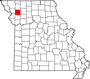 Map of Missouri highlighting DeKalb County | |
| Villages | ||
| Townships | ||
| Unincorporated communities | ||
| Ghost towns | ||
| Footnotes | ‡This populated place also has portions in an adjacent county or counties | |
| Authority control |
|
|---|