Dresser, California
Dresser (formerly, Alston, Dresser Siding,[2] and Merienda[3]) is an unincorporated community in Alameda County, California. Its ZIP code is 94536 and its area codes are 510 and 341.
Dresser | |
|---|---|
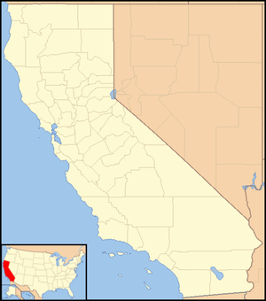 Dresser Location in California  Dresser Dresser (the United States) | |
| Coordinates: 37°35′33″N 121°57′21″W | |
| Country | United States |
| State | California |
| County | Alameda County |
| Elevation | 105 ft (32 m) |
Geography and background
It is located on the Southern Pacific Railroad 3 miles (4.8 km) north-northeast of downtown Fremont,[3] at an elevation of 105 feet (32 m). The city's name was Merienda until 1915, and then was Alston until 1957.[3] It was established as a station on the Southern Pacific Railroad in 1923 to serve the California Pressed Brick Company in Niles Canyon.
Current status
The area as indicated on Google Maps[lower-alpha 1] as the center of Dresser is currently not accessible from Niles Canyon Road, with a locked gate and numerous "Keep Out" signs posted. There are no signs indicating that the town even used to exist behind the gate. By looking at recent satellite imagery of Dresser (e.g., Google Maps), one can see ruins of buildings and three standing smokestacks that used to comprise the California Pressed Brick Company.[4] Reportedly, the location has been used for partying since it was closed in the 1990s.[5] The adjacent "Secret Sidewalk" (Niles Canyon Aqueduct)[6] is also used for such purposes.[5]
References
- "Dresser". Geographic Names Information System. United States Geological Survey.
- Both "Dresser". Geographic Names Information System. United States Geological Survey.
- Durham, David L. (1998). California's Geographic Names: A Gazetteer of Historic and Modern Names of the State. Clovis, Calif.: Word Dancer Press. p. 625. ISBN 1-884995-14-4.
- "California Pressed Brick Company". Wikimapia.
- Levin, Sam. "The Secret Sidewalk May Not Be Secret Much Longer". East Bay Express. Retrieved 14 November 2011.
- "Sunol Aqueduct". Wikimapia. Retrieved 14 November 2011.
Notes
- Where other reliable sources are available for the boundaries of neighborhoods, they should be treated preferentially to Google Maps and Google Street View. It is difficult if not impossible to verify as they are subject to change and documentation and archives are not available.
External links
- U.S. Geological Survey Geographic Names Information System: Dresser
- Sunol Aqueduct
- Photos of the brick factory: view 1, view 2, view 3
- Anecdotes of the Secret Sidewalk
Municipalities and communities of Alameda County, California, United States | ||
|---|---|---|
| Cities | 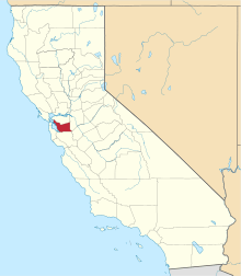 Alameda County map | |
| CDPs | ||
| Unincorporated communities | ||
| Annexed communities | ||
| Former townships |
| |
| Former communities | ||
| Bodies of water |
|  |
|---|---|---|
| Counties | ||
| Major cities | ||
| Cities and towns 100k–250k | ||
| Cities and towns 50k–99k | ||
| Cities and towns 25k–50k | ||
| Cities and towns 10k–25k |
| |
| Sub-regions | ||